
-
Federal
Images
National Aeronautics and Space Administration —
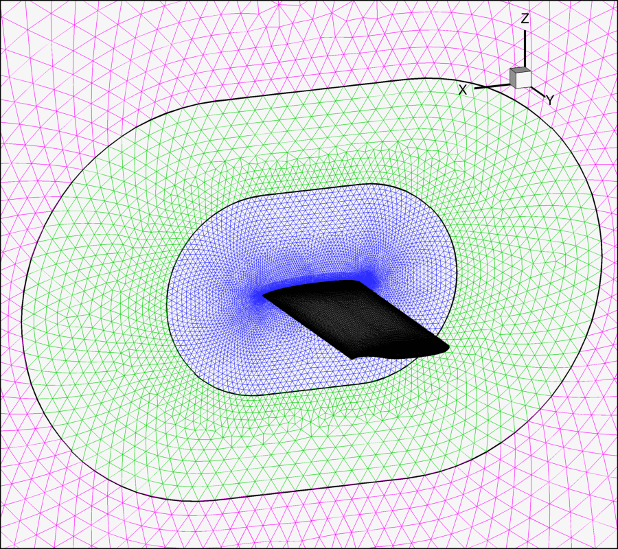
Images for the website main pages and all configurations. The upload and access points for the other images are: Website Template RSW images BSCW Images HIRENASD Images -
Federal
National Wildlife Refuge System Map
Department of the Interior —
When President Theodore Roosevelt made Florida's tiny Pelican Island a refuge for birds in 1903, he wrote the ¬first chapter of a great American conservation success... -
Federal
Real System Failures
National Aeronautics and Space Administration —
This resource area contains descriptions of actual electronic systems failure scenarios with an emphasis on the diversity of failure modes and effects that can befall... -
Federal
GPM Ground Validation CXSI Radar Imagery OLYMPEX V1
National Aeronautics and Space Administration —
The GPM Ground Validation CXSI Radar Imagery OLYMPEX dataset contains radar reflectivity and precipitation rate images obtained from Environment and Climate Change... -
Federal
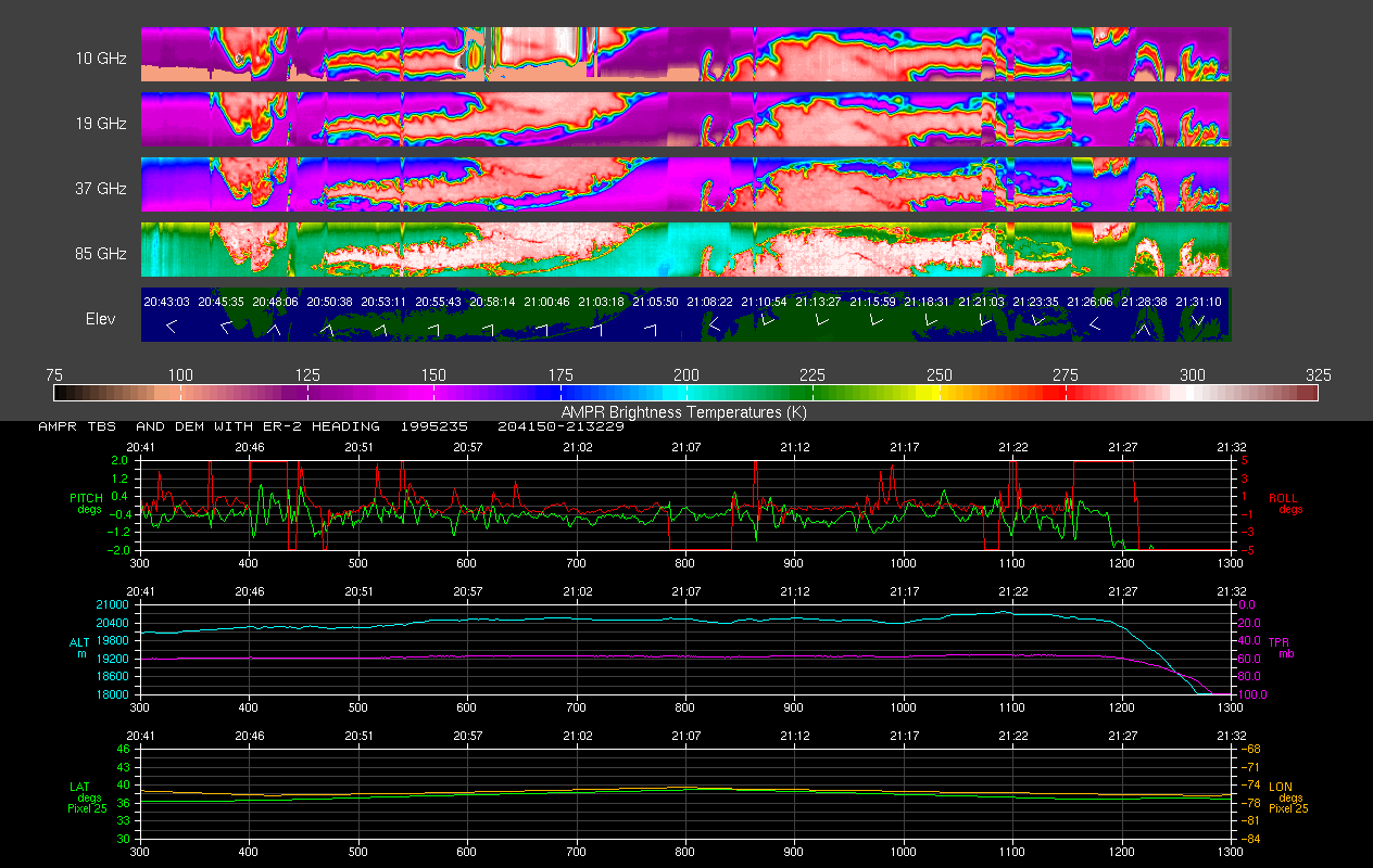
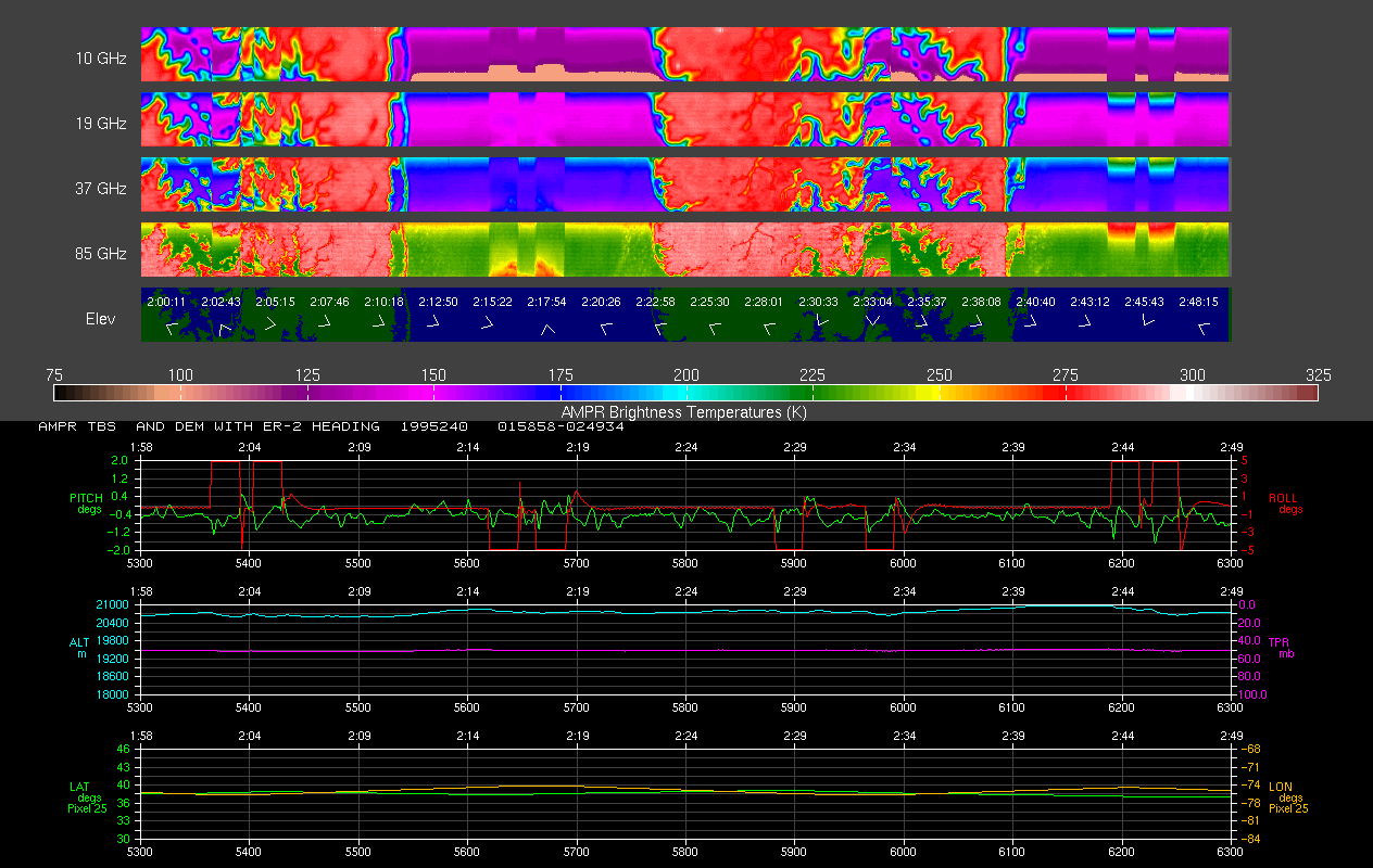
AMPR BRIGHTNESS TEMPERATURE CAMEX-2 V2
National Aeronautics and Space Administration —
The Advanced Microwave Precipitation Radiometer (AMPR) was deployed during the Convection and Moisture Experiment 2 (CAMEX-2). AMPR data were collected at a... -
Federal
AIRS/Aqua L1B Near Real Time (NRT) Visible/Near Infrared (VIS/NIR) quality assurance subset V005 (AIRVBQAP_NRT) at GES DISC
National Aeronautics and Space Administration —
The AIRS Level 1B Near Real Time (NRT) product (AIRVBQAP_NRT_005) differs from the routine product (AIRVBQAP_005) in 2 ways to meet the three hour latency... -
Federal
NOAA/WDS Paleoclimatology - Brown fire data from Black Hills Plot 113 - IMPD US113001
National Oceanic and Atmospheric Administration, Department of Commerce —
This archived Paleoclimatology Study is available from the NOAA National Centers for Environmental Information (NCEI), under the World Data Service (WDS) for... -
Federal
Simulating Degradation Data for Prognostic Algorithm Development
National Aeronautics and Space Administration —
PHM08 Challenge Dataset is now publicly available at the NASA Prognostics Respository + Download INTRODUCTION - WHY SIMULATE DEGRADATION DATA? Of various challenges... -
Federal
UARS PEM Level 2 VMAG DC V001 (UARPE2VMAGDC) at GES DISC
National Aeronautics and Space Administration —
The Particle Environment Monitor (PEM) level 2 Vector Magnetometer (VMAG) DC daily product contains the Vector Magnetic Field component, UARS Aspect Magnetometers... -
Federal
AMPR JACKSONVILLE BRIGHTNESS TEMPERATURE (TB) V2
National Aeronautics and Space Administration —
The Advanced Microwave Precipitation Radiometer (AMPR) was deployed in Jacksonville, FL for the initial AMPR instrument validation. AMPR data were collected at four... -
Federal
Packery Channel, TX
National Oceanic and Atmospheric Administration, Department of Commerce —
GCOOS 52North Sensor Observation Service This station provides the following variables: Air pressure, Air temperature, Sea surface height above sea level, Sea water... -
Federal
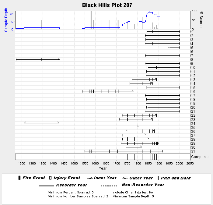
NOAA/WDS Paleoclimatology - Brown fire data from Black Hills Plot 207 - IMPD US207001
National Oceanic and Atmospheric Administration, Department of Commerce —
This archived Paleoclimatology Study is available from the NOAA National Centers for Environmental Information (NCEI), under the World Data Service (WDS) for... -
Federal
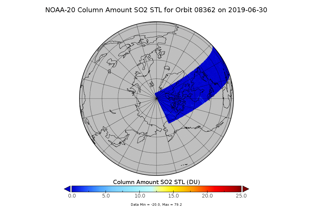
OMPS-N20 NM PCA SO2 Step 1 Total Column 1-Orbit L2 Swath 17x13km
National Aeronautics and Space Administration —
The OMPS-N20_NM_PCA_SO2 Step1 Total Column 1-Orbit L2 Swath 17x13km collection 1 product contains the retrieved sulfur dioxide (SO2) measured by the Ozone Mapping and... -
Federal
NOAA/WDS Paleoclimatology - Brown fire data from Black Hills Plot 201 - IMPD US201001
National Oceanic and Atmospheric Administration, Department of Commerce —
This archived Paleoclimatology Study is available from the NOAA National Centers for Environmental Information (NCEI), under the World Data Service (WDS) for... -
Federal
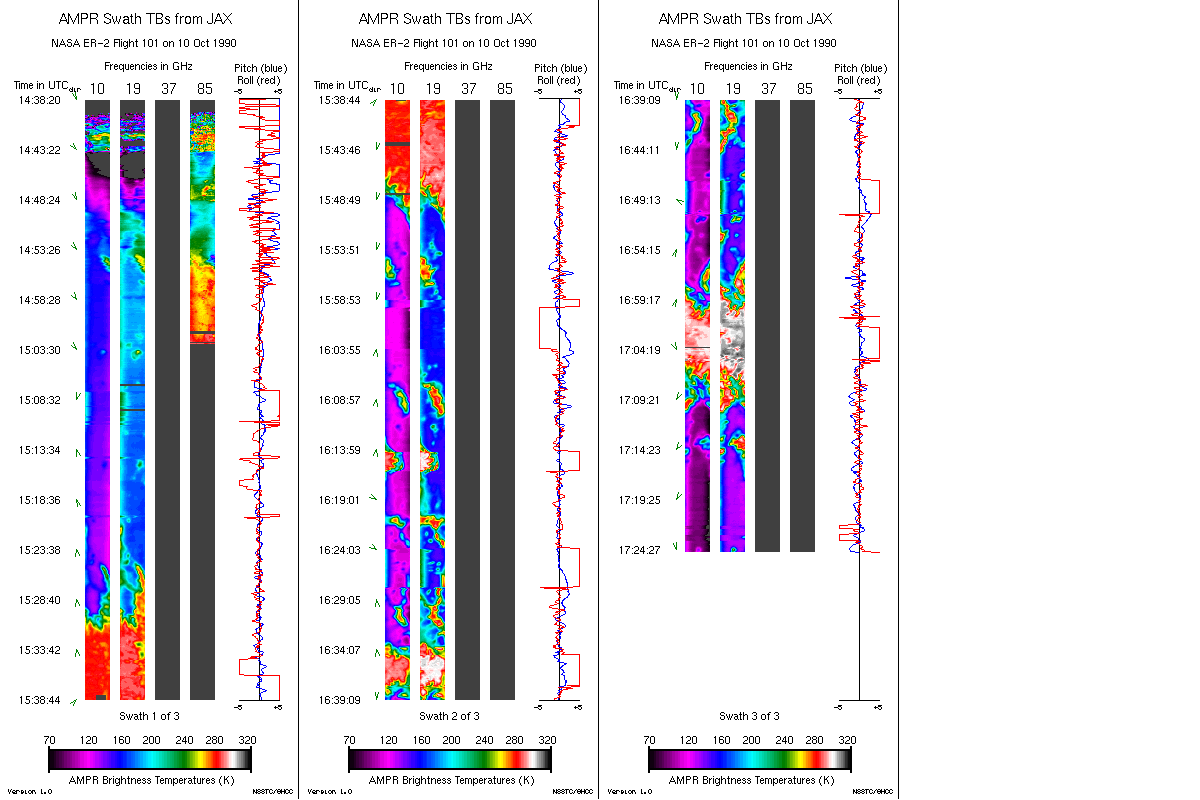
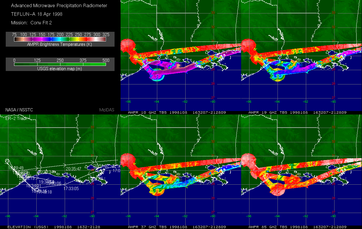
AMPR TEFLUN-A BRIGHTNESS TEMPERATURE (TB) V1
National Aeronautics and Space Administration —
The Advanced Microwave Precipitation Radiometer (AMPR) was deployed during the Texas-Florida Underflights (TEFLUN-A); the first of three TRMM ground validation...

Official websites use .gov
A
.gov website belongs to an official government
organization in the United States.
Secure .gov websites use HTTPS
A
lock (
) or https:// means you’ve safely connected to
the .gov website. Share sensitive information only on official,
secure websites.