
-
Federal
TOLNet University of Alabama in Huntsville Data
National Aeronautics and Space Administration —
TOLNet_UAH_Data is the lidar data collected by the Rocket-city O3 Quality Evaluation in the Troposphere (RO3QET) lidar at the University of Alabama in Huntsville,... -
Federal
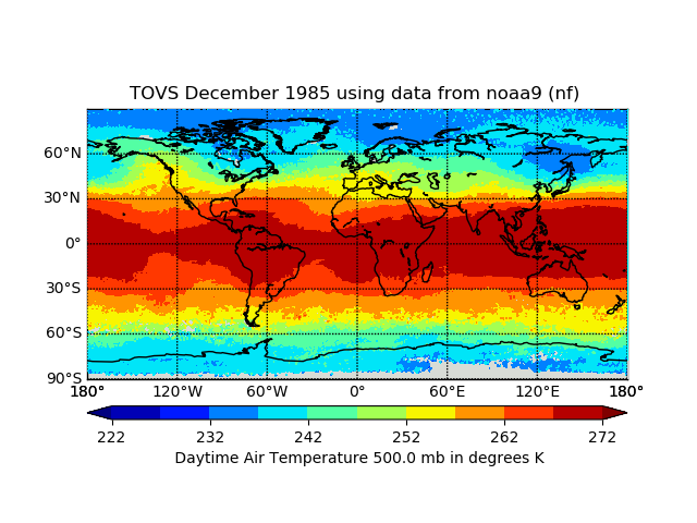
TOVS GLA MONTHLY GRIDS from NOAA-9 02 (TOVSAMNF) at GES DISC
National Aeronautics and Space Administration —
This dataset (TOVSAMNF) contains the TIROS Operational Vertical Sounder (TOVS) level 3 geophysical parameters derived using data from NOAA-9 and the physical... -
Federal
SOLVE I DC-8 Aircraft In-situ Meteorology and Navigational Data
National Aeronautics and Space Administration —
SOLVE1_MetNav_AircraftInSItu_DC8_Data is the in-situ meteorological and navigational data for the DC-8 aircraft collected during the SAGE III Ozone Loss and... -
Federal
HURRICANE AND SEVERE STORM SENTINEL (HS3) GLOBAL HAWK ADVANCED VERTICAL ATMOSPHERIC PROFILING SYSTEM (AVAPS) DROPSONDE SYSTEM V2
National Aeronautics and Space Administration —
The Hurricane and Severe Storm Sentinel (HS3) Global Hawk Advanced Vertical Atmospheric Profiling System (AVAPS) Dropsonde System dataset was collected by the... -
Federal
Automated Surface Observing System (ASOS) IMPACTS V1
National Aeronautics and Space Administration —
The Automated Surface Observing Systems (ASOS) IMPACTS dataset consists of a variety of ground-based observations during the Investigation of Microphysics and... -
Federal
TOLNet NASA Langley Research Center Data
National Aeronautics and Space Administration —
TOLNet_LaRC_Data is the lidar data collected by the Langley Mobile Ozone Lidar (LMOL) at NASA Langley Research Center (LaRC) as part of the Tropospheric Ozone Lidar... -
Federal
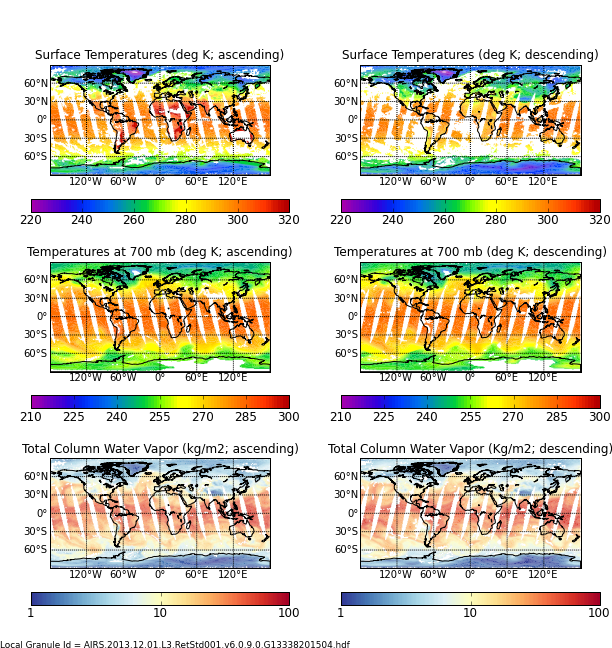
Aqua/AIRS L3 Daily Support Product (AIRS-only) 1 degree x 1 degree V7.0 at GES DISC
National Aeronautics and Space Administration —
The Atmospheric Infrared Sounder (AIRS) is a grating spectrometer (R = 1200) aboard the second Earth Observing System (EOS) polar-orbiting platform, EOS Aqua. In... -
Federal
Silalirijiit Project: Kangiqtugaapik (Clyde River), Nunavut, Canada, Weather Station Network, Version 1
National Aeronautics and Space Administration —
The Kangiqtugaapik (Clyde River), Nunavut, Canada, Weather Station Network is a collection of weather station data from the locations of Akuliaqattak, Silasiutitalik,... -
Federal
Advanced Vertical Atmospheric Profiling System Dropsondes (AVAPS) IMPACTS V1
National Aeronautics and Space Administration —
The Advanced Vertical Atmospheric Profiling System (AVAPS) IMPACTS dataset consists of vertical atmospheric profile measurements collected by the Advanced Vertical... -
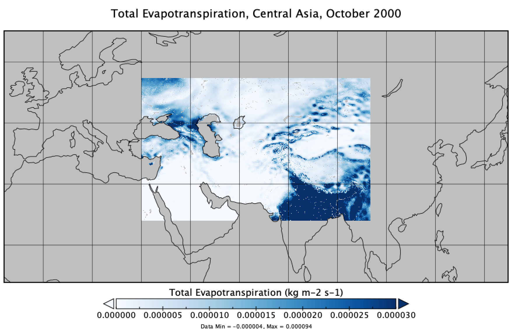
Federal
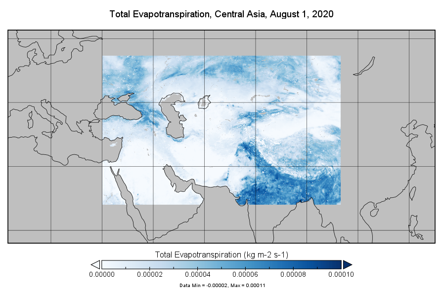
FLDAS2 Noah-MP GDAS Land Surface Model L4 Central Asia Daily 0.01 degree x 0.01 degree V001 (FLDAS_NOAHMP001_G_CA_D)
National Aeronautics and Space Administration —
This dataset contains a series of land surface parameters simulated from the Noah 3.6.1 model in the Famine Early Warning Systems Network (FEWS NET) Land Data... -
Federal
Cillaput: Our Weather, Yukon-Kuskowim Delta Weather Station Network, Version 1
National Aeronautics and Space Administration —
Cillaput: Our Weather, Yukon-Kuskowim Delta Weather Station Network provides access to current weather conditions in the villages of Chevak and Kotlik located in the... -
Federal
AIRS/Aqua L3 Daily Support Product (AIRS-only) 1 degree x 1 degree V006 (AIRS3SPD) at GES DISC
National Aeronautics and Space Administration —
The Atmospheric Infrared Sounder (AIRS) is a grating spectrometer (R = 1200) aboard the second Earth Observing System (EOS) polar-orbiting platform, EOS Aqua. In... -
Federal
MISR Level 1B2 Ellipsoid Data V004
National Aeronautics and Space Administration —
MI1B2E_004 is the Multi-angle Imaging SpectroRadiometer (MISR) Level 1B2 Ellipsoid Data Version 4 product. It contains Ellipsoid-projected Top-of-Atmosphere (TOA)... -
Federal
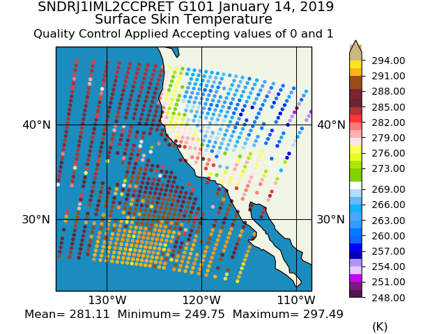
Sounder SIPS: JPSS-1 CrIS Level 2 CLIMCAPS: Atmosphere cloud and surface geophysical state V2 (SNDRJ1IML2CCPRET) at GES DISC
National Aeronautics and Space Administration —
WARNING: To users of the derived product “co_mmr_midtrop” (carbon monoxide mass mixing ratio to dry air [kg/kg] at ~500 hPa). This variable has a significant bias due... -
Federal
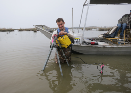
Delta-X: Turbidity, Water and Air Pressure, Temperature, MRD, Louisiana, 2021, V4
National Aeronautics and Space Administration —
This dataset provides turbidity measurements with co-located water and air pressure and temperature measurements in portions of the Mississippi River Delta, coastal... -
Federal
CERES and GEO-Enhanced TOA, Within-Atmosphere and Surface Fluxes, Clouds and Aerosols Monthly-Averaged 1-Hourly Terra Edition4A NGDA
National Aeronautics and Space Administration —
CER_SYN1deg-MHour_Terra-MODIS_Edition4A is the Clouds and the Earth's Radiant Energy System (CERES) and geostationary (GEO)-Enhanced Top-of-Atmosphere (TOA), Within-... -
Federal
FLDAS Noah Land Surface Model L4 Central Asia Daily 0.01 x 0.01 degree V001 (FLDAS_NOAH001_G_CA_D) at GES DISC
National Aeronautics and Space Administration —
This dataset contains a series of land surface parameters simulated from the Noah 3.6.1 model in the Famine Early Warning Systems Network (FEWS NET) Land Data... -
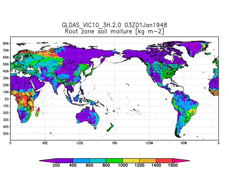
Federal
GLDAS VIC Land Surface Model L4 3 hourly 1.0 x 1.0 degree V2.0 (GLDAS_VIC10_3H) at GES DISC
National Aeronautics and Space Administration —
NASA Global Land Data Assimilation System Version 2 (GLDAS-2) has three components: GLDAS-2.0, GLDAS-2.1, and GLDAS-2.2. GLDAS-2.0 is forced entirely with the... -
Federal
Surface Meteorology Data: NCDC (FIFE)
National Aeronautics and Space Administration —
NCDC surface meteorology data for 1989

Official websites use .gov
A
.gov website belongs to an official government
organization in the United States.
Secure .gov websites use HTTPS
A
lock (
) or https:// means you’ve safely connected to
the .gov website. Share sensitive information only on official,
secure websites.