

19 datasets found for "State Plane Zones"
-
Federal
LLMs for EV Infrastructure Permitting
Department of Energy —
The Electric Vehicle (EV) charging permitting processes' database is a novel, multi-jurisdictional resource designed to contain the required codes and compliances in... -
Federal
2023 National Offshore Wind data set (NOW-23)
Department of Energy —
The 2023 National Offshore Wind data set (NOW-23) is the latest wind resource data set for offshore regions in the United States, which supersedes, for its offshore... -
Federal
BSEE Data Center - Geographic Mapping Data in Digital Format
Department of the Interior —
The geographic data are built from the Technical Information Management System (TIMS). TIMS consists of two separate databases: an attribute database and a spatial... -
Federal
NACP Aboveground Biomass and Carbon Baseline Data, V.2 (NBCD 2000), U.S.A., 2000
National Aeronautics and Space Administration —
The NBCD 2000 (National Biomass and Carbon Dataset for the Year 2000) data set provides a high-resolution (30 m) map of year-2000 baseline estimates of basal area-... -
Federal
Optical scattering measurements and simulation data for one-dimensional (1-D) patterned periodic sub-wavelength features
National Institute of Standards and Technology —
This data set consists of both measured and simulated optical intensities scattered off periodic line arrays, with simulations based upon an average geometric model... -
Federal
Optical scattering measurements and simulation data for one-dimensional (1-D) patterned periodic sub-wavelength features
Department of Commerce —
This data set consists of both measured and simulated optical intensities scattered off periodic line arrays, with simulations based upon an average geometric model... -
Federal
Hardware-in-the-loop Laboratory Performance Verification of Flexible Building Equipment in a Typical Commercial Building: Performance of Heating, Ventilation, and Air Conditioning and Thermal Energy Storage Across the United States
National Institute of Standards and Technology —
This high-fidelity dataset measures the holistic load flexibility performance of a suite of commonly used commercial building heating, ventilating, and air-... -
Federal
Hardware-in-the-loop Laboratory Performance Verification of Flexible Building Equipment in a Typical Commercial Building: Performance of Heating, Ventilation, and Air Conditioning and Thermal Energy Storage Across the United States
Department of Commerce —
This high-fidelity dataset measures the holistic load flexibility performance of a suite of commonly used commercial building heating, ventilating, and air-... -
State
San Francisco Bay and Sacramento-San Joaquin Delta DEM for Modeling, Version 4.2
State of California —
SUPERSEDED --> See version 4.3 https://data.cnra.ca.gov/dataset/san-francisco-bay-and-sacramento-san-joaquin-delta-dem-for-modeling-version-4-3 ## Citation and... -
Federal
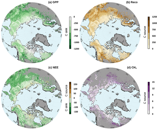
Gridded CO2 and CH4 Flux Estimates for pan-Arctic and Boreal Regions, 2003-2015
National Aeronautics and Space Administration —
This dataset provides gridded estimates of gross primary productivity (GPP), ecosystem respiration (Reco), net ecosystem CO2 exchange (NEE = Reco - GPP), and methane... -
Federal
AirMOSS: L4 Modeled Volumetric Root Zone Soil Moisture, 2012-2015
National Aeronautics and Space Administration —
This data set provides hourly gridded soil moisture estimates derived from hydrologic modeling at nine AirMOSS sites across North America. The AirMOSS L4 RZSM product... -
Federal
Tidal Wetlands Soil Organic Carbon and Estuarine Characteristics, USA, 1972-2015
National Aeronautics and Space Administration —
This dataset provides a synthesis of soil organic carbon (SOC) estimates and a variety of other environmental information from tidal wetlands within estuaries in the... -
State
San Francisco Bay and Sacramento-San Joaquin Delta DEM for Modeling, Version 4.3
State of California —
Citation and Main Description: This product is described in Chapter 5 of the 2018 DWR Delta Modeling Section annual report, produced jointly with USGS.... -
Federal
The Lake Observations by Citizen Scientists & Satellites (LOCSS) Level 1 Version 1.0
National Aeronautics and Space Administration —
This dataset contains data from the Lake Observations by Citizen Science and Satellites project, LOCSS which is a lake monitoring network. The data represent the... -
Federal
Relative Tidal Marsh Elevation Maps with Uncertainty for Conterminous USA, 2010
National Aeronautics and Space Administration —
This dataset provides maps of the elevation of coastal wetlands relative to tidal ranges for the conterminous United States (CONUS) at 30 m resolution for 2010. It... -
Federal
NACP Regional: National Greenhouse Gas Inventories and Aggregated Gridded Model Data
National Aeronautics and Space Administration —
This data set provides two products that were derived from the recently published North American Carbon Program (NACP) Regional Synthesis 1-degree terrestrial... -
Federal
Smerge-Noah-CCI root zone soil moisture 0-40 cm L4 daily 0.125 x 0.125 degree V2.0 (SMERGE_RZSM0_40CM) at GES DISC
National Aeronautics and Space Administration —
Smerge-Noah-CCI root zone soil moisture 0-40 cm L4 daily 0.125 x 0.125 degree V2.0 is a multi-decadal root-zone soil moisture product. Smerge is developed by merging... -
Federal
Gross Primary Production Maps of Tidal Wetlands across Conterminous USA, 2000-2019
National Aeronautics and Space Administration —
This dataset provides mapped tidal wetland gross primary production (GPP) estimates (g C/m2/day) derived from multiple wetland types at 250-m resolution across the...
19 datasets found for "State Plane Zones"