

287 datasets found for "Orthophotographs"
-
Census Tracts in 1990
District of Columbia —
Census Year 1990 Tract Polygons. This dataset contains polygon features, created as part of the DC Geographic Information System (DC GIS) for the D.C. Office of the... -
Washington DC Administrative Boundary
District of Columbia —
The District of Columbia jurisdiction and administrative boundary. The boundary was identified from public land records and digitized using a combination of sources... -
Central Employment Areas
District of Columbia —
The dataset includes polygons representing the location and attributes of Central Employment Area (CEA). The CEA is the core area of the District of Columbia where the... -
Census Tracts in 1980
District of Columbia —
Census Year 1980 Census Tracts. The dataset contains polygons representing CY 1980 census tracts, created as part of the D.C. Geographic Information System (DC GIS)... -
Census Tracts in 1960
District of Columbia —
Census Year 1960 Census Tracts. The dataset contains polygons representing CY 1960 census tracts, created as part of the D.C. Geographic Information System (DC GIS)... -
Census Tracts in 1930
District of Columbia —
Census Year 1930 Census Tracts. The dataset contains polygons representing CY 1930 census tracts, created as part of the D.C. Geographic Information System (DC GIS)... -
Architect of the Capitol
District of Columbia —
Architect of the Capitol jurisdiction boundary. The dataset contains locations and attributes of the Architect of the Capitol jurisdiction boundary, created as part of... -
Fire Stations
District of Columbia —
This dataset contains points for fire stations that were initially identified from DC Fire and EMS Department records and heads-up digitized from 2002... -
Federal
Original aerial photographs of Fall Creek Lake, Oregon, acquired during annual drawdown to streambed November 10, 2016
Department of the Interior —
The Middle Fork Willamette River basin encompasses 3,548 square kilometers of western Oregon and drains to the mainstem Willamette River. Fall Creek basin encompasses... -
Federal
Digital Elevation Model and orthophotographs of Greenland based on aerial photographs from 1978-1987 (G150 AERODEM) (NCEI Accession 0145405)
National Oceanic and Atmospheric Administration, Department of Commerce —
Here, we present a medium-resolution DEM and orthophotographs that consistently cover the entire surroundings and margins of the Greenland Ice Sheet 1978-1987. About... -
Census Tracts in 1970
District of Columbia —
Census Year 1970 Census Tracts. The dataset contains polygons representing CY 1970 census tracts, created as part of the D.C. Geographic Information System (DC GIS)... -
Federal
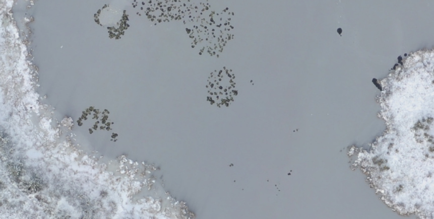
ABoVE: Aerial Photographs of Frozen Lakes near Fairbanks, Alaska, October 2014
National Aeronautics and Space Administration —
This dataset includes high resolution orthophotographs of 21 lakes in the region of Fairbanks, Alaska, USA. Aerial photographs were taken on October 8, 2014, three... -
Census Tracts in 1950
District of Columbia —
Census Year 1950 Census Tracts. The dataset contains polygons representing CY 1950 census tracts, created as part of the D.C. Geographic Information System (DC GIS)... -
Wards from 2002 with Census 2000
District of Columbia —
2002 Wards. The dataset contains polygons representing boundaries of District of Columbia 2000 election wards, created as part of the DC Geographic Information System... -
Federal
2007 MrSID Image of St. John Utilized to derive Benthic Habitat Maps (18064_c7_se.sid)
National Oceanic and Atmospheric Administration, Department of Commerce —
This MrSID (.sid) file is an orthophoto mosaic from a collection of GeoTIFF format natural color and false color infrared orthophotos covering the islands of Puerto... -
Single Member District from 1990
District of Columbia —
District of Columbia Single Member District (SMD) boundaries. This dataset contains lines representing advisory neighborhood commission (ANC) single member districts... -
Voting Precinct 1990
District of Columbia —
1990 Voting Precincts. The dataset contains polygons representing boundaries of District of Columbia voting precincts, established in 1992 (based on the Wards... -
Census Tracts in 1940
District of Columbia —
Census Year 1940 Census Tracts. The dataset contains polygons representing CY 1940 census tracts, created as part of the D.C. Geographic Information System (DC GIS)... -
Federal
Wetted channel and bar features for the Coquille River, Oregon 2005
Department of the Interior —
The Coquille River system is an unregulated system that encompasses 2,745 square kilometers of southwestern Oregon and flows into the Pacific Ocean near the town of... -
Federal
Wetted channel and bar features for the Tillamook, Trask, Wilson, Kilchis, and Miami Rivers, Oregon in 1967
Department of the Interior —
The Tillamook Bay subbasins and Nehalem River basins encompass 1,369 and 2,207 respective square kilometers of northwestern Oregon and drain to the Pacific Ocean. The...
287 datasets found for "Orthophotographs"