
-
Federal
OSU SST Climatology, MODIS Aqua, West US, 2002-2003, DEPRECATED, Lon0360
National Oceanic and Atmospheric Administration, Department of Commerce —
This suite of CHLA and SST climatology and anomaly data products are derived from daily, 0.0125 degree x 0.0125 degree, MODIS Aqua CHLA and SST fields that cover the... -
Federal
Last of the Wild Project, Version 2, 2005 (LWP-2): Global Human Footprint Dataset (IGHP)
National Aeronautics and Space Administration —
The Global Human Footprint Dataset of the Last of the Wild Project, Version 2, 2005 (LWP-2) is the Human Influence Index (HII) normalized by biome. The HII is a... -
Federal
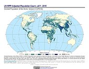
Gridded Population of the World, Version 4 (GPWv4): Population Count Adjusted to Match 2015 Revision of UN WPP Country Totals, Revision 11
National Aeronautics and Space Administration —
The Gridded Population of the World, Version 4 (GPWv4): Population Count Adjusted to Match 2015 Revision of UN WPP Country Totals, Revision 11 consists of estimates... -
Federal
Global Multihazard Mortality Risks and Distribution
National Aeronautics and Space Administration —
The Global Multihazard Mortality Risks and Distribution is a 2.5 minute grid identifying and characterizing the nature of multihazard risk at the global scale. For... -
Federal
Terrestrial Condition Assessment (TCA) Alaska Drought (Map Service)
Department of Agriculture —
TCA AK drought data represent areas of recent drought stress based on the U.S. Drought Monitor data (https://droughtmonitor.unl.edu/) for two time periods: January 6,... -
State
Pallid Bat Habitat Model for NSNF Connectivity - CDFW [ds1049]
State of California —
This grid represents habitat suitability based on the California Wildlife Habitat Relationships (CWHR) expert opinion habitat suitability rankings by habitat type.... -
Federal
Annual Mean PM2.5 Components Trace Elements (TEs) 50m Urban and 1km Non-Urban Area Grids for Contiguous U.S., 2000-2019, v1
National Aeronautics and Space Administration —
The Annual Mean PM2.5 Components Trace Elements (TEs) 50m Urban and 1km Non-Urban Area Grids for Contiguous U.S., 2000-2019, v1 data set contains annual predictions... -
Federal
Global 1-km Downscaled Urban Land Extent Projection and Base Year Grids by SSP Scenarios, 2000-2100
National Aeronautics and Space Administration —
The Global 1-km Downscaled Urban Land Extent Projection and Base Year Grids by SSP Scenarios, 2000-2100 consists of global SSP-consistent spatial urban land fraction... -
Federal
CRED Simrad em3002d multibeam backscatter data from the banktop and bank edge environments at Tutuila, American Samoa, South Pacific with 16 meter resolution in GeoTIFF format
National Oceanic and Atmospheric Administration, Department of Commerce —
Multibeam backscatter imagery extracted from gridded bathymetry of Tutuila, American Samoa, South Pacific These data provide coverage between 20 and 5000 meters. The... -
Federal
Global Fertilizer and Manure, Version 1: Nitrogen in Manure Production
National Aeronautics and Space Administration —
The Nitrogen in Manure Production data set of the Global Fertilizer and Manure, Version 1 Data Collection represents the amount of nitrogen manure produced and... -
Federal
VIIRS/NPP Land Surface Temperature/Emissivity Daily L3 Global 1km SIN Grid Day V001
National Aeronautics and Space Administration —
The VNP21A1D VIIRS Version 1 data product was decommissioned on April 8th, 2025. Users are encouraged to use Version 2 data products, which provideFederalMODIS/Terra Land Surface Temperature/3-Band Emissivity Daily L3 Global 1km SIN Grid Day V061
National Aeronautics and Space Administration —
A suite of Moderate Resolution Imaging Spectroradiometer (MODIS) Land Surface Temperature and Emissivity (LST&E) products are available in Collection 6.1. The...FederalPrecipitation Reconstruction over Land (PREC/L)
National Oceanic and Atmospheric Administration, Department of Commerce —
The monthly data set consists files of 3 resolutions of monthly averaged precipitation totals. The global analyses are defined by interpolation of gauge observations...FederalGlobal Subnational Infant Mortality Rates, Version 2.01
National Aeronautics and Space Administration —
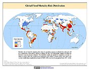
The Global Subnational Infant Mortality Rates, Version 2.01 consist of Infant Mortality Rate (IMR) estimates for 234 countries and territories, 143 of which include...FederalGlobal Flood Mortality Risks and Distribution
National Aeronautics and Space Administration —
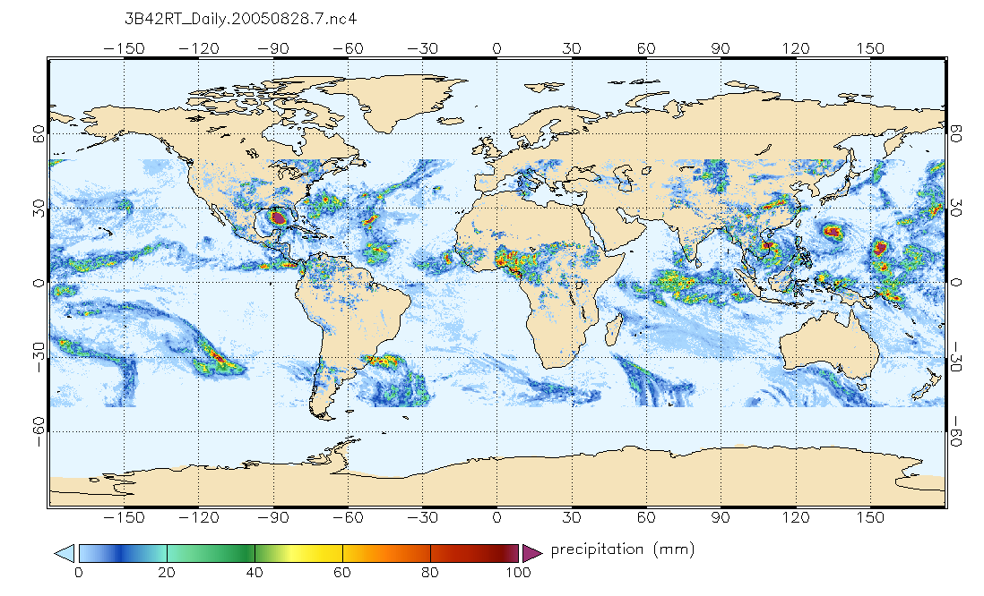
The Global Flood Mortality Risks and Distribution is a 2.5 minute grid of global flood mortality risks. Gridded Population of the World, Version 3 (GPWv3) data...FederalTRMM (TMPA-RT) Near Real-Time Precipitation L3 1 day 0.25 degree x 0.25 degree V7 (TRMM_3B42RT_Daily) at GES DISC
National Aeronautics and Space Administration —
TMPA (3B42RT_Daily) dataset have been discontinued as of Dec. 31, 2019, and users are strongly encouraged to shift to the successor IMERG dataset (doi:...FederalGlobal Annual PM2.5 Grids from MODIS, MISR, SeaWiFS and VIIRS Aerosol Optical Depth (AOD), 1998-2022, V5.GL.04 NGDA
National Aeronautics and Space Administration —
The Global Annual PM2.5 Grids from MODIS, MISR, SeaWiFS and VIIRS Aerosol Optical Depth (AOD), 1998-2022, V5.GL.04 consists of annual concentrations (micrograms per...FederalRegridded Harmonized World Soil Database v1.2
National Aeronautics and Space Administration —
This data set describes select global soil parameters from the Harmonized World Soil Database (HWSD) v1.2, including additional calculated parameters such as area...FederalGlobal Volcano Hazard Frequency and Distribution
National Aeronautics and Space Administration —
Global Volcano Hazard Frequency and Distribution is a 2.5 minute gridded data set based upon the National Geophysical Data Center (NGDC) Volcano Database spanning the...288 datasets found for ""Grid Cells""

Official websites use .gov
A
.gov website belongs to an official government
organization in the United States.
Secure .gov websites use HTTPS
A
lock (
) or https:// means you’ve safely connected to
the .gov website. Share sensitive information only on official,
secure websites.