

Gridded Population of the World, Version 4 (GPWv4): Population Count Adjusted to Match 2015 Revision of UN WPP Country Totals, Revision 11
Access & Use Information
Public: This dataset is intended for public access and use.
License: No license information was provided. If this work was prepared by an officer or employee of the United States government as part of that person's official duties it is considered a U.S. Government Work.
Downloads & Resources
-
Google Scholar search resultsHTML
Search results for publications that cite this dataset by its DOI.
-
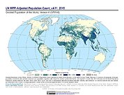
Get a related visualizationJPEG
Sample browse graphic of the data set.
-
Download this datasetHTML
Data Download Page
-
View documentation related to this datasetHTML
Data Set Overview Page
References
Dates
| Metadata Created Date | November 12, 2020 |
|---|---|
| Metadata Updated Date | August 22, 2025 |
Metadata Source
- Data.json Data.json Metadata
Harvested from NASA Data.json
Additional Metadata
| Resource Type | Dataset |
|---|---|
| Metadata Created Date | November 12, 2020 |
| Metadata Updated Date | August 22, 2025 |
| Publisher | SEDAC |
| Maintainer | |
| Identifier | C1597158382-SEDAC |
| Data First Published | 2018-12-31 |
| Language | en-US |
| Data Last Modified | 2025-07-17 |
| Category | GPW, geospatial |
| Public Access Level | public |
| Bureau Code | 026:00 |
| Metadata Context | https://project-open-data.cio.gov/v1.1/schema/catalog.jsonld |
| Schema Version | https://project-open-data.cio.gov/v1.1/schema |
| Catalog Describedby | https://project-open-data.cio.gov/v1.1/schema/catalog.json |
| Harvest Object Id | 610f97a1-578a-40d7-99cd-4b22460d108c |
| Harvest Source Id | 58f92550-7a01-4f00-b1b2-8dc953bd598f |
| Harvest Source Title | NASA Data.json |
| Metadata Type | geospatial |
| Old Spatial | -180.0 -90.0 180.0 90.0 |
| Program Code | 026:001 |
| Related Documents | https://doi.org/10.1080/23754931.2015.1014272, https://doi.org/10.7927/H4BC3WMT, https://doi.org/10.7927/H42Z13KG, https://doi.org/10.7927/H4Z60M4Z, https://doi.org/10.7927/H4TD9VDP, https://doi.org/10.7927/H4JW8BX5, https://doi.org/10.7927/H49C6VHW, https://doi.org/10.7927/H45Q4T5F, https://doi.org/10.7927/H46M34XX, https://doi.org/10.7927/H4F47M65, https://doi.org/10.7927/H4JQ0XZW |
| Source Datajson Identifier | True |
| Source Hash | 6291f4d3e5e14af30d433a34eb8b56a3d30dd2bfe6e020f054de4cda27dd9425 |
| Source Schema Version | 1.1 |
| Spatial | |
| Temporal | 2000-07-01T00:00:00Z/2020-07-01T00:00:00Z |
Didn't find what you're looking for? Suggest a dataset here.