
-
Federal
SnowEx17 Ground Penetrating Radar Raw V001
National Aeronautics and Space Administration —
This data set contains the RAW and UNPROCESSED results of a ground penetrating radar survey conducted as part of the 2017 SnowEx campaign. The processed data can be... -
Federal
SMAPVEX12 PALS Backscatter Data V001
National Aeronautics and Space Administration —
This data set contains backscatter data obtained by the Passive Active L-band System (PALS) microwave aircraft instrument as part of the Soil Moisture Active Passive... -
Federal
Appendices for Geothermal Exploration Artificial Intelligence Report
Department of Energy —
The Geothermal Exploration Artificial Intelligence looks to use machine learning to spot geothermal identifiers from land maps. This is done to remotely detect... -
Federal
NOAA Climate Data Record (CDR) of NEXRAD Quantitative Precipitation Estimates (QPE) (Restricted)
National Oceanic and Atmospheric Administration, Department of Commerce —
NOAA NEXRAD Quantitative Precipitation Estimation (QPE) Climate Data Record (CDR) is created from the Radar Multi-Radar/Multi-Sensor (MRMS) Reanalysis to produce... -
Federal
Gazetteer of Planetary Nomenclature: Venus: 1:10 million-scale Altimetry Quadrangles: Lavinia
National Aeronautics and Space Administration —
This set of maps diplays altimetric radar images of Venus approved by the International Astronomical Union (IAU). -
Federal
TRMM Precipitation Radar Rainfall Rate and Profile L2 1.5 hours V7 (TRMM_2A25) at GES DISC
National Aeronautics and Space Administration —
The new version of these data is in GPM-like format (consistent with the GPM Dual-frequency Radar data format), and can be found under the name GPM_2APR. The TRMM... -
Federal
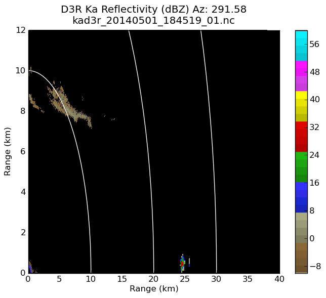
GPM GROUND VALIDATION DUAL-FREQUENCY DUAL-POLARIZED DOPPLER RADAR (D3R) IPHEX V1
National Aeronautics and Space Administration —
The GPM Ground Validation Dual-frequency Dual-polarized Doppler Radar (D3R) IPHEx data set contains radar reflectivity and doppler velocity measurements. The D3R was... -
Federal
PDS Cassini Data Release 16
National Aeronautics and Space Administration —
CDA, CIRS, ISS, RADAR, RSS, SPICE, UVIS, VIMS -
Federal
PDS Cassini Data Release 33
National Aeronautics and Space Administration —
CAPS, CDA, CIRS, HRD, INMS, ISS, MAG, MIMI, RADAR, RPWS, RSS, SPICE, UVIS, VIMS -
Federal
GPM GROUND VALIDATION NASA MICRO RAIN RADAR (MRR) MC3E V1
National Aeronautics and Space Administration —
The GPM Ground Validation NASA Micro Rain Radar (MRR) MC3E dataset was collected by a Micro Rain Radar (MRR), which is a vertically pointing Doppler radar which... -
Federal
Currents, HF Radar, US West Coast, RTV, Near-Real Time, 2012-present, Hourly, 1km, Lon0360
National Oceanic and Atmospheric Administration, Department of Commerce —
Surface ocean velocities estimated from HF-Radar are representative of the upper 0.5 meters of the ocean. The main objective of near-real time processing is to... -
Federal
Radar - Colorado City, TX - Raw Data
Department of Energy —
Overview Raw data captured from the NOAA ESRL website: https://www.esrl.noaa.gov/psd/data/obs/data/ Hourly Radar Winds (WwWind) and Temperature (WwTemp) -
Federal
TRMM Radar Rainfall Statistics L3 1 month (5 x 5) and (0.5 x 0.5) degree V7 (TRMM_3A25) at GES DISC
National Aeronautics and Space Administration —
The new version of these data is in GPM-like format (consistent with the GPM Dual-frequency Radar data format), and can be found under the name GPM_3PR. This product... -
Federal
SnowEx20 Grand Mesa IOP Lidar and GPR-Derived Snow Water Equivalent and Snow Density V001
National Aeronautics and Space Administration —
This data set contains snow water equivalent (SWE) and snow density raster data derived from a lidar-based snow depth data set (SnowEx20 Grand Mesa IOP QSI Lidar Snow... -
Federal
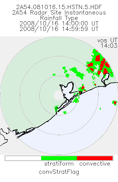
TRMM Ground Validation Radar Site Rain Type Map L2 1 hour 2 km V7 (TRMM_2A54) at GES DISC
National Aeronautics and Space Administration —
'Radar Site Convective/Stratiform Map', is an instantaneous map in Cartesian coordinates with a 2 km resolution. At single radar sites, the map covers an area of 300... -
Federal
Analysis of Existing InSAR Data Brady Hot Springs Geothermal Area
Department of Energy —
Attributes of synthetic aperture radar (SAR) data acquired by TerraSAR-X and TanDEM-X satellite missions and archived at WInSAR facility. -
Federal
Radar - 915MHz - De Smet, SD - Raw Data
Department of Energy —
Overview Raw data captured from the NOAA ESRL website: https://www.esrl.noaa.gov/psd/data/obs/data/ Hourly Radar Winds (WwWind) and Temperature (WwTemp) -
Federal
PDS Cassini Data Release 19
National Aeronautics and Space Administration —
CDA, CIRS, ISS, RADAR, RPWS, RSS, SPICE, UVIS, VIMS -
Federal
Deterministic Move Lists for Federal Incumbent Protection in the CBRS Band
Department of Commerce —
The 3.5 GHz citizens broadband radio service (CBRS) band in the U.S. is a key portion of mid-band spectrum shared between commercial operators and existing federal... -
Federal
Active Transportation Demand Management (ATDM) Trajectory Level Validation
Department of Transportation —
The ATDM Trajectory Validation project developed a validation framework and a trajectory computational engine to compare and validate simulated and observed vehicle...

Official websites use .gov
A
.gov website belongs to an official government
organization in the United States.
Secure .gov websites use HTTPS
A
lock (
) or https:// means you’ve safely connected to
the .gov website. Share sensitive information only on official,
secure websites.