
-
Federal
IRIS/Nimbus-4 Level 1 Radiance Data V001 (IRISN4RAD) at GES DISC
National Aeronautics and Space Administration —
The Nimbus-4 Infrared Interferometer Spectrometer (IRIS) Level 1 Radiance Data contain thermal emissions of the Earth's atmosphere at wave numbers between 400 and... -
Federal
PMR/Nimbus-6 Level 1 Radiance Data from CD-ROM V001 (PMRN6L1RAD_CDROM) at GES DISC
National Aeronautics and Space Administration —
PMRN6L1RAD_CDROM is the gridded Nimbus-6 Pressure Modulated Radiometer (PMR) Level 1 Radiance Data Product. The radiances are measured at CO2 lines in the 15 micron... -
Federal
SCR/Nimbus-4 Level 1 Radiance Data from CD-ROM V001 (SCRN4L1RAD_CDROM) at GES DISC
National Aeronautics and Space Administration —
SCRN4L1RAD_CDROM is the gridded Nimbus-4 Selective Chopper Radiometer (SCR) Level 1 Radiance Data Product. The radiances are measured by 16 channels at 2.3 to 15... -
Federal
SIRS/Nimbus-4 Level 1 Radiance Data V001 (SIRSN4L1) at GES DISC
National Aeronautics and Space Administration —
SIRSN4L1 is the Nimbus-4 Satellite Infrared Spectrometer (SIRS) Level 1 Radiance Data product. SIRS measured infrared radiation (11 to 36 micrometers) emitted from... -
Federal
HIRS/Nimbus-6 Level 1 Calibrated Radiances for the Global Atmospheric Research Program (GARP) V001 (HIRSN6L1GARP) at GES DISC
National Aeronautics and Space Administration —
The Nimbus-6 High Resolution Infrared Radiometer (HIRS) Level 1 Calibrated Radiances for the Global Atmospheric Research Program (GARP) data product contains daily... -
Federal
THIR/Nimbus-4 Level 1 Meteorological Radiation Data at 6.7 microns V001 (THIRN4L1CH67) at GES DISC
National Aeronautics and Space Administration —
THIRN4L1CH67 is the Nimbus-4 Temperature-Humidity Infrared Radiometer (THIR) Level 1 Meteorological Radiation Data at 6.7 microns product contains radiances expressed... -
Federal
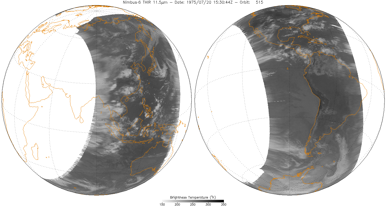
THIR/Nimbus-6 Level 1 Meteorological Radiation Data at 11.5 microns V001 (THIRN6L1CH115) at GES DISC
National Aeronautics and Space Administration —
THIRN6L1CH115 is the Nimbus-6 Temperature-Humidity Infrared Radiometer (THIR) Level 1 Meteorological Radiation Data at 11.5 microns product and contains radiances... -
Federal
HRIR/Nimbus-2 Level 1 Meteorological Radiation Data V001 (HRIRN2L1) at GES DISC
National Aeronautics and Space Administration —
HRIRN2L1 is the High Resolution Infrared Radiometer (HRIR) Nimbus-2 Level 1 Meteorological Radiance Data (NMRT) product and contains infrared radiances converted to... -
Federal
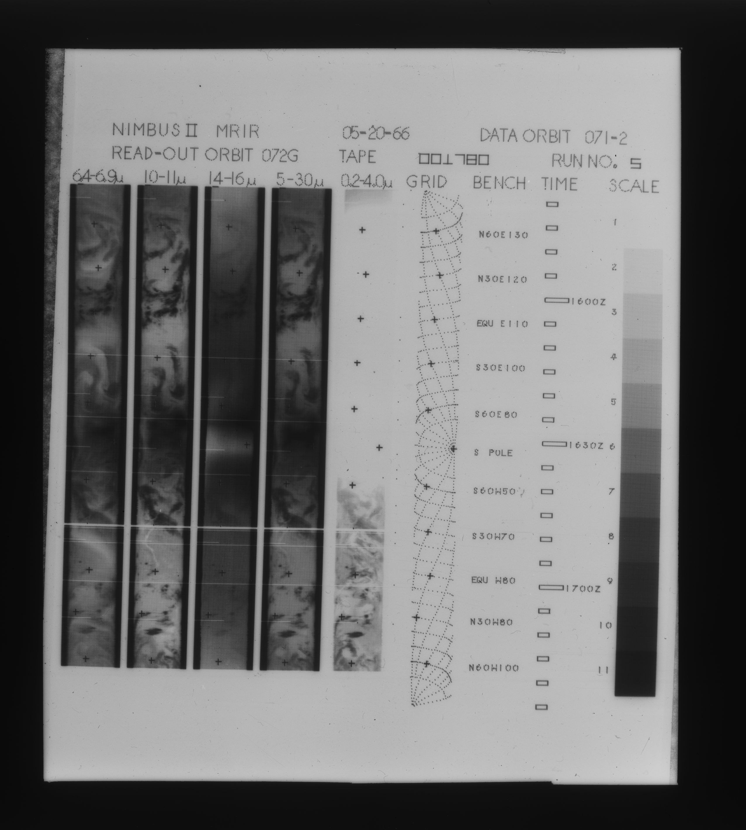
MRIR/Nimbus-2 Images of Daytime Brightness Temperature on 4 x 5 inch Film Sheets V001 (MRIRN2IM) at GES DISC
National Aeronautics and Space Administration —
MRIRN2IM is the Nimbus-2 Medium Resolution Infrared Radiometer (MRIR) data product consisting of 4 x 5 inch photographic film sheets. Each film sheet contains an... -
Federal
THIR/Nimbus-5 Level 1 Meteorological Radiation Data at 6.7 microns V001 (THIRN5L1CH67) at GES DISC
National Aeronautics and Space Administration —
THIRN5L1CH67 is the Nimbus-5 Temperature-Humidity Infrared Radiometer (THIR) Level 1 Meteorological Radiation Data at 6.7 microns product and contains radiances... -
Federal
SCR/Nimbus-4 Level 1 Calibrated Radiances V001 (SCRN4L1RAD) at GES DISC
National Aeronautics and Space Administration —
SCRN4L1RAD is the Nimbus-4 Selective Chopper Radiometer (SCR) Level 1 Calibrated Radiances data product. The calibrated radiances are measured at 6 channels from 2.3... -
Federal
SCAMS/Nimbus-6 Images of Brightness Temperatures, Water Vapor and Temperature on 70-mm Film V001 (SCAMSN6IM) at GES DISC
National Aeronautics and Space Administration —
The SCAMSN6IM data product consists of images of brightness temperatures, water vapor and temperature on 70 mm film strips from the Nimbus-6 Scanning Microwave... -
Federal
HIRS/Nimbus-6 Images of Brightness Temperature on 70 mm Film V001 (HIRSN6IM) at GES DISC
National Aeronautics and Space Administration —
The HIRSN6IM data product consists of images of brightness temperatures on 70 mm film strips from the Nimbus-6 High Resolution Infrared Radiation Sounder. Each... -
Federal
MRIR/Nimbus-3 Level 1 Meteorological Radiation Data V001 (MRIRN3L1) at GES DISC
National Aeronautics and Space Administration —
MRIRN3L1 is the Nimbus-3 Medium-Resolution Infrared Radiometer (MRIR) Level 1 Meteorological Radiance Data product and contain radiances expressed as equivalent... -
Federal
SIRS/Nimbus-3 Level 1 Radiance Data V001 (SIRSN3L1) at GES DISC
National Aeronautics and Space Administration —
SIRSN3L1 is the Nimbus-3 Satellite Infrared Spectrometer (SIRS) Level 1 Radiance Data product. SIRS measured infrared radiation (11 to 36 micrometers) emitted from... -
Federal
SAFARI 2000 ER-2 Color-IR Aerial Photography, Dry Season 2000
National Aeronautics and Space Administration —
Aerial photography from the NASA ER-2 high-altitude aircraft was collected to provide detailed and spatially extensive documentation over parts of the SAFARI study... -
Federal
ITPR/Nimbus-5 Level 1 Calibrated Radiances V001 (ITPRN5L1) at GES DISC
National Aeronautics and Space Administration —
ITPRN5L1 is the Nimbus-5 Infrared Temperature Profile Radiometer (ITPR) Level-1 Calibrated Radiances data product which contains radiances at 7 infrared spectral... -
Federal
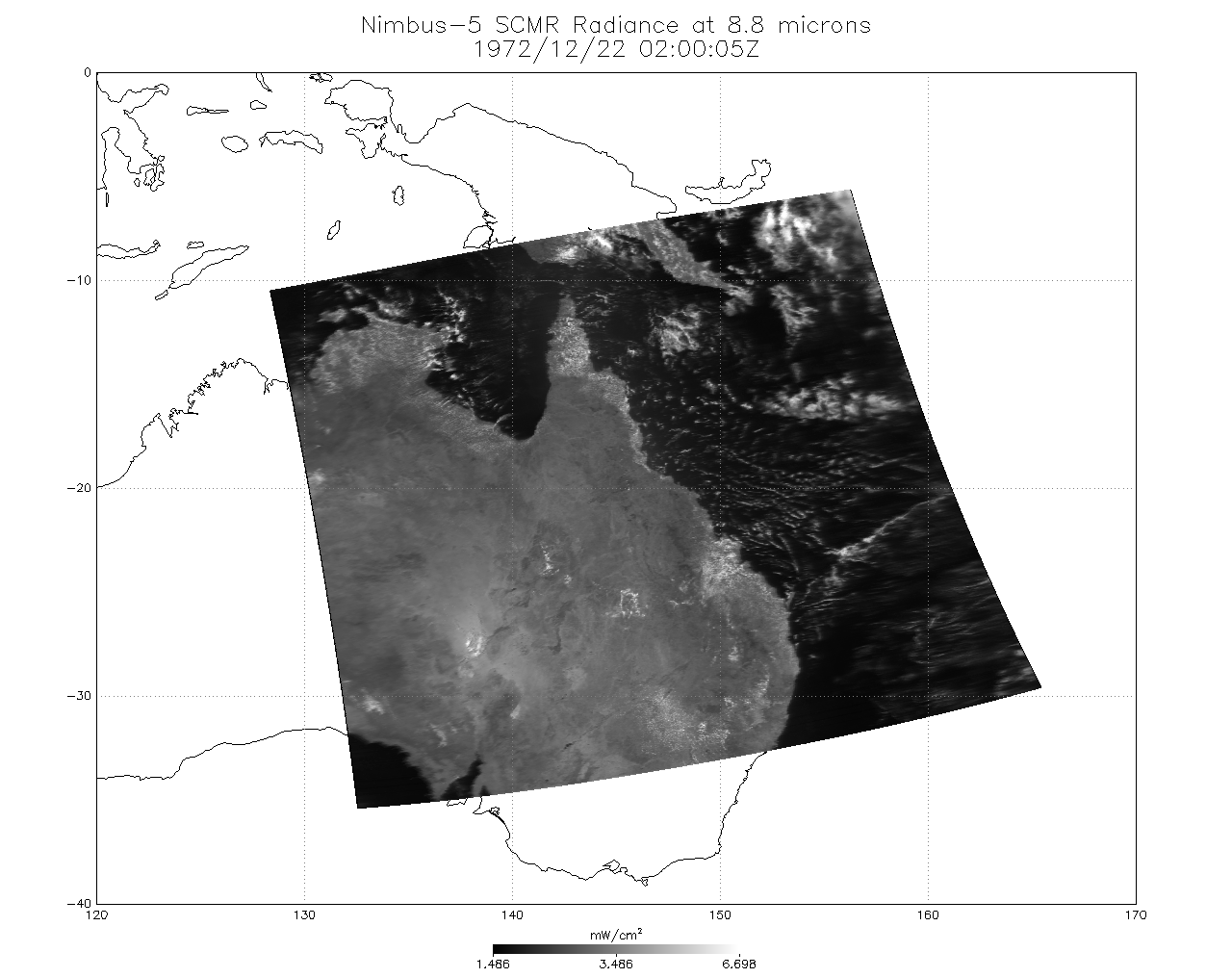
SCMR/Nimbus-5 Level 1 Calibrated and Geolocated Radiances V001 (SCMRN5L1RAD) at GES DISC
National Aeronautics and Space Administration —
SCMRN5L1RAD is the Nimbus-5 Surface Composition Mapping Radiometer (SCMR) Level 1 Calibrated and Geolocated Radiances data product. SCMR measured (1) terrestrial... -
Federal
HRIR/Nimbus-2 Images of Nighttime Brightness Temperature on 70 mm Film V001 (HRIRN2IM) at GES DISC
National Aeronautics and Space Administration —
HRIRN2IM is the Nimbus-2 High-Resolution Infrared Radiometer (HRIR) data product containing scanned negatives of photofacsimile 70mm film strips. The images contain... -
Federal
SAFARI 2000 MODIS Airborne Simulator Data, Southern Africa, Dry Season 2000
National Aeronautics and Space Administration —
This dataset contains the Moderate Resolution Imaging Spectroradiometer (MODIS) Airborne Simulator (MAS) multispectral data collected during the SAFARI 2000 project....

Official websites use .gov
A
.gov website belongs to an official government
organization in the United States.
Secure .gov websites use HTTPS
A
lock (
) or https:// means you’ve safely connected to
the .gov website. Share sensitive information only on official,
secure websites.