
-
Federal
Arctic Vegetation Plots for NGEE-Arctic at Barrow, Alaska, 2012
National Aeronautics and Space Administration —
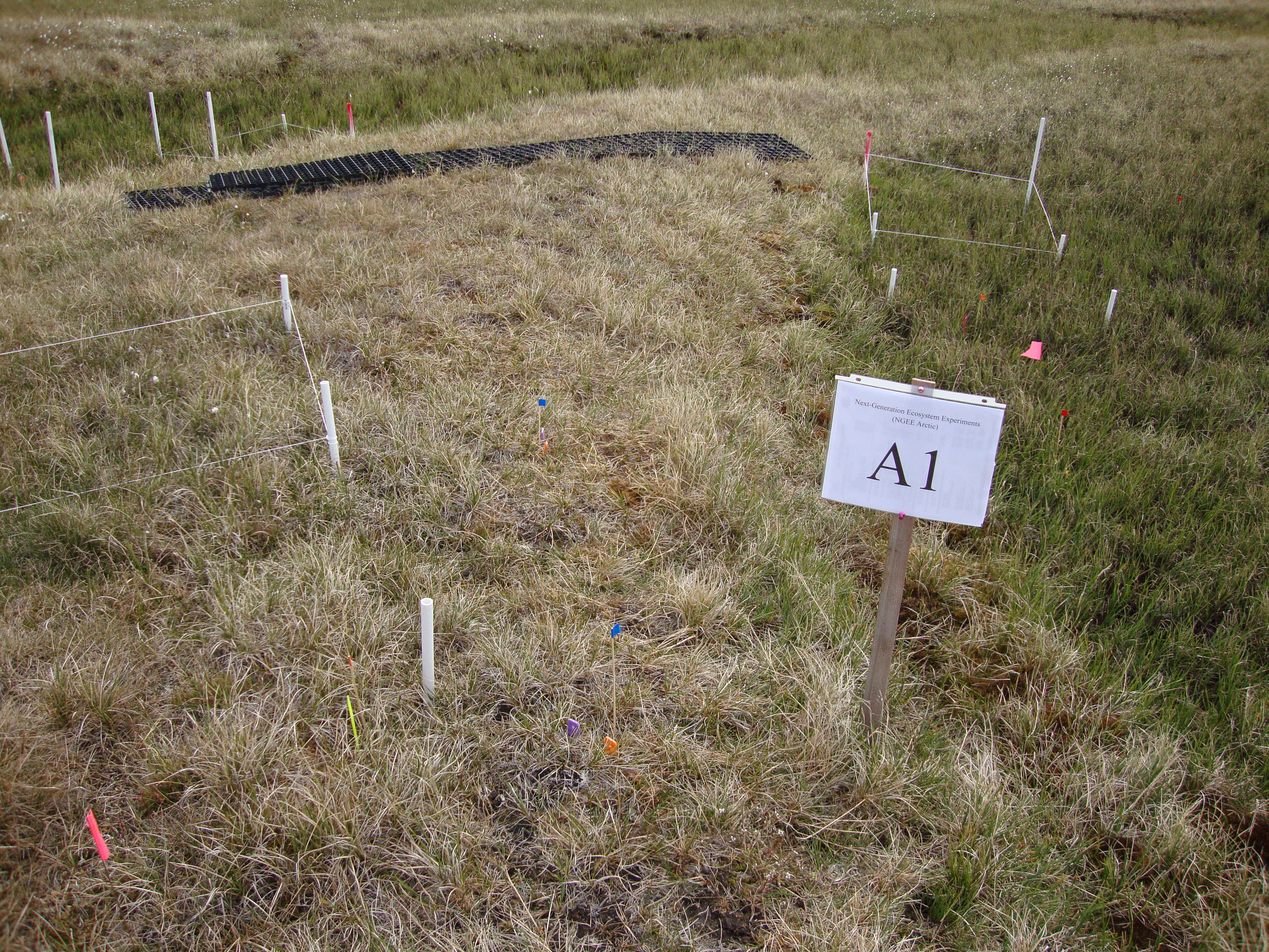
This data set provides vegetation cover and environmental plot data collected on the Barrow Environmental Observatory (BEO), Barrow, Alaska in 2012. Forty-eight 1 x 1... -
Federal
Arctic Vegetation Plots in Flux Tower Footprints, North Slope, Alaska, 2014
National Aeronautics and Space Administration —
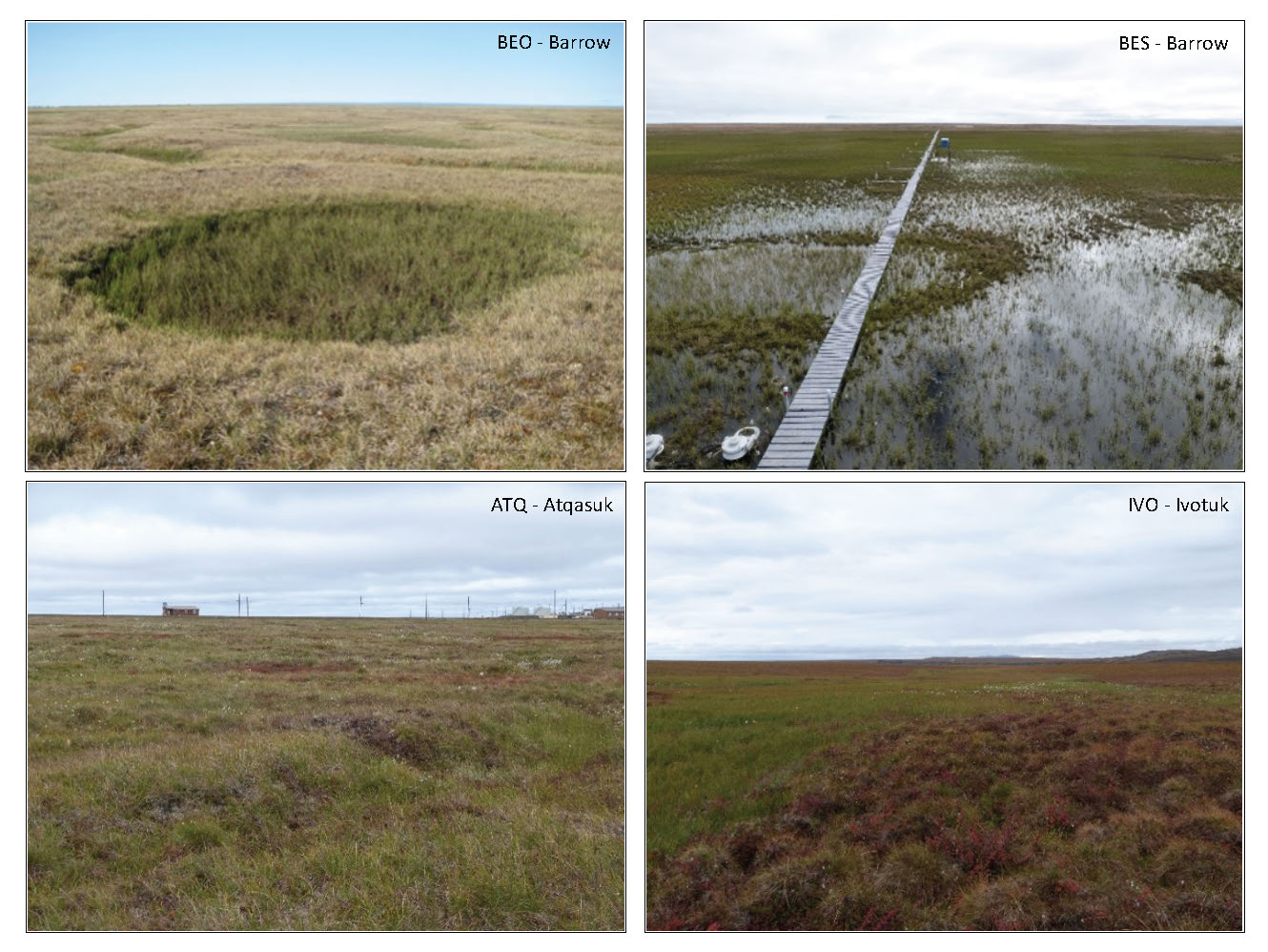
This data set provides vegetation, environmental, and soil data collected from plots located in the footprints of eddy covariance flux towers along a 300 km north-... -
Federal
ABoVE: Post-Fire and Unburned Vegetation Community and Field Data, NWT, Canada, 2017
National Aeronautics and Space Administration —
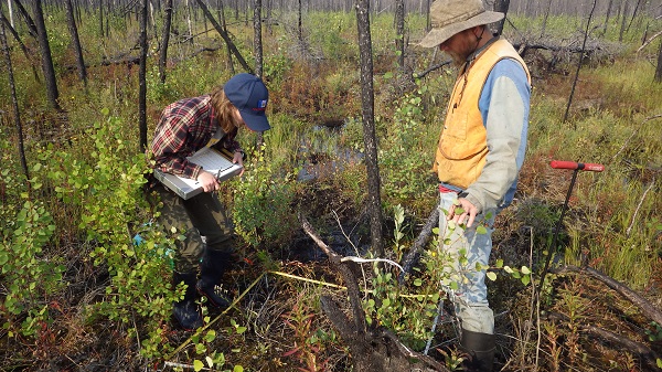
This dataset provides vegetation community characteristics, soil moisture, and biophysical data collected in 2017 from 11 study sites in the ABoVE Study area. The 11... -
Federal
Pre-Delta-X: L3 AirSWOT-derived Water Level Profiles, Wax Lake Outlet, LA, USA, 2015
National Aeronautics and Space Administration —
This dataset contains water level profiles generated from the AirSWOT data collected in the Atchafalaya Basin in Southern Louisiana, USA, within the Mississippi River... -
Federal
ABoVE: Dall Sheep Lamb Recruitment and Climate Data, Alaska and NW Canada, 2000-2015 NGDA
National Aeronautics and Space Administration —
This dataset contains estimated annual average Dall sheep (Ovis dalli dalli) lamb-to-ewe ratios for each year from 2000-2015 across the full species range in Alaska... -
Federal
Remote Sensing Data Before and After California Rim and King Forest Fires, 2010-2015
National Aeronautics and Space Administration —
This data set provides high-resolution surface reflectance, thermal imagery, burn severity metrics, and LiDAR-derived structural measures of forested areas in the... -
Federal
ABoVE: Post-Fire and Unburned Vegetation Community and Field Data, NWT, Canada, 2018
National Aeronautics and Space Administration —
This dataset provides vegetation community characteristics and biophysical data collected in 2018 from areas that were burned by wildfire in 2014 and 2015, and from... -
Federal
Arctic Vegetation Plots at ARCSS/LAII Flux Sites, North Slope, Alaska, 1995-1996
National Aeronautics and Space Administration —
This dataset provides vegetation cover and environmental plot and soil data collected at flux tower sites of the North Slope Arctic System Science/Land-Atmosphere-Ice... -
Federal
NDVI, Species Cover, and LAI, Burned and Unburned sites, Interior Alaska, 2017-2018 NGDA
National Aeronautics and Space Administration —
This dataset provides leaf area index (LAI), tree species and canopy cover, normalized difference vegetation index (NDVI), and NDVI trends for boreal forests in... -
Federal
ABoVE: Burned Area, Depth, and Combustion for Alaska and Canada, 2001-2019 NGDA
National Aeronautics and Space Administration —
This dataset provides annual gridded estimates of fire locations and associated burn fraction per pixel for Alaska and Canada at approximately 500 m spatial... -
Federal
Pre-Delta-X: Channel Bathymetry of the Atchafalaya Basin, LA, USA, 2016
National Aeronautics and Space Administration —
This dataset provides water depths and water surface elevations collected during bathymetric surveys of the main channel of the Wax Lake Delta within the Mississippi... -
Federal
CMS: Forest Inventory and Biophysical Measurements, Para, Brazil, 2012-2014
National Aeronautics and Space Administration —
This data set provides measurements for diameter at breast height (DBH), commercial tree height, and total tree height for forest inventories taken at the Fazenda... -
Federal
RLC Forest Cover of the Former Soviet Union, 1973
National Aeronautics and Space Administration —
This data set is a 1:15 million scale forest cover map for the land area of the Former Soviet Union. Twenty-two land cover classes are distinguished, of which 20 are... -
Federal
Ground-Based Vegetation Community Photos, Toolik Lake Area, Alaska, 2014-2015
National Aeronautics and Space Administration —
This dataset contains 731 ground-based nadir vegetation community and ground surface photographs of selected field plots taken as ground reference data for vegetation... -
Federal
Multispectral Imagery, NDVI, and Terrain Models, Big Trail Lake, Fairbanks, AK, 2019
National Aeronautics and Space Administration —
This dataset provides multispectral reflectance imagery (green at 550 nm, red at 660 nm, red edge at 735 nm, and near-infrared at 790 nm), normalized difference... -
Federal
Global Aboveground and Belowground Biomass Carbon Density Maps for the Year 2010
National Aeronautics and Space Administration —
This dataset provides temporally consistent and harmonized global maps of aboveground and belowground biomass carbon density for the year 2010 at a 300-m spatial... -
Federal
MODIS/Terra+Aqua Leaf Area Index/FPAR 4-Day L4 Global 500m SIN Grid V061 NGDA
National Aeronautics and Space Administration —
The MCD15A3H Version 6.1 Moderate Resolution Imaging Spectroradiometer (MODIS) Level 4, Combined Fraction of Photosynthetically Active Radiation (FPAR), and Leaf Area... -
Federal
VIIRS/NPP Leaf Area Index/FPAR 8-Day L4 Global 500m SIN Grid V001
National Aeronautics and Space Administration —
The Visible Infrared Imaging Radiometer Suite (VIIRS) Leaf Area Index (LAI) and Fraction of Photosynthetically Active Radiation (FPAR) Version 1 data product provides... -
Federal
A Global Database of Gas Fluxes from Soils after Rewetting or Thawing, Version 1.0
National Aeronautics and Space Administration —
This database contains information compiled from published studies on gas flux from soil following rewetting or thawing. The resulting database includes 222 field and... -
Federal
NACP: MODIS Daily Land Incident 4-km PAR Images For North America, 2003-2005 NGDA
National Aeronautics and Space Administration —
This data set contains daily Moderate Resolution Imaging Spectroradiometer (MODIS) land incident photosynthetically active radiation (PAR) images over North America...

Official websites use .gov
A
.gov website belongs to an official government
organization in the United States.
Secure .gov websites use HTTPS
A
lock (
) or https:// means you’ve safely connected to
the .gov website. Share sensitive information only on official,
secure websites.