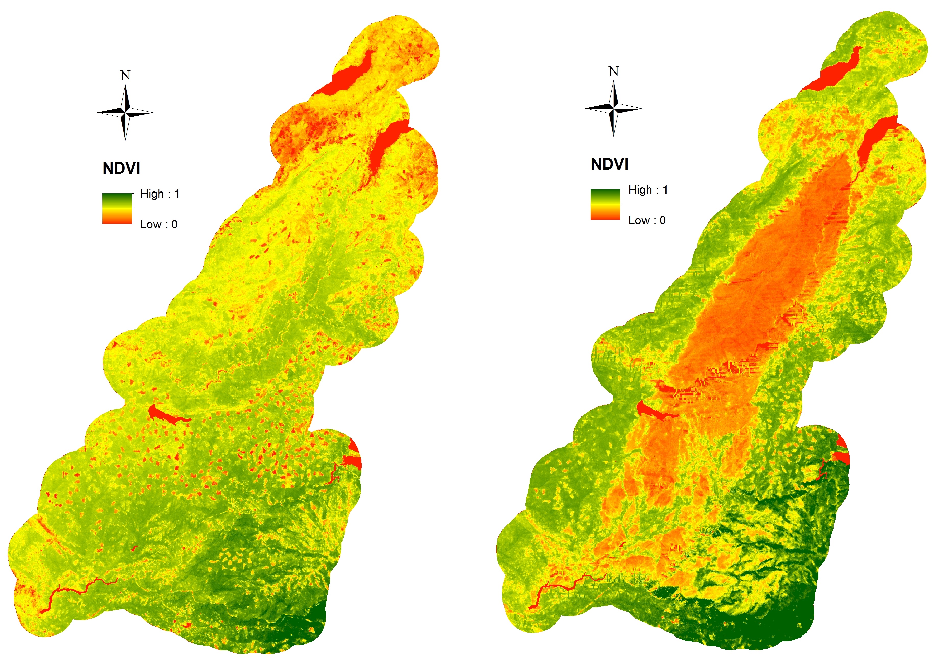
Remote Sensing Data Before and After California Rim and King Forest Fires, 2010-2015
Access & Use Information
Downloads & Resources
-
Google Scholar search resultsHTML
Search results for publications that cite this dataset by its DOI.
-
Download this datasetHTML
This link allows direct data access via Earthdata login
-
View documentation related to this datasetHTML
ORNL DAAC Data Set Documentation
-
This dataset's landing pageHTML
Data set Landing Page DOI URL
-
View documentation related to this datasetPDF
Data Set Documentation
-
Get a related visualizationJPEG
Browse Image
-
Landing PageLanding Page
Dates
| Metadata Created Date | October 4, 2023 |
|---|---|
| Metadata Updated Date | December 6, 2023 |
Metadata Source
- Data.json Data.json Metadata
Harvested from NASA Data.json
Graphic Preview

Additional Metadata
| Resource Type | Dataset |
|---|---|
| Metadata Created Date | October 4, 2023 |
| Metadata Updated Date | December 6, 2023 |
| Publisher | ORNL_DAAC |
| Maintainer | |
| Identifier | C2773214672-ORNL_CLOUD |
| Data First Published | 2016-09-07 |
| Language | en-US |
| Data Last Modified | 2023-09-26 |
| Category | Vegetation, geospatial |
| Public Access Level | public |
| Bureau Code | 026:00 |
| Metadata Context | https://project-open-data.cio.gov/v1.1/schema/catalog.jsonld |
| Metadata Catalog ID | https://data.nasa.gov/data.json |
| Schema Version | https://project-open-data.cio.gov/v1.1/schema |
| Catalog Describedby | https://project-open-data.cio.gov/v1.1/schema/catalog.json |
| Citation | Stavros, E.N., Z. Tane, V. Kane, S. Veraverbeke, R. McGaughey, J.A. Lutz, C. Ramirez, and D.S. Schimel. 2016. Remote Sensing Data Before and After California Rim and King Forest Fires, 2010-2015. ORNL DAAC, Oak Ridge, Tennessee, USA. http://dx.doi.org/10.3334/ORNLDAAC/1288 |
| Graphic Preview Description | Browse Image |
| Graphic Preview File | https://daac.ornl.gov/VEGETATION/guides/KRFA_browse.jpg |
| Harvest Object Id | 417f0189-a7cb-44c8-9dfc-77889545aac3 |
| Harvest Source Id | 58f92550-7a01-4f00-b1b2-8dc953bd598f |
| Harvest Source Title | NASA Data.json |
| Homepage URL | https://doi.org/10.3334/ORNLDAAC/1288 |
| Metadata Type | geospatial |
| Old Spatial | -120.81 37.66 -119.57 39.22 |
| Program Code | 026:001 |
| Source Datajson Identifier | True |
| Source Hash | c97d4179c67784fdf5c4d5addf67ab603b9d46f28955b6a1024002ec013fc308 |
| Source Schema Version | 1.1 |
| Spatial | |
| Temporal | 2010-07-21T00:00:00Z/2015-01-15T23:59:59Z |
Didn't find what you're looking for? Suggest a dataset here.

