
-
MASTER: HyspIRI Airborne Campaign, California, Spring 2015
This dataset includes Level 1B (L1B) and Level 2 (L2) data products from the MODIS/ASTER Airborne Simulator (MASTER) instrument. The spectral data were collected as part of the... -
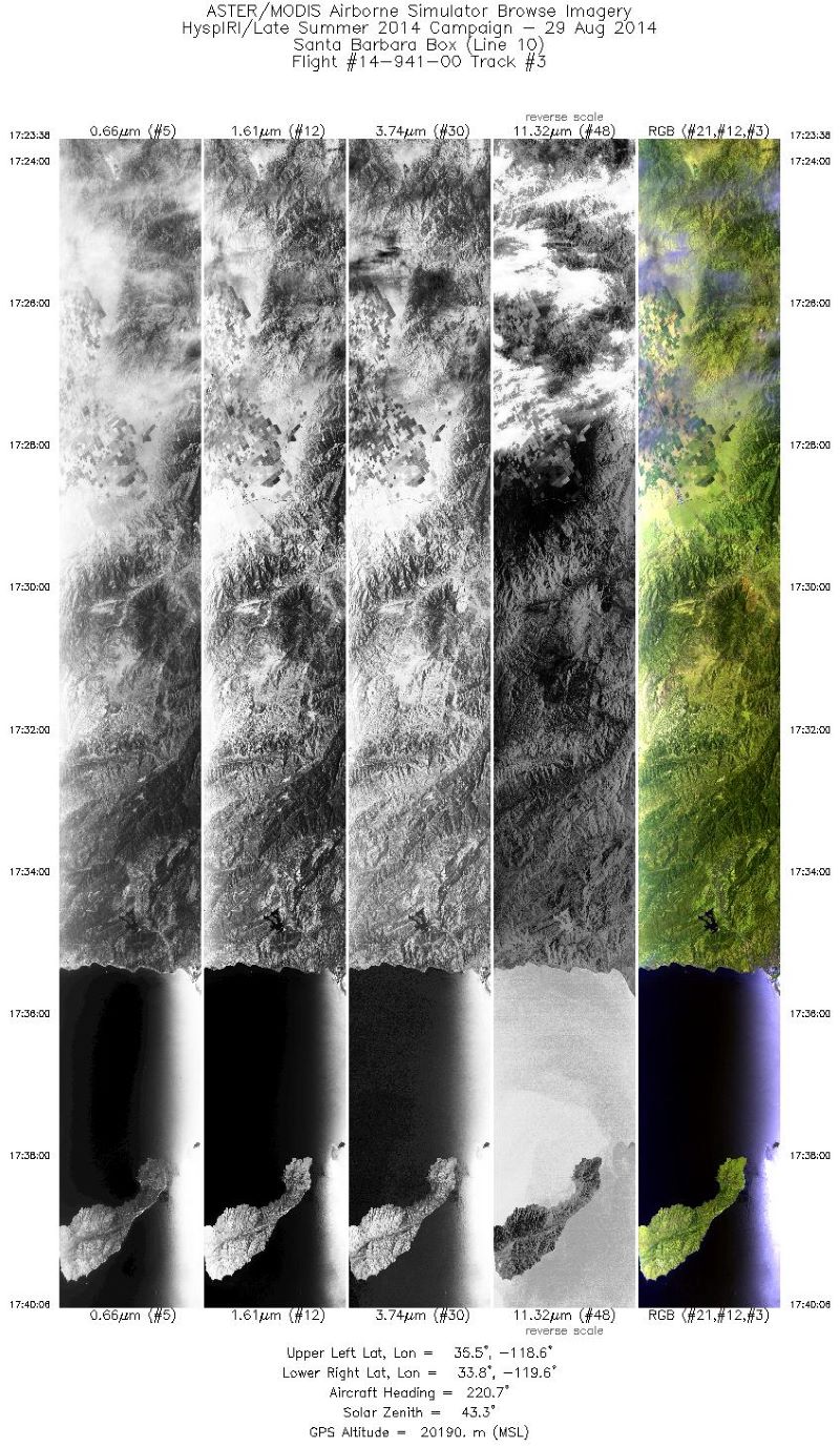
MASTER: HyspIRI Airborne Campaign, California, Summer 2014
This dataset includes Level 1B (L1B) and Level 2 (L2) data products from the MODIS/ASTER Airborne Simulator (MASTER) instrument. The spectral data were collected as part of the... -
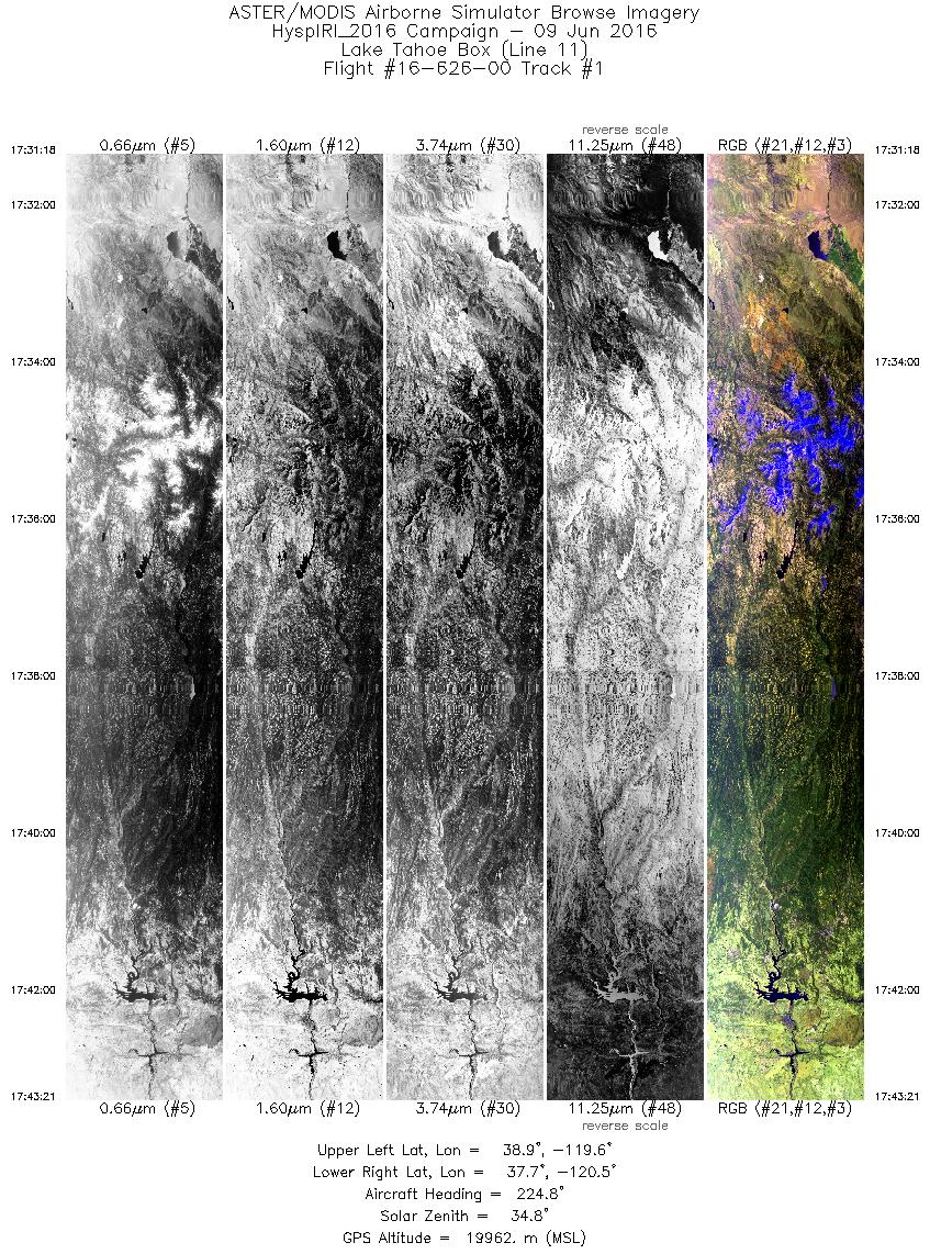
MASTER: HyspIRI Airborne Campaign, California and Nevada, Summer 2016
This dataset includes Level 1B (L1B) and Level 2 (L2) data products from the MODIS/ASTER Airborne Simulator (MASTER) instrument. The data were collected as part of the... -
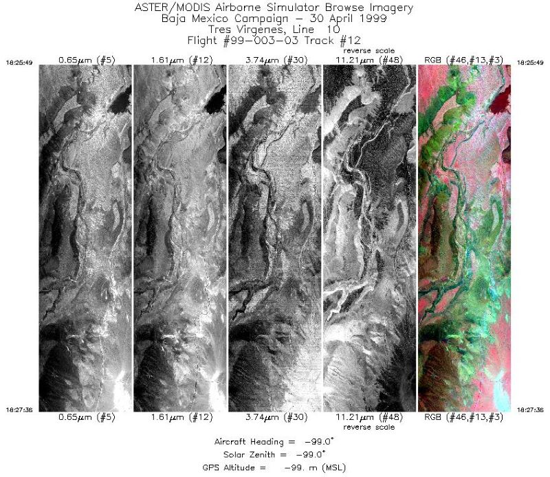
MASTER: Airborne Science, Baja Mexico-Nevada, April-May, 1999
This dataset includes Level 1B (L1B) data products from the MODIS/ASTER Airborne Simulator (MASTER) instrument. The spectral data were collected during 7 flights aboard a DOE... -
MASTER: Airborne Science, California-Nevada, May-June, 2008
This dataset includes Level 1B (L1B) and Level 2 (L2) data products from the MODIS/ASTER Airborne Simulator (MASTER) instrument. The spectral data were collected as part of the... -
MASTER: Airborne Science, Nevada, May 2006
This dataset includes Level 1B (L1B) data products from the MODIS/ASTER Airborne Simulator (MASTER) instrument. The spectral data were collected during five flights aboard a DOE... -
PhenoCam Dataset v3.0: Vegetation Phenology from Digital Camera Imagery, 2000-2023
This dataset provides vegetation phenological observations for 738 sites across diverse ecosystems of the world (mostly North America) from 2000 to 2023. The phenology data were... -
Pre-Delta-X: L3 AirSWOT-derived Water Level Profiles, Wax Lake Outlet, LA, USA, 2015
This dataset contains water level profiles generated from the AirSWOT data collected in the Atchafalaya Basin in Southern Louisiana, USA, within the Mississippi River Delta... -
Pre-LBA ABLE-2A and ABLE-2B Expedition Data
The ABLE 2A and 2B (Atmospheric Boundary Layer Experiments) data consists of estimates of the rate of exchange of a wide variety of aerosols and gases between the Amazon Basin... -
Forest Inventories and DBH at Burned and Unburned Forest Sites, Acre, Brazil, 2017
This data set provides measurements of diameter at breast height (DBH) and species identification at four forest sites in the eastern side of Acre, Brazil including Bonal (A),... -
Global Soil Types, 0.5-Degree Grid (Modified Zobler)
A global data set of soil types is available at 0.5-degree latitude by 0.5-degree longitude resolution. There are 106 soil units, based on Zobler?s (1986) assessment of the...

Official websites use .gov
A
.gov website belongs to an official government
organization in the United States.
Secure .gov websites use HTTPS
A
lock (
) or https:// means you’ve safely connected to
the .gov website. Share sensitive information only on official,
secure websites.