
-
MERRA-2 tavg1_2d_aer_Nx: 2d,1-Hourly,Time-averaged,Single-Level,Assimilation,Aerosol Diagnostics 0.625 x 0.5 degree V5.12.4 (M2T1NXAER) at GES DISC recent views
M2T1NXAER (or tavg1_2d_aer_Nx) is an hourly time-averaged 2-dimensional data collection in Modern-Era Retrospective analysis for Research and Applications version 2 (MERRA-2).... -
Georeferenced Population Datasets of Mexico (GEO-MEX): GIS of Mexican States, Municipalities and Islands recent views
The GIS of Mexican States, Municipalities and Islands consists of attribute and boundary data for 1990. The attribute data include population, language, education, literacy,... -
Georeferenced Population Datasets of Mexico (GEO-MEX): Urban Place GIS Coverage of Mexico recent views
The Urban Place GIS Coverage of Mexico is a vector based point Geographic Information System (GIS) coverage of 696 urban places in Mexico. Each Urban Place is geographically... -
Mars surface image (Curiosity rover) labeled data set version 1 recent views
This data set consists of 6691 images spanning 24 classes that were collected by the Mars Science Laboratory (MSL, Curosity) rover by three instruments (Mastcam Right eye,... -
ASTER Global DEM NGDA recent views
ASTER is capable of collecting in-track stereo using nadir- and aft-looking near infrared cameras. Since 2001, these stereo pairs have been used to produce single-scene (60- x... -
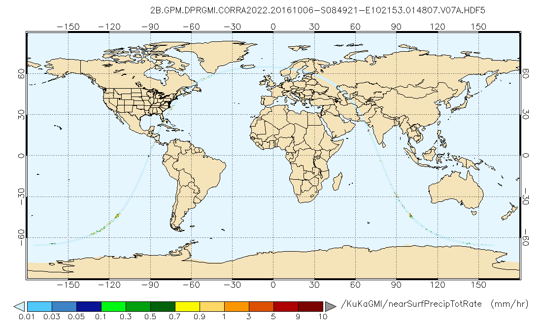
GPM DPR and GMI Combined Precipitation L2B 1.5 hours 5 km V07 (GPM_2BCMB) at GES DISC recent views
Version 07 is the current version of the data set. Older versions will no longer be available and have been superseded by Version 07. This is a precipitation product created... -
Aviation Safety Reporting System: Maintenance Reports recent views
A sampling of reports from aircraft maintenance personnel. -
Poverty Mapping Project: Global Subnational Prevalence of Child Malnutrition recent views
The Poverty Mapping Project: Global Subnational Prevalence of Child Malnutrition data set consists of estimates of the percentage of children with weight-for-age z-scores that... -
National Space Science Data Center Master Catalog recent views
The National Space Science Data Center serves as the permanent archive for NASA space science mission data. 'Space science' means astronomy and astrophysics, solar and space... -
GPM IMERG Final Precipitation L3 1 month 0.1 degree x 0.1 degree V07 (GPM_3IMERGM) at GES DISC recent views
Version 07 is the current version of the data set. Older versions will no longer be available and have been superseded by Version 07. The Integrated Multi-satellitE Retrievals... -
Prediction Of Worldwide Energy Resources (POWER) recent views
The POWER Project contains over 380 satellite-derived meteorology and solar energy Analysis Ready Data (ARD) at four temporal levels: hourly, daily, monthly (by year 12 months +... -
GLDAS Catchment Land Surface Model L4 daily 0.25 x 0.25 degree GRACE-DA1 V2.2 (GLDAS_CLSM025_DA1_D) at GES DISC recent views
NASA Global Land Data Assimilation System Version 2 (GLDAS-2) has three components: GLDAS-2.0, GLDAS-2.1, and GLDAS-2.2. GLDAS-2.0 is forced entirely with the Princeton... -
Black Hole-Black Hole Waveform Catalog recent views
Numerically-generated gravitational waveforms for binary black holes. -
Analysis of Virtual Sensors for Predicting Aircraft Fuel Consumption recent views
Previous research described the use of machine learning algorithms to predict aircraft fuel consumption. This technique, known as Virtual Sensors, models fuel consumption as a... -
MODIS/Terra Clouds 5-Min L2 Swath 1km and 5km NGDA recent views
The MODIS/Terra Clouds 5-Min L2 Swath 1km and 5km product (MOD06_L2) consists of cloud optical and physical parameters. These parameters are derived using remotely sensed... -
Global Vegetation Greenness (NDVI) from AVHRR GIMMS-3G+, 1981-2022 recent views
This dataset holds the Global Inventory Modeling and Mapping Studies-3rd Generation V1.2 (GIMMS-3G+) data for the Normalized Difference Vegetation Index (NDVI). NDVI was based... -
Declassified Satellite Imagery 2 (2002) recent views
Declassified satellite images provide an important worldwide record of land-surface change. With the success of the first release of classified satellite photography in 1995,... -
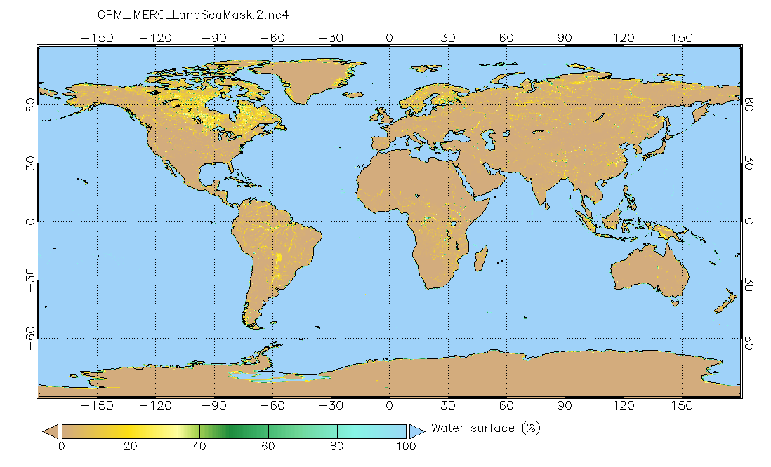
Land/Sea static mask relevant to IMERG precipitation 0.1x0.1 degree V2 (GPM_IMERG_LandSeaMask) at GES DISC recent views
Version 2 is the current version of the data set. Older versions will no longer be available and have been superseded by Version 2. This land sea mask originated from the NOAA... -
HTML files recent views
This is a resource where HTML files will be stored for the website -
Spacecraft Material Outgassing Data recent views
This compilation of outgassing data of materials intended for spacecraft use were obtained at the Goddard Space Flight Center (GSFC), utilizing equipment developed at Stanford...

Official websites use .gov
A
.gov website belongs to an official government
organization in the United States.
Secure .gov websites use HTTPS
A
lock (
) or https:// means you’ve safely connected to
the .gov website. Share sensitive information only on official,
secure websites.