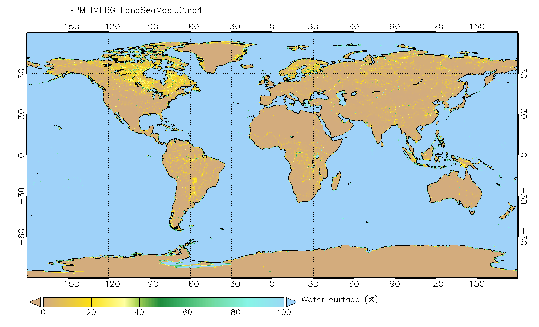
Land/Sea static mask relevant to IMERG precipitation 0.1x0.1 degree V2 (GPM_IMERG_LandSeaMask) at GES DISC
Access & Use Information
Downloads & Resources
-
Google Scholar search resultsHTML
Search results for publications that cite this dataset by its DOI.
-
Get a related visualizationPNG
GPM_IMERG_LandSeaMask.png
-
This dataset's landing pageHTML
Access the dataset landing page from the GES DISC website.
-
Download this dataset through a directory mapHTML
-
Use GRADS DATA SERVER (GDS) to access the...HTML
The GrADS Data Server (GDS) is another form of OPeNDAP that provides...
-
Use OPeNDAP to access the dataset's dataHTML
Access the data via the OPeNDAP protocol.
-
Landing PageLanding Page
Dates
| Metadata Created Date | November 12, 2020 |
|---|---|
| Metadata Updated Date | December 6, 2023 |
Metadata Source
- Data.json Data.json Metadata
Harvested from NASA Data.json
Graphic Preview

Additional Metadata
| Resource Type | Dataset |
|---|---|
| Metadata Created Date | November 12, 2020 |
| Metadata Updated Date | December 6, 2023 |
| Publisher | NASA/GSFC/SED/ESD/GCDC/GESDISC |
| Maintainer | |
| Identifier | C1617332035-GES_DISC |
| Data First Published | 2019-06-07 |
| Language | en-US |
| Data Last Modified | 2019-02-08 |
| Category | GPM, geospatial |
| Public Access Level | public |
| Bureau Code | 026:00 |
| Metadata Context | https://project-open-data.cio.gov/v1.1/schema/catalog.jsonld |
| Metadata Catalog ID | https://data.nasa.gov/data.json |
| Schema Version | https://project-open-data.cio.gov/v1.1/schema |
| Catalog Describedby | https://project-open-data.cio.gov/v1.1/schema/catalog.json |
| Citation | Bill Olson, Dave Bolvin, George Huffman. David Silberstein. 2019-06-15. GPM_IMERG_LandSeaMask. Version 2. Land/Sea static mask relevant to IMERG precipitation 0.1x0.1 degree V2. Greenbelt, MD. Archived by National Aeronautics and Space Administration, U.S. Government, Goddard Earth Sciences Data and Information Services Center (GES DISC). https://doi.org/10.5067/6P5EM1HPR3VD. https://disc.gsfc.nasa.gov/datacollection/GPM_IMERG_LandSeaMask_2.html. Digital Science Data. |
| Creator | Bill Olson, Dave Bolvin, George Huffman |
| Data Presentation Form | Digital Science Data |
| Editor | David Silberstein |
| Graphic Preview File | https://docserver.gesdisc.eosdis.nasa.gov/public/project/GPM/browse/GPM_IMERG_LandSeaMask.png |
| Harvest Object Id | 90011e5f-e3e9-4e69-9c42-b6345f770f5e |
| Harvest Source Id | 58f92550-7a01-4f00-b1b2-8dc953bd598f |
| Harvest Source Title | NASA Data.json |
| Homepage URL | https://doi.org/10.5067/6P5EM1HPR3VD |
| Metadata Type | geospatial |
| Old Spatial | -180.0 -90.0 180.0 90.0 |
| Program Code | 026:001 |
| Release Place | Greenbelt, MD |
| Series Name | GPM_IMERG_LandSeaMask |
| Source Datajson Identifier | True |
| Source Hash | 4f7efc65340a55a509bebf61fa3e423a8d2f0b04325c56cdc8ec815bb4bf5d3b |
| Source Schema Version | 1.1 |
| Spatial | |
| Temporal | 1998-01-01T00:00:00Z/2022-01-17T00:00:00Z |
Didn't find what you're looking for? Suggest a dataset here.

