
-
JERS-1 Synthetic Aperture Radar, 100-m Mosaics, South America: 1995-1996, R1 recent views
This data set provides ~100-m resolution image mosaics of South America acquired during the low flood season between September and December 1995 and during the high flood season... -
GLDAS VIC Land Surface Model L4 monthly 1.0 x 1.0 degree Early Product V2.1 (GLDAS_VIC10_M_EP) at GES DISC recent views
NASA Global Land Data Assimilation System Version 2 (GLDAS-2) has three components: GLDAS-2.0, GLDAS-2.1, and GLDAS-2.2. GLDAS-2.0 is forced entirely with the Princeton... -
JPL TELLUS GRACE-FO Level-3 Monthly Land Water-Equivalent-Thickness Surface Mass Anomaly Release 6.3 version 04 recent views
This data set is produced by the Jet Propulsion Laboratory (JPL) as part of the GRACE-FO (Gravity Recovery and Climate Experiment Follow-On) program and derives the terrestrial... -
NLDAS Mosaic Land Surface Model L4 Hourly 0.125 x 0.125 degree V002 (NLDAS_MOS0125_H) at GES DISC recent views
This data set contains a series of land surface parameters simulated from the Mosaic land-surface model (LSM) for Phase 2 of the North American Land Data Assimilation System... -
GLDAS Noah Land Surface Model L4 3 hourly 0.25 x 0.25 degree V2.1 (GLDAS_NOAH025_3H) at GES DISC recent views
NASA Global Land Data Assimilation System Version 2 (GLDAS-2) has three components: GLDAS-2.0, GLDAS-2.1, and GLDAS-2.2. GLDAS-2.0 is forced entirely with the Princeton... -
Global Hydrologic Soil Groups (HYSOGs250m) for Curve Number-Based Runoff Modeling recent views
This dataset - HYSOGs250m - represents a globally consistent, gridded dataset of hydrologic soil groups (HSGs) with a geographical resolution of 1/480 decimal degrees,... -
LBA-ECO CD-06 Biogeochemistry of Ji-Parana River and Tributaries, Brazil: 1999-2003 recent views
This data set provides spatially extensive and temporally intensive surveys of the river biogeochemistry of the Ji-Parana River Basin in Western Amazonia, Rondonia, Brazil. The... -
ABoVE: Lake and Pond Extents in Alaskan Boreal and Tundra Subregions, 2019-2021 recent views
This dataset provides polygon spatial files of lake and pond extents for three sub-regions of Interior Alaska's boreal forest, and one tundra region located in Alaska's Yukon-... -
Pre SWOT Hydrology GRRATS Daily River Heights and Storage Version 2 recent views
The Global River Radar Altimeter Time Series (GRRATS) 1km/daily interpolations are river heights from ERS-1, ERS-2, TOPEX/Poseidon OSTM/Jason-2 and Envisat that are interpolated... -
Daymet: Monthly Climate Summaries on a 1-km Grid for North America, Version 4 R1 recent views
This dataset provides Daymet Version 4 R1 monthly climate summaries derived from Daymet Version 4 R1 daily data at a 1 km x 1 km spatial resolution for five Daymet variables:... -
GLDAS VIC Land Surface Model L4 3 hourly 1.0 x 1.0 degree V2.1 (GLDAS_VIC10_3H) at GES DISC recent views
NASA Global Land Data Assimilation System Version 2 (GLDAS-2) has three components: GLDAS-2.0, GLDAS-2.1, and GLDAS-2.2. GLDAS-2.0 is forced entirely with the Princeton... -
SWOT Level 2 River Single-Pass Vector Data Product, Version 2.0 recent views
The SWOT Level 2 River Single-Pass Vector Data Product from the Surface Water Ocean Topography (SWOT) mission provides water surface elevation, slope, width, and discharge... -
SENTINEL-1B_SINGLE_POL_GRD_HIGH_RES recent views
Sentinel-1B Single-pol ground projected high and full resolution images -
Sentinel-3A OLCI Global Mapped CyAN Project, True Color (TC) - Near Real-Time (NRT) Data, version 5.0 recent views
The Ocean Biology DAAC produces near real-time (quicklook) products using the best-available combination of ancillary data from meteorological and ozone data. As such, the... -
Sentinel-3B OLCI Global Mapped CyAN Project, True Color (TC) - Near Real-Time (NRT) Data, version 5.0 recent views
The Ocean Biology DAAC produces near real-time (quicklook) products using the best-available combination of ancillary data from meteorological and ozone data. As such, the... -
Arctic Soil Freeze/Thaw Status from SMMR and SSM/I, Version 2 recent views
This data set contains near-surface (< 5 cm) soil freeze/thaw status on snow-free and snow-covered land surfaces over the Arctic terrestrial drainage basin. The near-surface... -
Sea Ice Melt Pond Data from the Canadian Arctic, Version 1 recent views
This data set contains observations of albedo, depth, and physical characteristics of melt ponds on sea ice, taken during the summer of 1994. The melt ponds studied were located... -
GLDAS CLM Land Surface Model L4 3 hourly 1.0 x 1.0 degree Subsetted V001 (GLDAS_CLM10SUBP_3H) at GES DISC recent views
With the upgraded Land Surface Models (LSMs) and updated forcing data sets, the GLDAS version 2.1 (GLDAS-2.1) production stream serves as a replacement for GLDAS-001. The entire... -
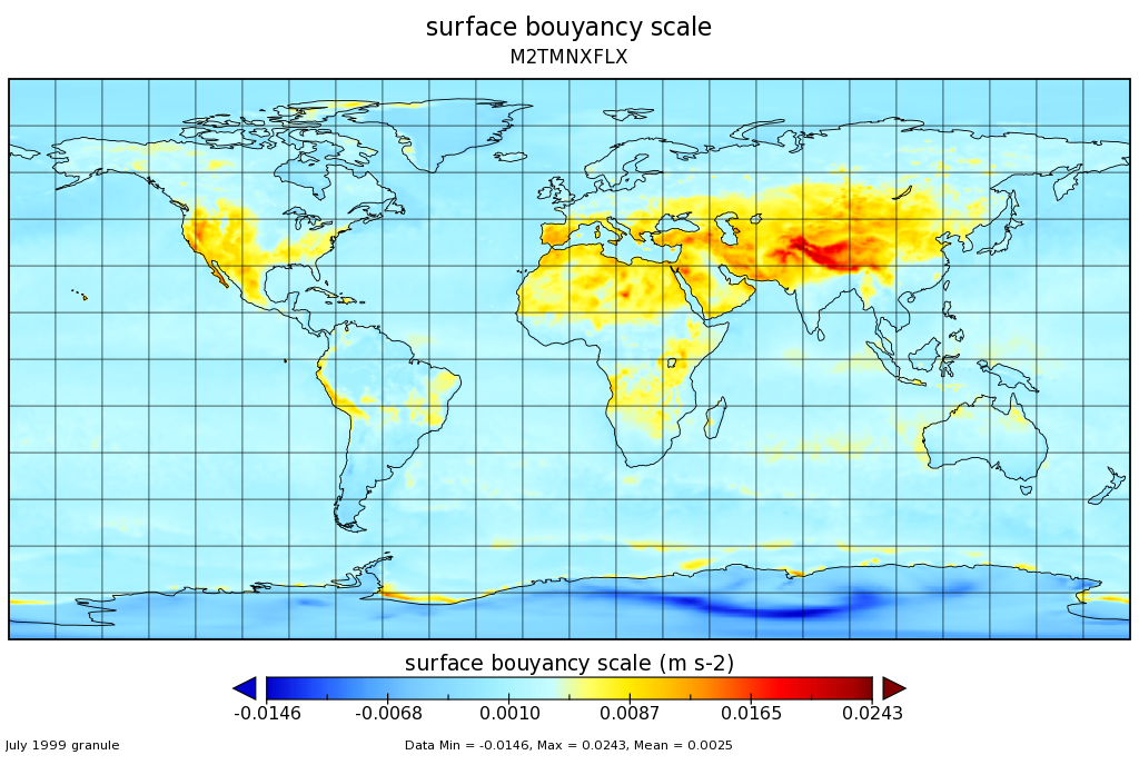
MERRA-2 tavgM_2d_flx_Nx: 2d,Monthly mean,Time-Averaged,Single-Level,Assimilation,Surface Flux Diagnostics 0.625 x 0.5 degree V5.12.4 (M2TMNXFLX) at GES DISC recent views
M2TMNXFLX (or tavgM_2d_flx_Nx) is a time-averaged 2-dimensional monthly mean data collection in Modern-Era Retrospective analysis for Research and Applications version 2...

Official websites use .gov
A
.gov website belongs to an official government
organization in the United States.
Secure .gov websites use HTTPS
A
lock (
) or https:// means you’ve safely connected to
the .gov website. Share sensitive information only on official,
secure websites.