
-
Global Land Cover Characterization Program recent views
The Global Land Cover Characterization Project was established to meet science data requirements identified by the International Geosphere and Biosphere Programme (IGBP), and... -
USGS Digital Orthophoto Quadrangles recent views
A Digital Orthophoto Quadrangle (DOQ) is a computer-generated image of an aerial photograph in which the image displacement caused by terrain relief and camera tilt has been... -
Fire Intensity and Burn Severity Metrics for Circumpolar Boreal Forests, 2001-2013 NGDA recent views
This data set provides products characterizing immediate and longer-term ecosystem changes from fires in the circumpolar boreal forests of Northern Eurasia and North America.... -
USGS Global Forest Observations Initiative (GFOI) Guatemala recent views
The Global Forest Observations Initiative (GFOI) is an initiative of the inter-governmental Group on Earth Observations (GEO) that aims to: foster the sustained availability of... -
Global Forest Ecosystem Structure and Function Data For Carbon Balance Research recent views
A comprehensive global database has been assembled to quantify CO2 fluxes and pathways across different levels of integration (from photosynthesis up to net ecosystem... -
Aerial Photographs (from AMES Pilot Land Data System); USGS EDC, Sioux Falls recent views
The aerial photography inventoried by the Pilot Land Data System (PLDS) at NASA AMES Research Center has been transferred to the USGS EROS Data Center. The photos were obtained... -
ABoVE: Peak Greenness for Canadian Boreal Forest from Landsat 5 TM Imagery, 1984-2011 recent views
This dataset provides a 28-year time series of peak greenness (NDVI) data derived from Landsat 5 TM imagery over the boreal forest region of Canada. Landsat 5 TM scenes were... -
USGS Global Forest Observations Initiative (GFOI) Costa Rica recent views
The Global Forest Observations Initiative (GFOI) is an initiative of the inter-governmental Group on Earth Observations (GEO) that aims to: foster the sustained availability of... -
Alaska's Changing YK Delta: Knowledge Exchange between Elders and Geoscientists, 2018 recent views
This dataset provides a booklet documenting the discussions and outcomes from a knowledge-exchange meeting with Yup'ik elders from the Yukon-Kuskokwim Delta (YKD), western... -
Urban Biogenic CO2 fluxes: GPP, Reco and NEE Estimates from SMUrF, 2010-2019 NGDA recent views
This dataset contains estimates of biogenic CO2 flux components at 0.05 degree resolution from the Solar-Induced Fluorescence (SIF) for Modeling Urban biogenic Fluxes (SMUrF)... -
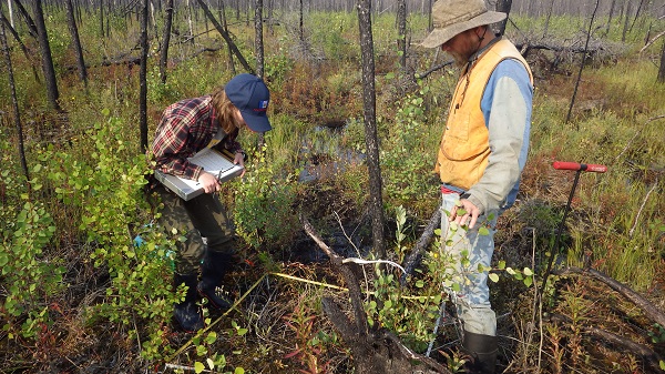
ABoVE: Characterization of Carbon Dynamics in Burned Forest Plots, NWT, Canada, 2014 recent views
This dataset provides field data from boreal forests in the Northwest Territories (NWT), Canada, that were burned by wildfires in 2014. During fieldwork in 2015, 211 burned... -
SAFARI 2000 Global Burned Area Map, 1-km, Southern Africa, 2000 recent views
The Global Burned Area 2000 initiative (GBA2000) was launched by the Global Vegetation Mapping Unit of the Joint Research Centre of the European Commission, in partnership with... -
Burned and Unburned Field Site Data, Noatak, Seward, and North Slope, AK, 2016-2018 recent views
This dataset includes field measurements from unburned and burned 10 m x 10 m and 1 m x 1 m plots in the Noatak, Seward, and North Slope regions of the Alaskan tundra during... -
ABoVE: Synthesis of Burned and Unburned Forest Site Data, AK and Canada, 1983-2016 recent views
This dataset is a synthesis of field plot characterization data, derived above-ground and below-ground combusted carbon, and acquired Fire Weather Index (FWI) System components... -
ABoVE: Post-Fire and Unburned Vegetation Community and Field Data, NWT, Canada, 2017 recent views
This dataset provides vegetation community characteristics, soil moisture, and biophysical data collected in 2017 from 11 study sites in the ABoVE Study area. The 11 study areas... -
USGS Global Forest Observations Initiative (GFOI) Brazil recent views
The Global Forest Observations Initiative (GFOI) is an initiative of the inter-governmental Group on Earth Observations (GEO) that aims to: foster the sustained availability of... -
USGS Global Forest Observations Initiative (GFOI) Guyana recent views
The Global Forest Observations Initiative (GFOI) is an initiative of the inter-governmental Group on Earth Observations (GEO) that aims to: foster the sustained availability of... -
USGS Global Forest Observations Initiative (GFOI) Philippines recent views
The Global Forest Observations Initiative (GFOI) is an initiative of the inter-governmental Group on Earth Observations (GEO) that aims to: foster the sustained availability of... -
ABoVE: Post-Fire and Unburned Vegetation Community and Field Data, NWT, Canada, 2018 recent views
This dataset provides vegetation community characteristics and biophysical data collected in 2018 from areas that were burned by wildfire in 2014 and 2015, and from nine... -
NACP: Forest Carbon Stocks, Fluxes and Productivity Estimates, Western USA, 1979-2099 recent views
This dataset contains annual estimates of carbon stocks, fluxes, and productivity over forested land in 11 states of the western USA (Arizona, California, Colorado, Idaho,...

Official websites use .gov
A
.gov website belongs to an official government
organization in the United States.
Secure .gov websites use HTTPS
A
lock (
) or https:// means you’ve safely connected to
the .gov website. Share sensitive information only on official,
secure websites.