
-
Global Annual PM2.5 Grids from MODIS, MISR and SeaWiFS Aerosol Optical Depth (AOD), 1998-2019, V4.GL.03 NGDA recent views
The Global Annual PM2.5 Grids from MODIS, MISR and SeaWiFS Aerosol Optical Depth (AOD), 1998-2019, V4.GL.03 consists of annual concentrations (micrograms per cubic meter) of all... -
Global Fire Emissions Database, Version 4.1 (GFEDv4) NGDA recent views
This dataset provides global estimates of monthly burned area, monthly emissions and fractional contributions of different fire types, daily or 3-hourly fields to scale the... -
ABoVE: Burned Area, Depth, and Combustion for Alaska and Canada, 2001-2019 NGDA recent views
This dataset provides annual gridded estimates of fire locations and associated burn fraction per pixel for Alaska and Canada at approximately 500 m spatial resolution for the... -
ABoVE: Ignitions, Burned Area, and Emissions of Fires in AK, YT, and NWT, 2001-2018 NGDA recent views
This dataset provides estimates of daily burned area, carbon emissions, and uncertainty, and daily fire ignition locations for boreal fires in Alaska, U.S., and in the Yukon and... -
CARVE: Alaskan Fire Emissions Database (AKFED), 2001-2013 NGDA recent views
This data set provides estimates of annual carbon emissions (kg carbon per square meter) from boreal fires at 450-m resolution for the state of Alaska between 2001 and 2013. To... -
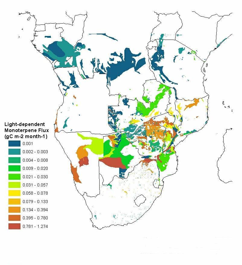
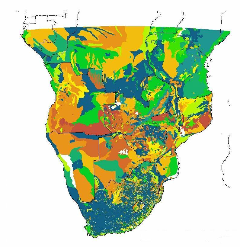
SAFARI 2000 Estimated BVOC Emissions for Southern African Land Cover Types NGDA recent views
Improved vegetation distribution and emission data for Africa south of the equator were developed for the Southern African Regional Science Initiative (SAFARI 2000) and combined... -
Annual wildland fire emissions (WFEIS v0.5) for Conterminous US and Alaska, 2001-2013 NGDA recent views
This data set contains annual modeled estimates of wildland fire emissions at 0.01 degree (~1-km) spatial resolution from the Wildland Fire Emissions Information System (WFEIS...

Official websites use .gov
A
.gov website belongs to an official government
organization in the United States.
Secure .gov websites use HTTPS
A
lock (
) or https:// means you’ve safely connected to
the .gov website. Share sensitive information only on official,
secure websites.