ABoVE: Ignitions, Burned Area, and Emissions of Fires in AK, YT, and NWT, 2001-2018
Access & Use Information
Downloads & Resources
-
Google Scholar search resultsHTML
Search results for publications that cite this dataset by its DOI.
-
Download this datasetHTML
This link allows direct data access via Earthdata login
-
View documentation related to this datasetHTML
ORNL DAAC Data Set Documentation
-
This dataset's landing pageHTML
Data set Landing Page DOI URL
-
View documentation related to this datasetPDF
ABoVE: Ignitions, Burned Area, and Emissions of Fires in AK, YT, and NWT,...
-
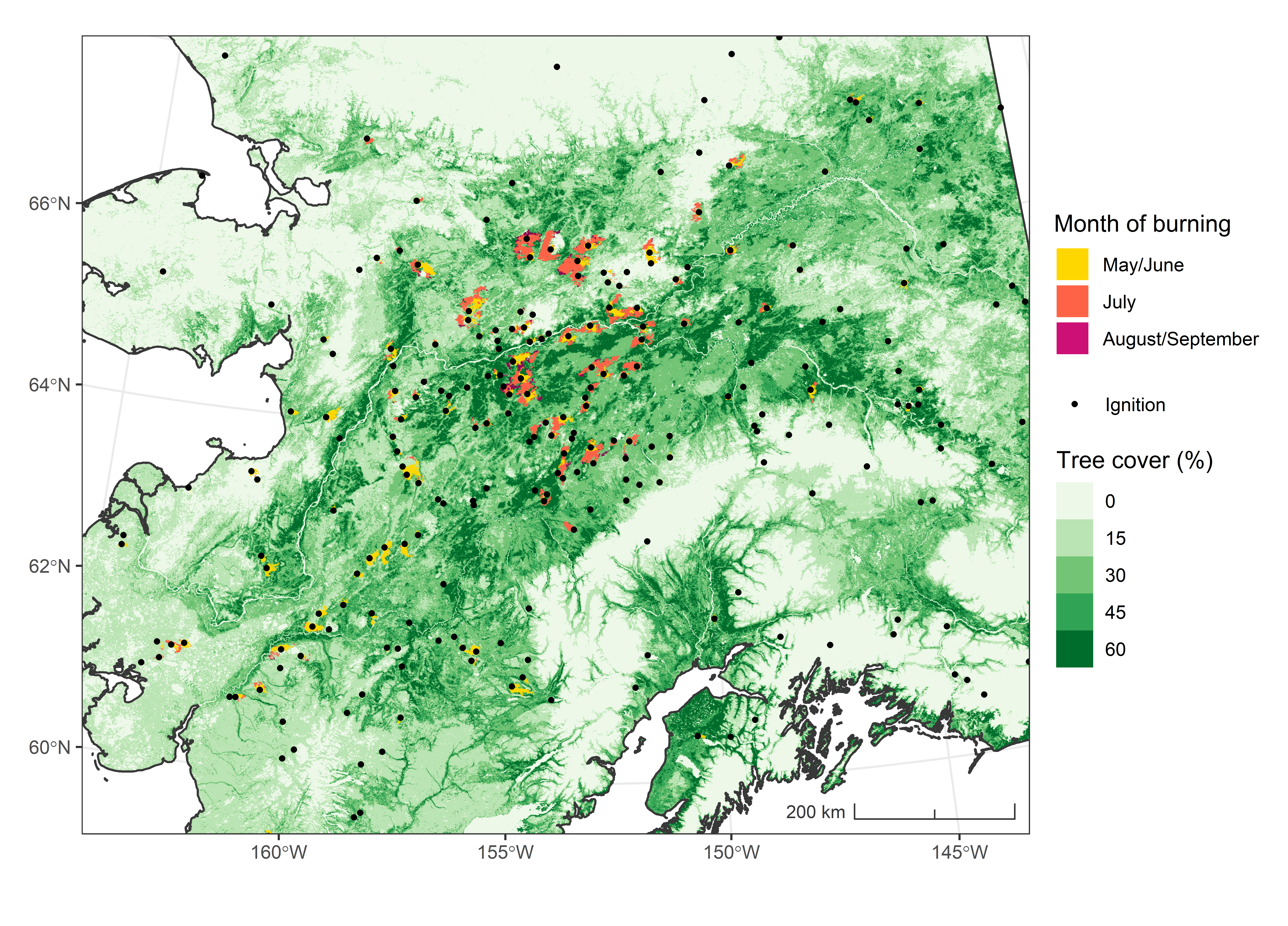
Get a related visualizationPNG
Ignition locations and burned area for Interior Alaska in 2015. Source:...
-
The dataset's project home pageHTML
ABoVE project site
-
Landing PageLanding Page
Dates
| Metadata Created Date | December 1, 2022 |
|---|---|
| Metadata Updated Date | December 6, 2023 |
Metadata Source
- Data.json Data.json Metadata
Harvested from NASA Data.json
Graphic Preview

Additional Metadata
| Resource Type | Dataset |
|---|---|
| Metadata Created Date | December 1, 2022 |
| Metadata Updated Date | December 6, 2023 |
| Publisher | ORNL_DAAC |
| Maintainer | |
| Identifier | C2111719486-ORNL_CLOUD |
| Data First Published | 2021-06-22 |
| Language | en-US |
| Data Last Modified | 2023-06-12 |
| Category | ABoVE, geospatial |
| Public Access Level | public |
| Bureau Code | 026:00 |
| Metadata Context | https://project-open-data.cio.gov/v1.1/schema/catalog.jsonld |
| Metadata Catalog ID | https://data.nasa.gov/data.json |
| Schema Version | https://project-open-data.cio.gov/v1.1/schema |
| Catalog Describedby | https://project-open-data.cio.gov/v1.1/schema/catalog.json |
| Citation | Scholten, R.C., S. Veraverbeke, R. Jandt, E.A. Miller, and B.M. Rogers. 2021. ABoVE: Ignitions, Burned Area, and Emissions of Fires in AK, YT, and NWT, 2001-2018. ORNL DAAC, Oak Ridge, Tennessee, USA. https://doi.org/10.3334/ORNLDAAC/1812 |
| Graphic Preview Description | Ignition locations and burned area for Interior Alaska in 2015. Source: Scholten et al., 2021b |
| Graphic Preview File | https://daac.ornl.gov/ABOVE/guides/BurnedArea_Emissions_AK_YT_NWT_Fig1.png |
| Harvest Object Id | e809708c-18c0-480c-b924-45b2d7fd3443 |
| Harvest Source Id | 58f92550-7a01-4f00-b1b2-8dc953bd598f |
| Harvest Source Title | NASA Data.json |
| Homepage URL | https://doi.org/10.3334/ORNLDAAC/1812 |
| Metadata Type | geospatial |
| Old Spatial | -167.0 51.63 -99.98 79.26 |
| Program Code | 026:001 |
| Source Datajson Identifier | True |
| Source Hash | 52e1860e915534fd6b3d0cae48260277a4121930607f188aa0f895247157bd22 |
| Source Schema Version | 1.1 |
| Spatial | |
| Temporal | 2001-01-01T00:00:00Z/2018-12-31T23:59:59Z |
Didn't find what you're looking for? Suggest a dataset here.

