Global Fire Emissions Database, Version 4.1 (GFEDv4)
Access & Use Information
Downloads & Resources
-
Google Scholar search resultsHTML
Search results for publications that cite this dataset by its DOI.
-
Download this datasetHTML
This link allows direct data access via Earthdata login
-
View documentation related to this datasetHTML
ORNL DAAC Data Set Documentation
-
This dataset's landing pageHTML
Data set Landing Page DOI URL
-
View documentation related to this datasetPDF
fire_emissions_v4_R1.pdf
-
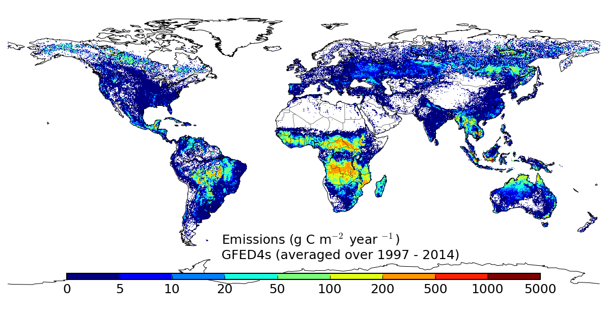
View documentation related to this datasetPNG
fire_emissions_v4_R1_Fig1.png
-
Get a related visualizationPNG
Browse Image
-
Landing PageLanding Page
Dates
| Metadata Created Date | September 14, 2023 |
|---|---|
| Metadata Updated Date | December 7, 2023 |
Metadata Source
- Data.json Data.json Metadata
Harvested from NASA Data.json
Graphic Preview

Additional Metadata
| Resource Type | Dataset |
|---|---|
| Metadata Created Date | September 14, 2023 |
| Metadata Updated Date | December 7, 2023 |
| Publisher | ORNL_DAAC |
| Maintainer | |
| Identifier | C2763353619-ORNL_CLOUD |
| Data First Published | 2017-09-29 |
| Language | en-US |
| Data Last Modified | 2023-09-11 |
| Category | Vegetation, geospatial |
| Category Tag 16E15F51 D96E 4051 9124 75665Abdc6Ff | "Arctic","Permafrost and Arctic Landscapes","Arctic Peoples and Ecosystems" |
| Public Access Level | public |
| Bureau Code | 026:00 |
| Metadata Context | https://project-open-data.cio.gov/v1.1/schema/catalog.jsonld |
| Metadata Catalog ID | https://data.nasa.gov/data.json |
| Schema Version | https://project-open-data.cio.gov/v1.1/schema |
| Catalog Describedby | https://project-open-data.cio.gov/v1.1/schema/catalog.json |
| Citation | Randerson, J.T., G.R. van der Werf, L. Giglio, G.J. Collatz, and P.S. Kasibhatla. 2017. Global Fire Emissions Database, Version 4.1 (GFEDv4). ORNL DAAC, Oak Ridge, Tennessee, USA. https://doi.org/10.3334/ORNLDAAC/1293 |
| Graphic Preview Description | Browse Image |
| Graphic Preview File | https://daac.ornl.gov/VEGETATION/guides//fire_emissions_v4_R1_Fig1.png |
| Harvest Object Id | 9216c0ce-d083-48a6-b017-e0efc0fada37 |
| Harvest Source Id | 58f92550-7a01-4f00-b1b2-8dc953bd598f |
| Harvest Source Title | NASA Data.json |
| Homepage URL | https://doi.org/10.3334/ORNLDAAC/1293 |
| Metadata Type | geospatial |
| Old Spatial | -180.0 -90.0 180.0 90.0 |
| Program Code | 026:001 |
| Source Datajson Identifier | True |
| Source Hash | fa23f92e827d1f86f20d195ff085c68d3fc96cee584034c44aa4764689c46eaf |
| Source Schema Version | 1.1 |
| Spatial | |
| Temporal | 1995-06-01T00:00:00Z/2016-12-31T23:59:59Z |
Didn't find what you're looking for? Suggest a dataset here.

