
-
ABoVE: Tundra Plant Functional Type Continuous-Cover, North Slope, Alaska, 2010-2015 recent views
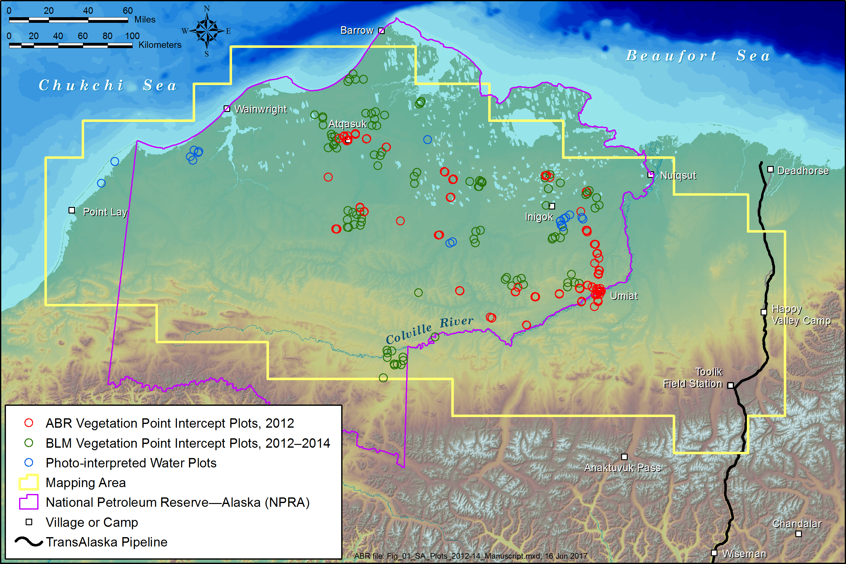
This dataset provides predicted continuous-field cover for tundra plant functional types (PFTs), across ~125,000 km2 of Alaska's North Slope at 30-m resolution. The data cover... -
Arctic Vegetation Plots at Toolik Lake, Alaska, 1989 recent views
This dataset provides environmental, soil, and vegetation data collected in August 1989 from 81 study plots at the Toolik Lake research site, located in the southern Arctic... -
Net Radiation and Albedo from MODIS for Xingu River Basin, Brazil, 2000-2012 NGDA recent views
This dataset provides daily average land surface net radiation (Rnet) as an 8-day time series at approximately 0.5 km resolution for the upper Xingu River Basin in Mato Grosso,... -
FIFE CDROM Vol. 3 Contents: NS001 Thematic Mapper Simulator (TMS) Imagery, 1987-1989 recent views
This data set provides aircraft-based NS001 Thematic Mapper Simulator (TMS) images of the study area associated with The First ISLSCP (International Satellite Land Surface... -
ABoVE: Reflectance Spectra of Tundra Plant Communities across Northern Alaska recent views
This dataset reports full-spectrum (350-2500 nm) reflectance measurements of diverse plant communities at the plot-level and individual plant species at the leaf-level, at... -
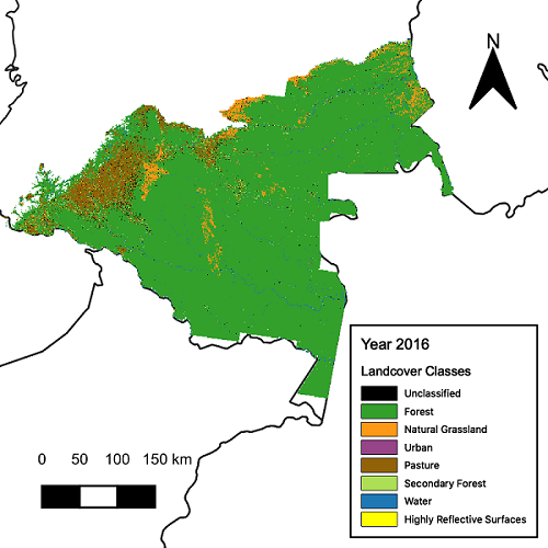
CMS: Landsat-derived Annual Land Cover Maps for the Colombian Amazon, 2001-2016 recent views
This dataset provides annual maps of land cover classes for the Colombian Amazon from 2001 through 2016 that were created by classifying time segments detected by the Continuous... -
ISLSCP II MODIS (Collection 4) Albedo, 2002 NGDA recent views
This International Satellite Land Surface Climatology Project (ISLSCP II) MODerate resolution Image Spectroradiometer (MODIS) dataset, ISLSCP II MODIS (Collection 4) Albedo... -
MODIS-derived Vegetation and Albedo Parameters for Agroecosystem-Climate Modeling NGDA recent views
This dataset provides MODIS-derived leaf area index (LAI), stem area index (SAI), vegetation area fraction, dominant landcover category, and albedo parameters for the... -
Hyperspectral Imagery from AVIRIS-NG for Sites in ID and CA, USA, 2014 and 2015 recent views
This dataset provides surface reflectance measured by the Airborne Visible/Infrared Imaging Spectrometer-Next Generation (AVIRIS-NG) instrument during flights over research... -
BOREAS RSS-02 Extracted Reflectance Factors Derived from ASAS Imagery recent views
Contains calculated bidirectional reflectance factor means derived from extractions of C130-based ASAS measurements made during BOREAS. -
ABoVE: Monthly Hydrological Fluxes for Canada and Alaska, 1979-2018 recent views
This dataset provides modeled estimates of monthly hydrological fluxes at 0.25-degree resolution over Alaska and Canada for the years 1979-2018. The estimates were derived from... -
MODIS-based GPP, PAR, fC4, and SANIRv estimates from SLOPE for CONUS, 2000-2019 NGDA recent views
This dataset contains estimated gross primary productivity (GPP), photosynthetically active radiation (PAR), soil adjusted near infrared reflectance of vegetation (SANIRv), the... -
L2 Daily Solar-Induced Fluorescence (SIF) from MetOp-B GOME-2, 2013-2021 recent views
This dataset provides Level 2 (L2) Solar-Induced Fluorescence (SIF) of chlorophyll estimates derived from the Global Ozone Monitoring Experiment 2 (GOME-2) instrument on the... -
SAFARI 2000 MISR Level 2 Data, Southern Africa, Dry Season 2000 recent views
MISR (Multi-angle Imaging SpectroRadiometer) views the sunlit Earth simultaneously at nine widely spaced and collects global images with high spatial detail in four colors at... -
ABoVE: Lake Growing Season Green Surface Reflectance Trends, AK and Canada, 1984-2019 recent views
This dataset provides an annual time series of Landsat green surface reflectance and the derived annual trend during the growing season (June and July) for 472,890 lakes across... -
BOREAS RSS-07 Regional LAI and FPAR Images From Ten-Day AVHRR-LAC Composites recent views
The BOREAS RSS-07 team collected various data sets to develop and validate an algorithm to allow the retrieval of the spatial distribution of LAI from remotely sensed images.... -
BOREAS NS001 TMS Level-0 Images in BIL Format recent views
The NS001 TMS imagery, along with the other remotely sensed images, was collected in order to provide spatially extensive information over the primary study areas. This... -
SHIFT: HyTES L2 Geolocated Land Surface Temperature and Emissivity, March 23 2022 recent views
This dataset holds Level 2 (L2) data for surface emissivity and land surface temperature (LST) collected by the Hyperspectral Thermal Emission Spectrometer (HyTES) instrument.... -
LBA-ECO CD-34 Hyperion 30-m Surface Reflectance, Amazon Basin: 2002-2005 recent views
This data set contains 20 multispectral surface reflectance images collected by the EO-1 satellite Hyperion sensor at 30-m resolution and covering the entire Amazon Basin for...

Official websites use .gov
A
.gov website belongs to an official government
organization in the United States.
Secure .gov websites use HTTPS
A
lock (
) or https:// means you’ve safely connected to
the .gov website. Share sensitive information only on official,
secure websites.