
-
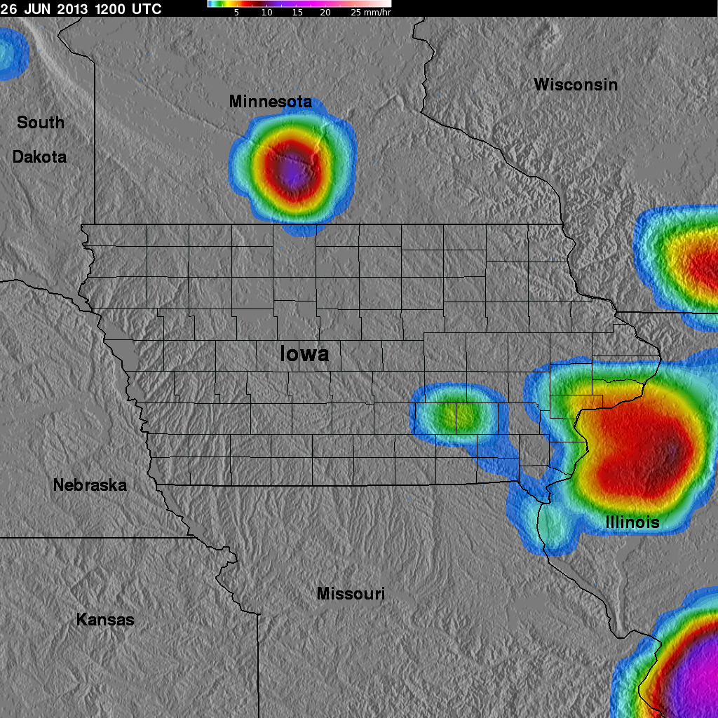
GPM Ground Validation TRMM Multi-satellite Precipitation Analysis (TMPA) IFloodS V7 recent views
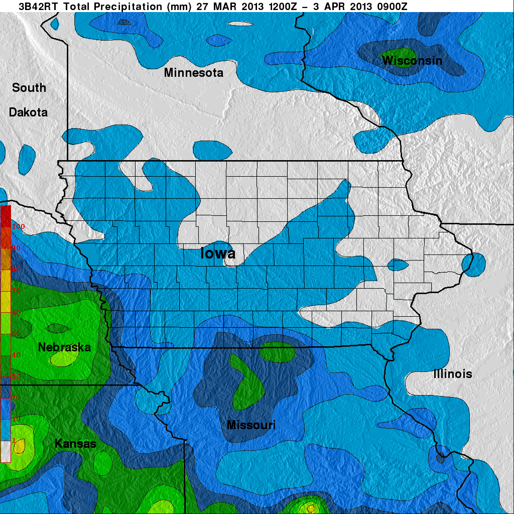
The GPM Ground Validation TRMM Multi-satellite Precipitation Analysis (TMPA) IFloodS dataset is a subset of the TMPA 3B42RT gridded precipitation real-time product selected for... -
GRIP HURRICANE IMAGING RADIOMETER (HIRAD) V1 recent views
The GRIP Hurricane Imaging Radiometer (HIRAD) V1 dataset contains measurements of brightness temperature taken at 4, 5, 6 and 6.6 GHz, as well as MERRA 2 m wind speed data and... -
TCSP HIGH ALTITUDE MMIC SOUNDING RADIOMETER (HAMSR) V1 recent views
The High Altitude MMIC Sounding Radiometer (HAMSR) is a 25-channel microwave atmospheric sounder operating as a cross-track scanner. There are three bands: an 8-channel band... -
GPM Ground Validation Airborne Precipitation Radar 3rd Generation (APR-3) OLYMPEX V2 recent views
The GPM Ground Validation Airborne Precipitation Radar 3rd Generation (APR-3) OLYMPEX V2 dataset was collected from November 12, 2015 to December 19, 2015 during the GPM Ground... -
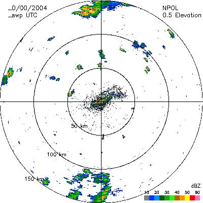
CAMEX-4 NASA PORTABLE S-BAND MULTIPARAMETER WX RESEARCH RADAR V1 recent views
The CAMEX-4 NASA Portable S-Band Multiparameter WX Research Radar dataset was collected by the NASA Portable S-band Multiparameter Weather Research Radar (NPOL), which is a... -
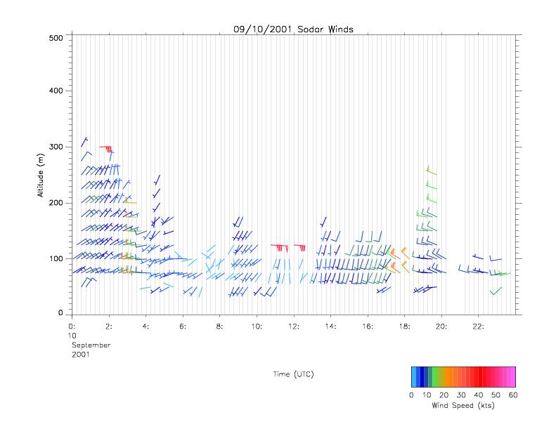
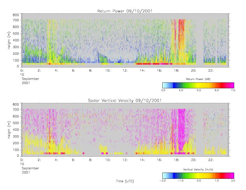
CAMEX-4 MIPS SODAR V1 recent views
The University of Alabama in Huntsville (UAH) Mobile Integrated Profiling System (MIPS) is a mobile atmospheric profiling system. It includes a 915 MHz Doppler profiler, lidar... -
CAMEX-4 CVI CLOUD CONDENSED WATER CONTENT V1 recent views
The CAMEX-4 DC-8 Forward and NADIR Video dataset consists of DVDs which capture the forward and nadir views from the NASA DC-8 aircraft during CAMEX-4 flights. These videos... -
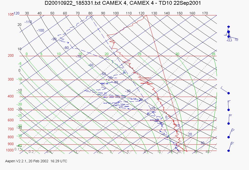
CAMEX-4 ER-2 HIGH ALTITUDE DROPSONDE V1 recent views
The CAMEX-4 ER-2 High Altitude Dropsonde dataset was collected by the ER-2 High Altitude Dropsonde System (EHAD), which used dropwinsondes fitted with Global Positioning System... -
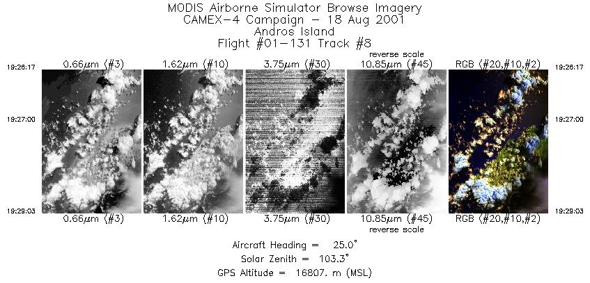
CAMEX-4 ER-2 MODIS AIRBORNE SIMULATOR (MAS) V1 recent views
The MODIS Airborne Simulator (MAS) is an airborne scanning spectrometer that acquires high spatial resolution imagery of cloud and surface features from its vantage point on-... -
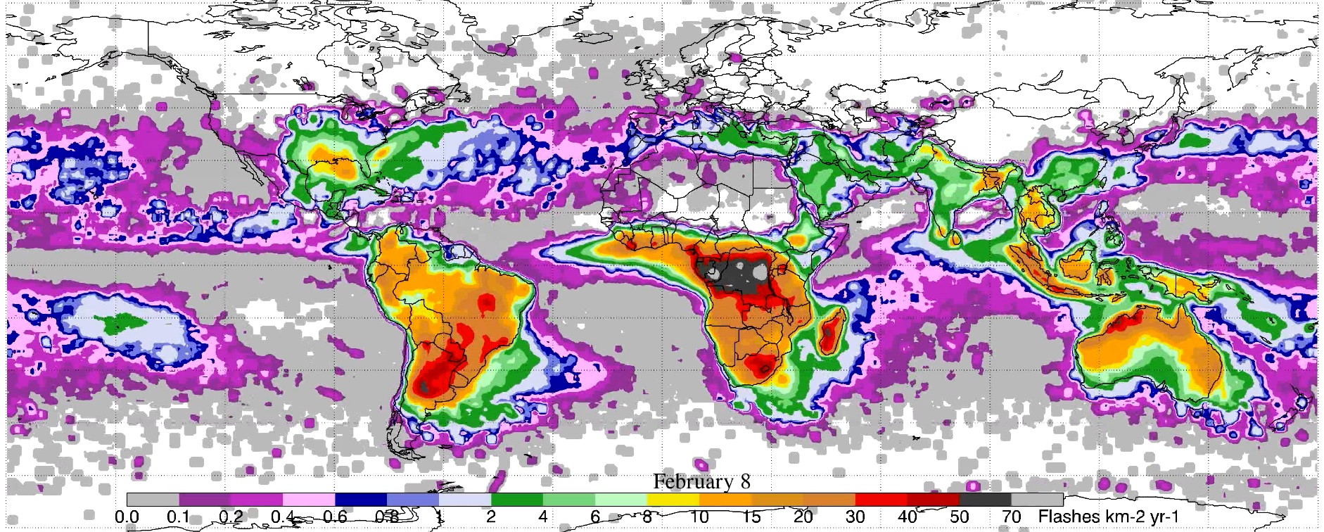
LIS/OTD 0.5 Degree High Resolution Monthly Climatology (HRMC) V2.3.2015 recent views
The LIS/OTD 0.5 Degree High Resolution Monthly Climatology (HRMC) contains a variety of gridded climatologies of total lightning flash rates obtained from two lightning... -
GPM Ground Validation Global Flood Monitoring System (GFMS) Flood Maps IFloodS V1 recent views
The GPM Ground Validation Global Flood Monitoring System (GFMS) Flood Maps IFloodS dataset contains global flood estimates on a 0.25 degree spatial resolution every 3 hours,... -
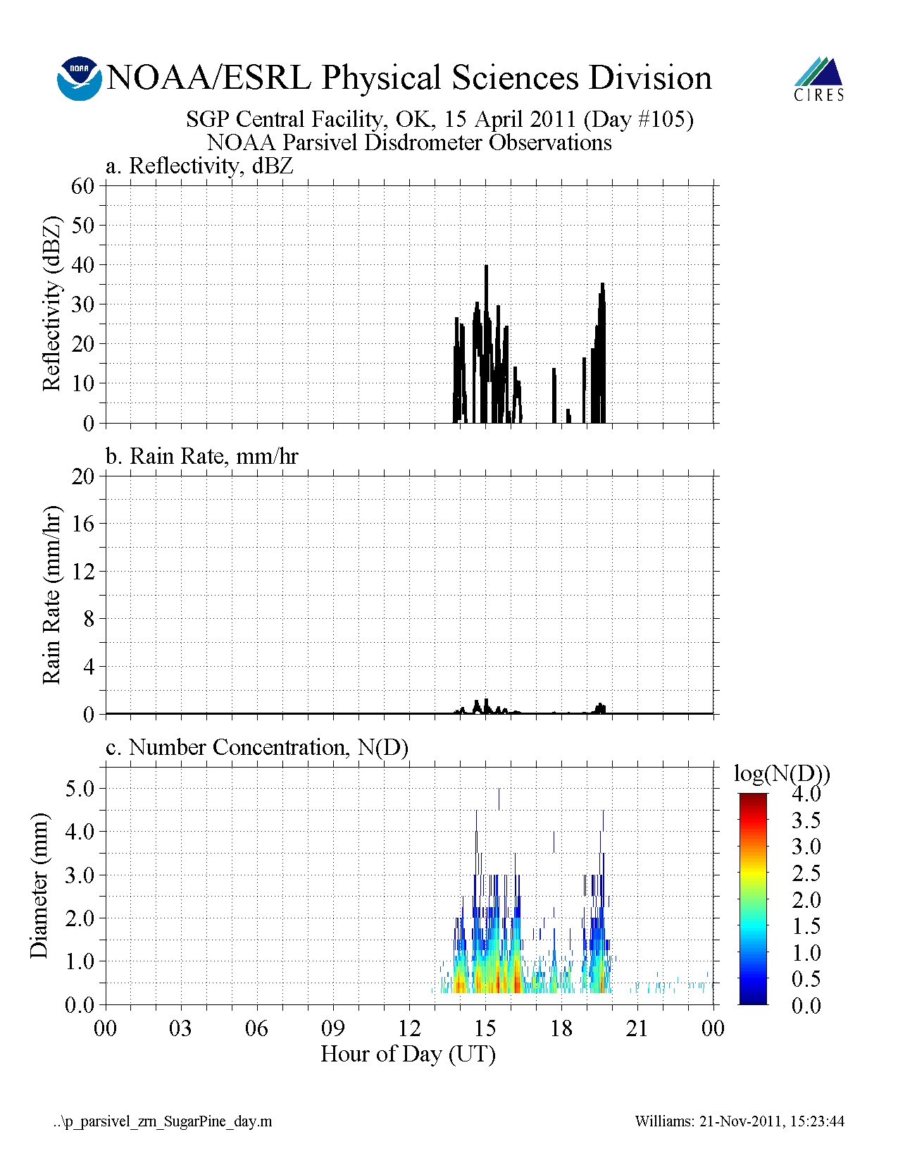
GPM GROUND VALIDATION NOAA PARSIVEL MC3E V1 recent views
The GPM Ground Validation NOAA Parsivel MC3E dataset was collected in central Oklahoma during the Midlatitude Continental Convective Clouds Experiment (MC3E) from April 5, 2011... -
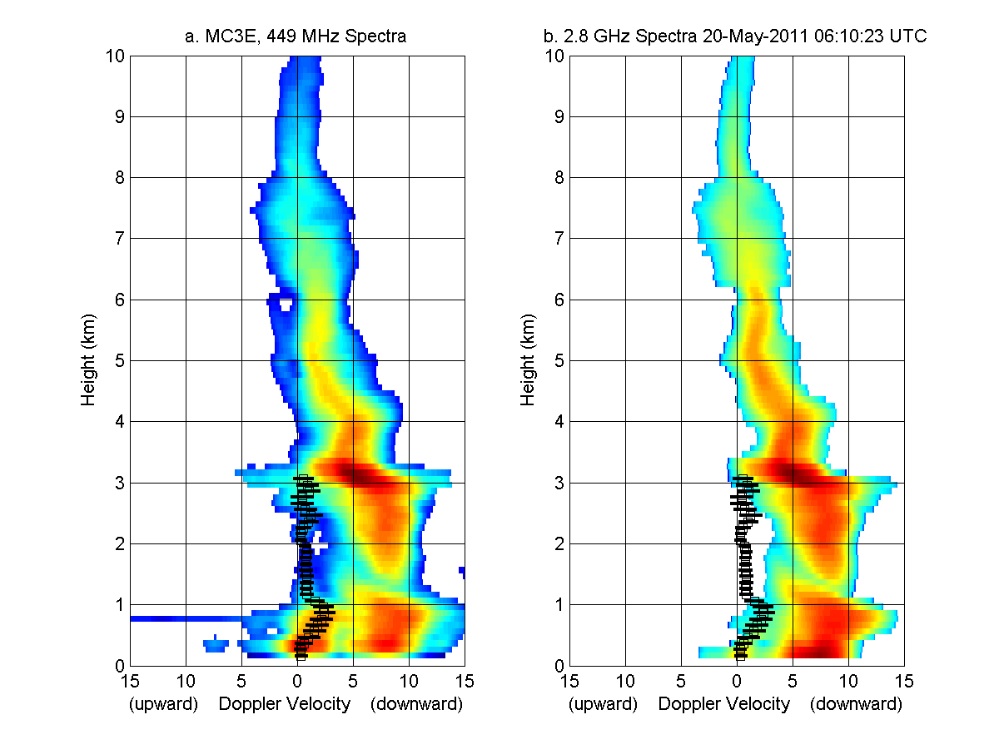
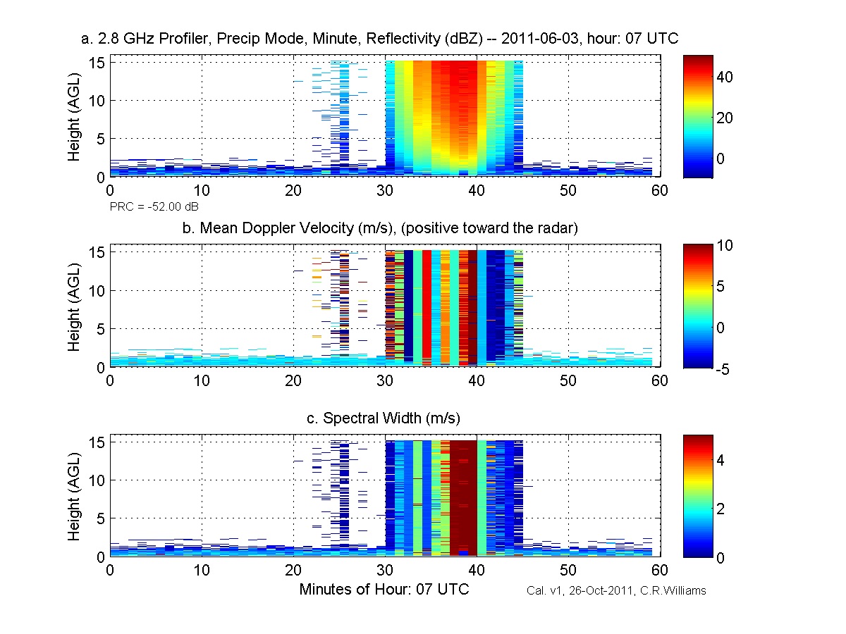
GPM GROUND VALIDATION NOAA UHF 449 PROFILER MC3E V1 recent views
The GPM Ground Validation NOAA UHF 449 Profiler MC3E dataset was collected during the NASA supported Midlatitude Continental Convective Clouds Experiment (MC3E). The overarching... -
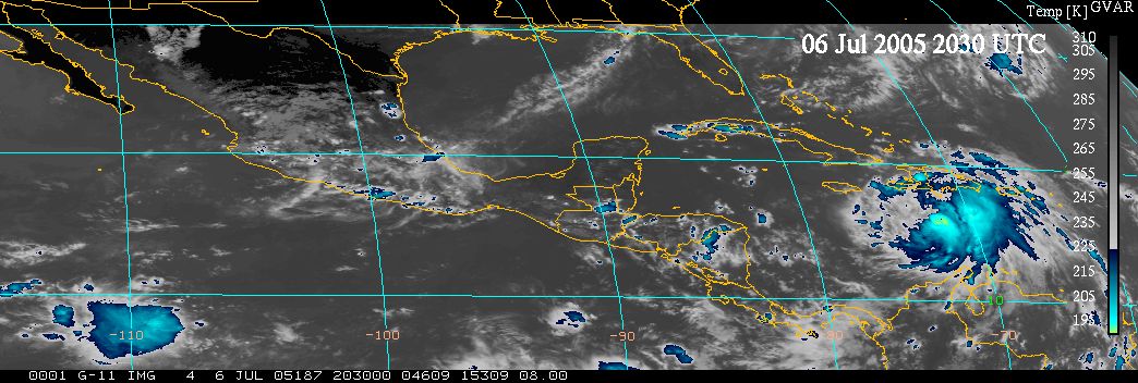
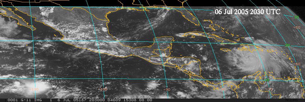
TCSP GOES VISIBLE AND INFRARED IMAGES V1 recent views
The TCSP GOES Visible and Infrared Images dataset was collected in support of the Tropical Cloud Systems and Processes (TCSP) mission, visible and infrared imagery from the... -
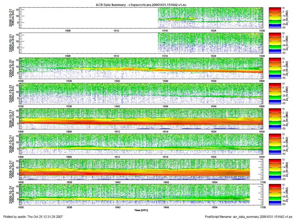
GPM Ground Validation NASA W-band Aircraft Cloud Radar (WACR) C3VP V1 recent views
The GPM Ground Validation NASA W-band Airborne Cloud Radar (WACR) C3VP dataset consists of calibrated co- and cross-polarized radar reflectivity at 94 GHz during the Canadian... -
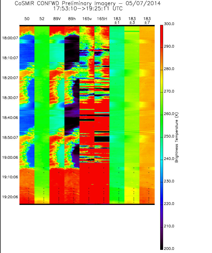
GPM GROUND VALIDATION CONICAL SCANNING MILLIMETER-WAVE IMAGING RADIOMETER (COSMIR) IPHEx V1 recent views
The GPM Ground Validation Conical Scanning Millimeter-wave Imaging Radiometer (CoSMIR) IPHEx dataset consists of brightness temperatures from 9 channels as measured by the... -
GPM GROUND VALIDATION NOAA S-BAND PROFILER MINUTE DATA MC3E V1 recent views
The GPM Ground Validation NOAA S-Band Profiler Minute Data MC3E dataset was gathered during the Midlatitude Continental Convective Clouds Experiment (MC3E) in Oklahoma from... -
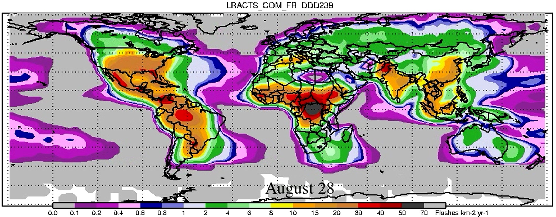
LIS/OTD 2.5 Degree Low Resolution Annual Climatology Time Series (LRACTS) V2.3.2015 recent views
The LIS/OTD 2.5 Degree Low Resolution Annual Climatology Time Series (LRACTS) consists of gridded climatologies of total lightning flash rates seen by the spaceborne Optical... -
High Altitude MMIC Sounding Radiometer (HAMSR) CPEX-AW V1 recent views
The High Altitude MMIC Sounding Radiometer (HAMSR) CPEX-AW dataset includes measurements gathered by the HAMSR instrument during the Convective Processes Experiment – Aerosols... -
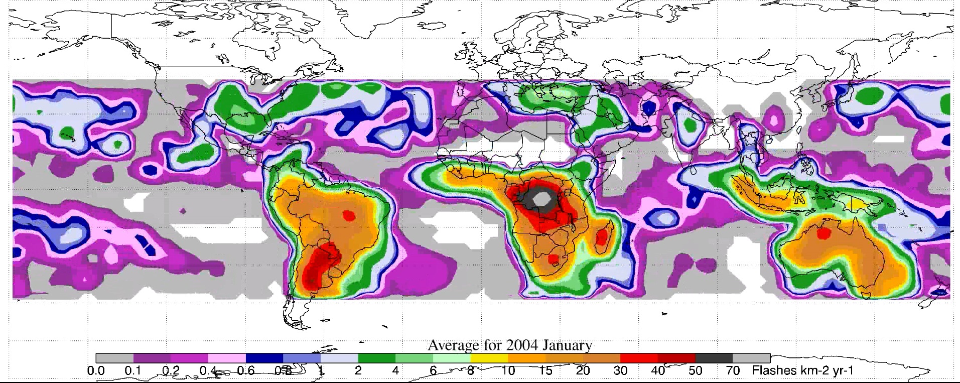
LIS/OTD 2.5 Degree Low Resolution Monthly Climatology Time Series (LRMTS) V2.3.2015 recent views
The LIS/OTD 2.5 Degree Low Resolution Monthly Climatology Time Series (LRMTS) contains a variety of gridded climatologies of total lightning flash rates obtained from two...

Official websites use .gov
A
.gov website belongs to an official government
organization in the United States.
Secure .gov websites use HTTPS
A
lock (
) or https:// means you’ve safely connected to
the .gov website. Share sensitive information only on official,
secure websites.