
-
VEMAP 2: Annual Ecosystem Model Responses to U.S. Climate Change, 1994-2100 recent views
Phase 2 of the VEMAP Project developed historical (1895-1993) gridded data sets of climate (temperature, precipitation, solar radiation, humidity, and wind speed) and projected... -
Global Land Cover Characterization Program recent views
The Global Land Cover Characterization Project was established to meet science data requirements identified by the International Geosphere and Biosphere Programme (IGBP), and... -
Global Vegetation Greenness (NDVI) from AVHRR GIMMS-3G+, 1981-2022 recent views
This dataset holds the Global Inventory Modeling and Mapping Studies-3rd Generation V1.2 (GIMMS-3G+) data for the Normalized Difference Vegetation Index (NDVI). NDVI was based... -
NACP North American Forest Dynamics Project: Forest Disturbance and Regrowth Data recent views
This data set provides the results of time-series analyses of Landsat imagery for 55 selected forested sites across the conterminous U.S.A. The output is a pair of disturbance... -
Global Land Cover Mapping and Estimation Yearly 30 m V001 recent views
NASA’s Making Earth System Data Records for Use in Research Environments (MEaSUREs) Global Land Cover Mapping and Estimation (GLanCE) annual 30 meter (m) Version 1 data product... -
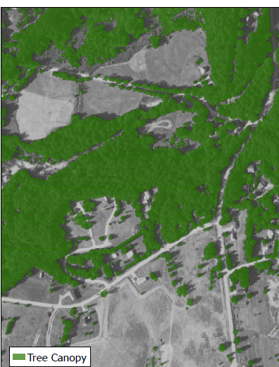
USGS Digital Orthophoto Quadrangles recent views
A Digital Orthophoto Quadrangle (DOQ) is a computer-generated image of an aerial photograph in which the image displacement caused by terrain relief and camera tilt has been... -
Forest Inventory and Biophysical Measurements, Brazilian Amazon, 2009-2018 recent views
This dataset provides the complete catalog of forest inventory and biophysical measurements collected over selected forest research sites across the Amazon rainforest in Brazil... -
MERRA-2 tavg1_2d_lnd_Nx: 2d,1-Hourly,Time-Averaged,Single-Level,Assimilation,Land Surface Diagnostics 0.625 x 0.5 degree V5.12.4 (M2T1NXLND) at GES DISC recent views
M2T1NXLND (or tavg1_2d_lnd_Nx) is an hourly time-averaged 2-dimensional data collection in Modern-Era Retrospective analysis for Research and Applications version 2 (MERRA-2).... -
TMI/TRMM surface soil moisture (LPRM) L2 V001 (LPRM_TMI_SOILM2) at GES DISC recent views
TMI/TRMM surface soil moisture (LPRM) L2 V001 is a Level 2 (swath) data set. Its land surface parameters, surface soil moisture, land surface (skin) temperature, and vegetation... -
VIIRS/NPP Gap-Filled Lunar BRDF-Adjusted Nighttime Lights Daily L3 Global 500m Linear Lat Lon Grid recent views
The second of the two VIIRS DNB-based datasets is a daily moonlight- and atmosphere-corrected Nighttime Lights (NTL) product called VIIRS/NPP Gap-Filled Lunar BRDF-Adjusted... -
MODIS/Terra Vegetation Indices 16-Day L3 Global 250m SIN Grid V061 NGDA recent views
The Terra Moderate Resolution Imaging Spectroradiometer (MODIS) Vegetation Indices (MOD13Q1) Version 6.1 data are generated every 16 days at 250 meter (m) spatial resolution as... -
Arctic Vegetation Plots at Atqasuk, Alaska, 1975, 2000, and 2010 recent views
This data set provides vegetation species abundance data collected in 1975 from 60 sites on the Arctic Coastal Plain near Atqasuk, Alaska, as well as environmental and species... -
NACP Integrated Wildland and Cropland 30-m Fuel Characteristics Map, U.S.A., 2010 recent views
The data set provides a 30-m comprehensive fuelbed characteristics map for both the wildland and cropland areas of the conterminous United States (CONUS) for 2010. This... -
Global Fire Emissions Database, Version 4.1 (GFEDv4) NGDA recent views
This dataset provides global estimates of monthly burned area, monthly emissions and fractional contributions of different fire types, daily or 3-hourly fields to scale the... -
MISR L2 Surface Product subset for the SAMUM region V002 recent views
This Level 2 Land Surface product contains information on land directional reflectance properties,albedos(spectral & PAR integrated),FPAR,asssociated radiation parameters...

Official websites use .gov
A
.gov website belongs to an official government
organization in the United States.
Secure .gov websites use HTTPS
A
lock (
) or https:// means you’ve safely connected to
the .gov website. Share sensitive information only on official,
secure websites.