
-
Federal
SWOT Level 2 KaRIn Low Rate Sea Surface Height Data Product - Basic, Version C
National Aeronautics and Space Administration —
The SWOT Level 2 KaRIn Low Rate Sea Surface Height Basic Data Product from the Surface Water Ocean Topography (SWOT) mission provides global sea surface height and... -
Federal
Jason-3 GPS based orbit and SSHA OGDR
National Aeronautics and Space Administration —
This is a near real time dataset that provides a GPS based orbit and Sea Surface Height Anomalies (SSHA) from that orbit. It is similar to the Jason-3 Operation... -
Federal
SWOT Level 2 Nadir Altimeter Geophysical Data Record with Waveforms - GDR Version D
National Aeronautics and Space Administration —
The SWOT Level 2 Nadir Altimeter Geophysical Data Record (GDR) with Waveforms dataset produced by the Surface Water and Ocean Topography (SWOT) mission provides sea... -
Federal
Metop-A ASCAT Inter-Calibrated ESDR Level 2 Observed and Modeled Spatial Derivatives of Surface Wind and Wind Stress Version 1.0
National Aeronautics and Space Administration —
This dataset contains the curl and divergence of ocean surface equivalent neutral wind and wind stress, derived from satellite-based scatterometer observations (the... -
Federal
SWOT Level 2 Nadir Altimeter Interim Geophysical Data Record with Waveforms - GDR Version D
National Aeronautics and Space Administration —
Same as L2_NALT_GDR, using preliminary values for some auxiliary data. Uses Medium-accuracy (preliminary) Orbit Ephemeris (MOE). Available with latency of This... -
Federal
SWOT Level 2 Nadir Altimeter Geophysical Data Record with Waveforms - SSHA, Version 1.0
National Aeronautics and Space Administration —
Nadir Altimeter Geophysical Data Record (GDR) products similar to those from ongoing nadir altimeter missions such as Jason-3. Provide sea surface height, significant... -
Federal
SCATSAT-1 ESDR Level 2 Ancillary Ocean Surface Fields Version 1.1
National Aeronautics and Space Administration —
This dataset contains the first science quality release (post-provisional after v1.0) of the MEaSUREs-funded Earth Science Data Record (ESDR) of ancillary data... -
Federal
QuikSCAT ESDR Level 2 Ancillary Ocean Surface Fields Version 1.1
National Aeronautics and Space Administration —
This dataset contains model output interpolated in space and time to the ESDR product from the scatterometer on the QuikSCAT satellite, representing the first science... -
Federal
GRACE-FO Level-1B Release version 4.0 from JPL in ASCII
National Aeronautics and Space Administration —
FOR EXPERT USE ONLY. The GRACE-FO Level-1B data provide all necessary inputs to derive monthly time variations in the Earth gravity field. Level-1B data are also used... -
Federal
SWOT Level 2 KaRIn Low Rate Sea Surface Height Data Product - Basic, Version D
National Aeronautics and Space Administration —
The SWOT Level 2 KaRIn Low Rate Sea Surface Height Basic Data Product from the Surface Water Ocean Topography (SWOT) mission provides global sea surface height and... -
Federal
SWOT Level 2 Nadir Altimeter Operational Geophysical Data Record with Waveforms - GDR Version D
National Aeronautics and Space Administration —
Same as L2_NALT_GDR using predicted values for some auxiliary data, and does not have GIM ionosphere model values. Uses the onboard DORIS orbit ephemeris. Available... -
Federal
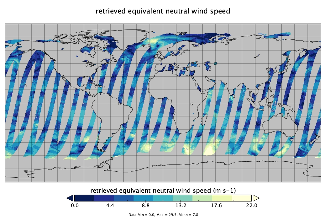
MetOp-A ASCAT Scatterometer Inter-Calibrated ESDR Level 2 Ocean Surface Equivalent Neutral Wind Vectors and Wind Stress Vectors Version 1.1
National Aeronautics and Space Administration —
This dataset contains ocean surface wind vectors (equivalent neutral and true 10m) and wind stress vectors derived from satellite-based scatterometer observations... -
Federal
MetOp-A ASCAT ESDR Level 2 Ancillary Ocean Surface Fields Version 1.1
National Aeronautics and Space Administration —
This dataset contains model output interpolated in space and time to observations from the MetOp-A ASCAT (ASCAT-A) instrument (a satellite-based scatterometer),... -
Federal
MetOp-B ASCAT Scatterometer Inter-Calibrated ESDR Level 3 Ocean Surface Equivalent Neutral Wind Vectors and Wind Stress Version 1.0
National Aeronautics and Space Administration —
This dataset contains gridded ocean surface wind vectors (equivalent neutral and true 10m) and wind stress vectors derived from satellite-based scatterometer... -
Federal
MetOp-A ASCAT Scatterometer Inter-Calibrated ESDR Level 3 Ocean Surface Equivalent Neutral Wind Vectors and Wind Stress Version 1.0
National Aeronautics and Space Administration —
This dataset contains gridded ocean surface wind vectors (equivalent neutral and true 10m) and wind stress vectors derived from satellite-based scatterometer... -
Federal
Metop-B ASCAT Inter-Calibrated ESDR Level 2 Observed and Modeled Spatial Derivatives of Surface Wind and Wind Stress Version 1.0
National Aeronautics and Space Administration —
This dataset contains the curl and divergence of ocean surface equivalent neutral wind and wind stress, derived from satellite-based scatterometer observations (the... -
Federal
MetOp-B ASCAT ESDR Level 2 Ancillary Ocean Surface Fields Version 1.1
National Aeronautics and Space Administration —
This dataset contains model output interpolated in space and time to observations from the MetOp-B ASCAT (ASCAT-B) instrument (a satellite-based scatterometer),... -
Federal
MetOp-B ASCAT Scatterometer Inter-Calibrated ESDR Level 2 Ocean Surface Equivalent Neutral Wind Vectors and Wind Stress Vectors Version 1.1
National Aeronautics and Space Administration —
This dataset contains ocean surface wind vectors (equivalent neutral and true 10m) and wind stress vectors derived from satellite-based scatterometer observations... -
Federal
SCATSAT-1 Scatterometer Inter-Calibrated ESDR Level 2 Ocean Surface Equivalent Neutral Wind Vectors and Wind Stress Vectors Version 1.1
National Aeronautics and Space Administration —
This dataset contains ocean surface wind vectors (equivalent neutral and true 10m) and wind stress vectors derived from satellite-based scatterometer observations...

Official websites use .gov
A
.gov website belongs to an official government
organization in the United States.
Secure .gov websites use HTTPS
A
lock (
) or https:// means you’ve safely connected to
the .gov website. Share sensitive information only on official,
secure websites.