

SWOT Level 2 Nadir Altimeter Geophysical Data Record with Waveforms - GDR Version D
Access & Use Information
Public: This dataset is intended for public access and use.
License: No license information was provided. If this work was prepared by an officer or employee of the United States government as part of that person's official duties it is considered a U.S. Government Work.
Downloads & Resources
-
Data Information (PDF)PDF
D-109532_SWOT_UserHandbook_RevA_20250311_sig-final.pdf
-
Data Information (Unknown Format)BIN
-
Data Information (Unknown Format)BIN
-
Data Information (Unknown Format)BIN
-
Data Information (Unknown Format)BIN
-
Data Information (HTML)HTML
swot.html
-
Data Information (Unknown Format)BIN
-
Data Information (Unknown Format)BIN
-
Data Information (Unknown Format)BIN
-
Data Information (Unknown Format)BIN
-
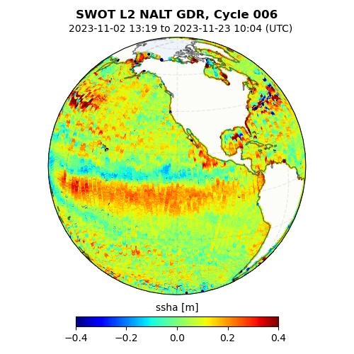
Data Information (JPEG)JPEG
SWOT_L2_NALT_GDR_D.jpg
-
Data Information (PDF)PDF
SALP-ST-M-EA-17043-CN_0107_NAlt.pdf
-
Landing PageLanding Page
Dates
| Metadata Created Date | May 13, 2025 |
|---|---|
| Metadata Updated Date | January 15, 2026 |
Metadata Source
- Data.json Data.json Metadata
Harvested from NASA Data.json
Additional Metadata
| Resource Type | Dataset |
|---|---|
| Metadata Created Date | May 13, 2025 |
| Metadata Updated Date | January 15, 2026 |
| Publisher | NASA/JPL;NASA/JPL/PODAAC |
| Maintainer | |
| Identifier | 10.5067/SWOT-NALT-GDR-D |
| Data Last Modified | 2026-01-13 |
| Category | Earth Science |
| Public Access Level | public |
| Bureau Code | 026:00 |
| Metadata Context | https://project-open-data.cio.gov/v1.1/schema/catalog.jsonld |
| Schema Version | https://project-open-data.cio.gov/v1.1/schema |
| Catalog Describedby | https://project-open-data.cio.gov/v1.1/schema/catalog.json |
| Harvest Object Id | 43621504-b322-4d2a-8438-2e3938c9934c |
| Harvest Source Id | 58f92550-7a01-4f00-b1b2-8dc953bd598f |
| Harvest Source Title | NASA Data.json |
| Homepage URL | https://archive.podaac.earthdata.nasa.gov/podaac-ops-cumulus-docs/web-misc/swot_mission_docs/D-109532_SWOT_UserHandbook_RevA_20250311_sig-final.pdf |
| Old Spatial | "CARTESIAN",{"WestBoundingCoordinate":-180.0,"NorthBoundingCoordinate":77.6,"EastBoundingCoordinate":180.0,"SouthBoundingCoordinate":-77.6} |
| Program Code | 026:000 |
| Source Datajson Identifier | True |
| Source Hash | c509c22f9e23b8c0a38b96285f8a7335a857d61d3cf0e605cc79522778b26ac8 |
| Source Schema Version | 1.1 |
| Spatial | |
| Temporal | 2022-12-16/2022-12-16 |
Didn't find what you're looking for? Suggest a dataset here.