

co_5_0_5_m_geo_industries.png
URL: https://gdr.openei.org/files/622/co_5_0_5_m_geo_industries.png
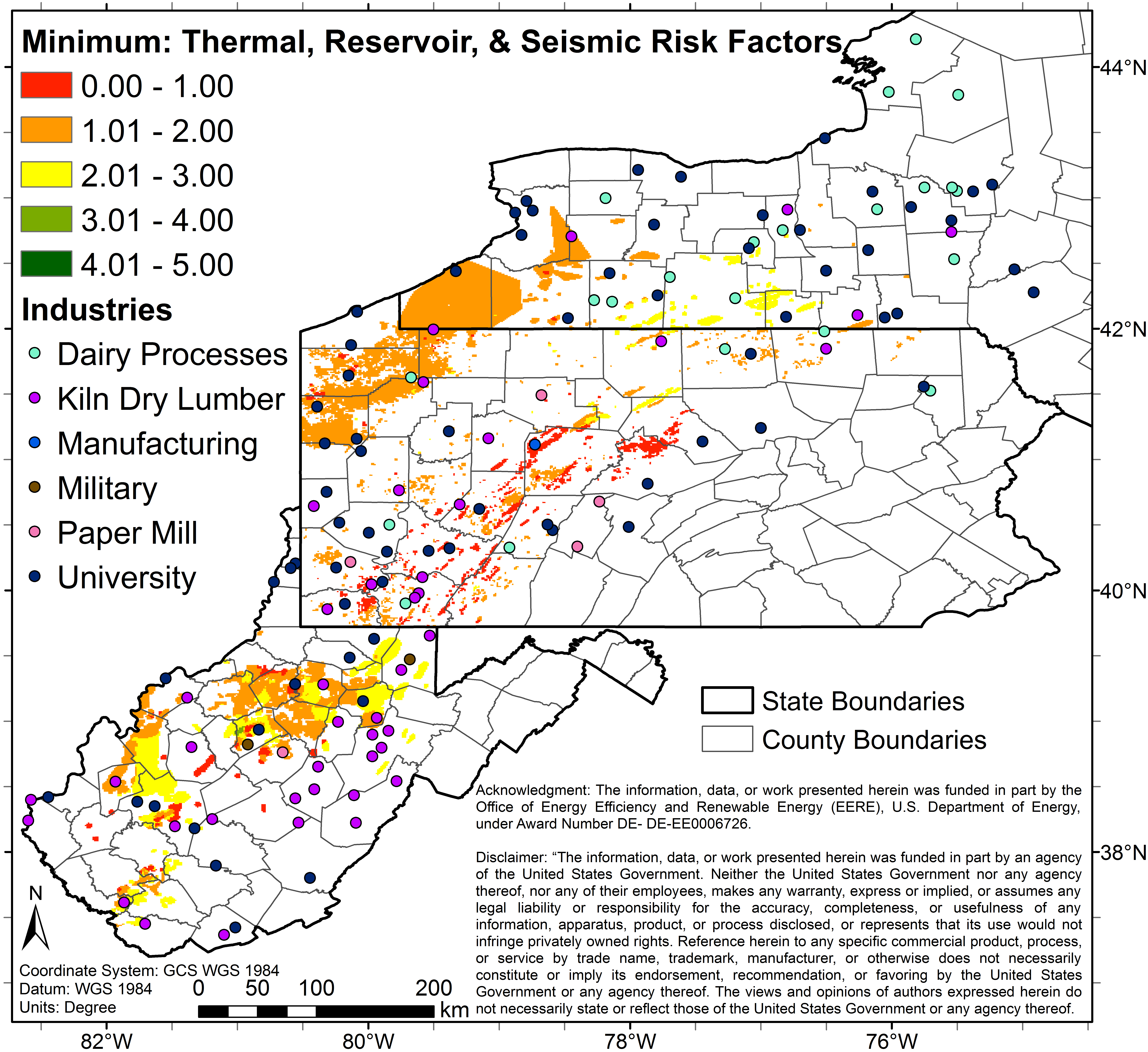
5 color map (Image File) of study area depicting predicted combined risks (thermal, reservoir, seismic) using a minimum combination method with prospective sites overlaid.
About this Resource
| Last updated | unknown |
|---|---|
| Created | unknown |
| Name | co_5_0_5_m_geo_industries.png |
| Format | PNG Image File |
| License | Creative Commons Attribution |
| Created | 8 months ago |
| Media type | image/png |
| has views | True |
| id | 4934dba3-5504-4e82-8747-6c43a57f6d6d |
| metadata modified | 8 months ago |
| package id | ceeee8a9-ee82-4393-ba02-290ffa753718 |
| position | 50 |
| state | active |
| tracking summary | {'total': 0, 'recent': 0} |