NRT AMSR2 Unified L3 Daily 25 km Brightness Temperature & Sea Ice Concentration Polar Grids V4
Access & Use Information
Downloads & Resources
-
Google Scholar search resultsHTML
Search results for publications that cite this dataset by its DOI.
-
Download this datasetHTML
Files may be downloaded directly to your workstation from this link
-
Download this dataset through LANCEHTML
Files may be downloaded directly to your workstation from this link
-
Get a related visualization through WORLDVIEWHTML
Interactively browse imagery in EOSDIS Worldview
-
View this dataset's data recipesHTML
Data Format Conversion Recipes
-
The dataset's project home pageHTML
The home page for the project or program which sponsored the dataset
-
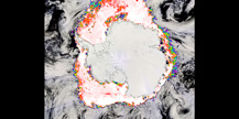
Get a related visualizationJPEG
Sample browse image
-
View documentation related to this datasetHTML
The guide document contains detailed information about the dataset
-
View documentation related to this datasetHTML
Instructions for citing GHRC data
-
Landing PageLanding Page
Dates
| Metadata Created Date | November 12, 2020 |
|---|---|
| Metadata Updated Date | December 6, 2023 |
Metadata Source
- Data.json Data.json Metadata
Harvested from NASA Data.json
Graphic Preview

Additional Metadata
| Resource Type | Dataset |
|---|---|
| Metadata Created Date | November 12, 2020 |
| Metadata Updated Date | December 6, 2023 |
| Publisher | Not provided |
| Maintainer | |
| Identifier | C1886605830-LANCEAMSR2 |
| Data First Published | 2020-06-30 |
| Language | en-US |
| Data Last Modified | 2020-06-30 |
| Category | LANCE, geospatial |
| Public Access Level | public |
| Bureau Code | 026:00 |
| Metadata Context | https://project-open-data.cio.gov/v1.1/schema/catalog.jsonld |
| Metadata Catalog ID | https://data.nasa.gov/data.json |
| Schema Version | https://project-open-data.cio.gov/v1.1/schema |
| Catalog Describedby | https://project-open-data.cio.gov/v1.1/schema/catalog.json |
| Citation | Meier, Walt, Josefino C Comiso, and Thorsten Markus.2019. NRT AMSR2 Unified L3 Daily 25 km Brightness Temperature & Sea Ice Concentration Polar Grids indicate subset used. Dataset available online from the NASA Global Hydrology Resource Center DAAC, Huntsville, Alabama, U.S.A. DOI: http://dx.doi.org/10.5067/AMSRU/AU_SI25_NRT_R04 |
| Graphic Preview Description | Sample browse image |
| Graphic Preview File | https://ghrc.nsstc.nasa.gov/pub/browse_sample/lance/AMSR_U2_SI25.jpg |
| Harvest Object Id | e77b67b1-20f5-4d1f-ae06-97693ad52a85 |
| Harvest Source Id | 58f92550-7a01-4f00-b1b2-8dc953bd598f |
| Harvest Source Title | NASA Data.json |
| Homepage URL | https://doi.org/10.5067/AMSRU/AU_SI25_NRT_R04 |
| Metadata Type | geospatial |
| Old Spatial | -180.0 -89.0 180.0 89.0 |
| Program Code | 026:001 |
| Source Datajson Identifier | True |
| Source Hash | 9c6f3ee64f351ccac2cc597bee7180f45b20c7fe15d9aaa91d732cf203f84cb9 |
| Source Schema Version | 1.1 |
| Spatial | |
| Temporal | 2020-06-29T08:00:00Z/2022-01-17T00:00:00Z |
Didn't find what you're looking for? Suggest a dataset here.

