
-
Federal
CORONA Satellite Photography
National Aeronautics and Space Administration —
On February 24, 1995, President Clinton signed an Executive Order, directing the declassification of intelligence imagery acquired by the first generation of United... -
Federal
Landsat 8
National Aeronautics and Space Administration —
The Operational Land Imager (OLI) and Thermal Infrared Sensor (TIRS) are onboard the Landsat 8 satellite, have acquired images of the Earth since February 2013. The... -
Federal
USGS Digital Orthophoto Quadrangles
National Aeronautics and Space Administration —
A Digital Orthophoto Quadrangle (DOQ) is a computer-generated image of an aerial photograph in which the image displacement caused by terrain relief and camera tilt... -
Federal
Shuttle Radar Topography Mission DTED Level 1 (3-arc second) Data (DTED-1)
National Aeronautics and Space Administration —
The Shuttle Radar Topography Mission (SRTM) successfully collected Interferometric Synthetic Aperture Radar (IFSAR) data over 80 percent of the landmass of the Earth... -
Federal
CORONA Satellite Photographs from the U.S. Geological Survey
National Aeronautics and Space Administration —
The first generation of U.S. photo intelligence satellites collected more than 860,000 images of the Earth’s surface between 1960 and 1972. The classified military... -
Federal
Shuttle Radar Topography Mission (SRTM) Images
National Aeronautics and Space Administration —
Culminating more than four years of processing data, NASA and the National Geospatial-Intelligence Agency (NGA) have completed Earth's most extensive global... -
Federal
Shuttle Radar Topography Mission (SRTM) Version 2
National Aeronautics and Space Administration —
NASA has released version 2 of the Shuttle Radar Topography Mission digital topographic data (also known as the "finished" version). Version 2 is the result of a... -
Federal
Shuttle Radar Topography Mission 1-arc second Global
National Aeronautics and Space Administration —
The Shuttle Radar Topography Mission (SRTM) was flown aboard the space shuttle Endeavour February 11-22, 2000. The National Aeronautics and Space Administration... -
Federal
GPM Ground Validation Doppler on Wheels (DOW) OLYMPEX V2
National Aeronautics and Space Administration —
The GPM Ground Validation Doppler on Wheels (DOW) OLYMPEX V2 dataset was obtained by a dual-polarization and dual-frequency X-band mobile radar operated by the Center... -
Federal
ADVANCED MICROWAVE SOUNDING UNIT-A (AMSU-A) SWATH FROM NOAA-15 V1
National Aeronautics and Space Administration —
AMSU-A, the Advanced Microwave Sounding Unit, is a 15-channel passive microwave radiometer used to profile atmospheric temperature and moisture from the earth's... -
Federal
SnowEx23 Bonanza Creek Experimental Forest Terrestrial Lidar Scans Raw V001
National Aeronautics and Space Administration —
This data set contains unprocessed point cloud data created from terrestrial lidar scans (TLS) collected during the SnowEx 2023 campaign from the Bonanza Creek... -
Federal
High-Resolution QuickBird Imagery and Related GIS Layers for Barrow, Alaska, USA, Version 1
National Aeronautics and Space Administration —
This data set contains high-resolution QuickBird imagery and geospatial data for the entire Barrow QuickBird image area (156.15° W - 157.07° W, 71.15° N - 71.41° N)... -
Federal
IceBridge UAF L1B HF Geolocated Radar Echo Strength Profiles V001
National Aeronautics and Space Administration —
This data set contains radar echograms acquired by the University of Alaska Fairbanks High-Frequency Radar Sounder over select glaciers in Alaska. The data are... -
Federal
GOES-R PLT Cloud Physics LiDAR (CPL) V1
National Aeronautics and Space Administration —
The GOES-R PLT Cloud Physics Lidar (CPL) dataset consists of backscatter coefficient, lidar depolarization ratio, layer top/base height, layer type, particulate... -
Federal
LRIR/Nimbus-6 Level 2 Inverted Profiles of Temperature and Ozone V001 (LRIRN6L2IPAT) at GES DISC
National Aeronautics and Space Administration —
LRIRN6L2IPAT is the Nimbus-6 Limb Radiance Inversion Radiometer (LRIR) Level 2 Inverted Profiles of Temperature and Ozone data product. The product contains daily... -
Federal
SMAP L3 Radiometer Global Daily 36 km EASE-Grid Soil Moisture V009
National Aeronautics and Space Administration —
This Level-3 (L3) soil moisture product provides a composite of daily estimates of global land surface conditions retrieved by the Soil Moisture Active Passive (SMAP)... -
Federal
TRMM Attitude and VIRS Packets and Header Record L1A V7 (TRMM_1A01) at GES DISC
National Aeronautics and Space Administration —
The Level-1A Product file, "1A01", is a concatenation of Header record, Spacecraft Attitude packets, VIRS Housekeeping Data packets, VIRS Science Data packets, QACs,... -
Federal
GPM GROUND VALIDATION DUAL-FREQUENCY DUAL-POLARIZED DOPPLER RADAR (D3R) GCPEX V1
National Aeronautics and Space Administration —
The GPM Ground Validation Dual-frequency Dual-polarized Doppler Radar (D3R) GCPEx and IFloodS data sets contain radar reflectivity and doppler velocity measurements.... -
Federal
GPM Ground Validation NOAA X-band Polarimetric Radar (NOXP) IPHEx V1
National Aeronautics and Space Administration —
The GPM Ground Validation NOAA X-band dual-Polarimetric radar (NOXP) IPHEx dataset consists of differential reflectivity, differential phase shift, co-polar cross... -
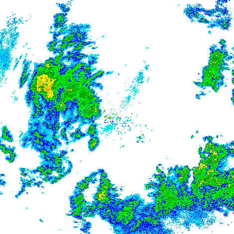
Federal
GPM GROUND VALIDATION NEXRAD LEVEL II KDVN IFLOODS V1
National Aeronautics and Space Administration —
The GPM Ground Validation Next Generation Weather Radar (NEXRAD) Level II IFloodS datasets were collected from four sites (see Table 1) from March 29, 2013 to June...

Official websites use .gov
A
.gov website belongs to an official government
organization in the United States.
Secure .gov websites use HTTPS
A
lock (
) or https:// means you’ve safely connected to
the .gov website. Share sensitive information only on official,
secure websites.