

CAMEX-3 ER-2 Millimeter-wave Imaging Radiometer (MIR) V1
Access & Use Information
Public: This dataset is intended for public access and use.
License: No license information was provided. If this work was prepared by an officer or employee of the United States government as part of that person's official duties it is considered a U.S. Government Work.
Downloads & Resources
-
Google Scholar search resultsHTML
Search results for publications that cite this dataset by its DOI.
-
Download this datasetHTML
Files may be downloaded directly to your workstation from this link
-
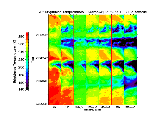
Get a related visualizationGIF
Sample Browse Image
-
View information related to this datasetHTML
Millimeter Imaging Radiometer (MIR)
-
View documentation related to this datasetPDF
The guide document contains detailed information about the dataset
-
View this dataset's publicationsHTML
An Airborne Millimeter-Wave Imaging Radiometer for Cloud, Precipitation, and...
-
View this dataset's publicationsHTML
Overview of the Convection and Moisture Experiment (CAMEX)
-
The dataset's project home pageHTML
CAMEX-3 Field Campaign Project Homepage
-
View documentation related to this datasetHTML
Instructions for citing GHRC data
-
Landing PageLanding Page
Dates
| Metadata Created Date | December 1, 2022 |
|---|---|
| Metadata Updated Date | April 11, 2025 |
Metadata Source
- Data.json Data.json Metadata
Harvested from NASA Data.json
Additional Metadata
| Resource Type | Dataset |
|---|---|
| Metadata Created Date | December 1, 2022 |
| Metadata Updated Date | April 11, 2025 |
| Publisher | NASA/MSFC/GHRC |
| Maintainer | |
| Identifier | C1979112308-GHRC_DAAC |
| Data First Published | 2020-02-27 |
| Language | en-US |
| Data Last Modified | 2025-03-31 |
| Category | CAMEX-3, geospatial |
| Public Access Level | public |
| Bureau Code | 026:00 |
| Metadata Context | https://project-open-data.cio.gov/v1.1/schema/catalog.jsonld |
| Schema Version | https://project-open-data.cio.gov/v1.1/schema |
| Catalog Describedby | https://project-open-data.cio.gov/v1.1/schema/catalog.json |
| Harvest Object Id | 16d5f404-5edb-4f32-be8f-dfd22967d861 |
| Harvest Source Id | 58f92550-7a01-4f00-b1b2-8dc953bd598f |
| Harvest Source Title | NASA Data.json |
| Homepage URL | https://doi.org/10.5067/CAMEX-3/MIR/DATA101 |
| Metadata Type | geospatial |
| Old Spatial | -85.5 23.12 -70.053 33.937 |
| Program Code | 026:001 |
| Source Datajson Identifier | True |
| Source Hash | 1112a5e5017421c1da027d691a73b62784950001386494ca4c70df5640e6709e |
| Source Schema Version | 1.1 |
| Spatial | |
| Temporal | 1998-08-08T17:33:00Z/1998-09-08T20:51:00Z |
Didn't find what you're looking for? Suggest a dataset here.