
-
Federal
MODIS-derived Annual Vegetation Resilience, 2000-2019 NGDA recent views
National Aeronautics and Space Administration —
This dataset provides estimates of vegetation resilience in the Arctic Boreal Vulnerability Experiment (ABoVE) core domain at annual time steps for 2000-2019 and at... -
Federal
Impacts of Wildfires on Boreal Forest Ecosystem Carbon Dynamics recent views
National Aeronautics and Space Administration —
This dataset contains simulations of net primary production (NPP), heterotrophic respiration (RH), net ecosystem production (NEP), and soil temperature data in North... -
Federal
CERES A-Train Integrated CALIPSO, CloudSat, CERES, and MODIS (CCCM) Merged Release B1 NGDA recent views
National Aeronautics and Space Administration —
CER-NEWS_CCCM_Aqua-FM3-MODIS-CAL-CS_RelB1 is the Clouds and the Earth's Radiant Energy System (CERES) NASA Energy and Water cycle Study (NEWS) A-Train Integrated... -
Federal
Annual Land Use and Urban Land Cover: Ethiopia, Nigeria, and South Africa, 2016-2020 recent views
National Aeronautics and Space Administration —
This dataset provides a two-tier annual Land Use (LU) and Urban Land Cover (LC) product suite over three African countries, Ethiopia, Nigeria, and South Africa,... -
Federal
Delta-X AVIRIS-NG L3 Derived Vegetation Types, MRD, Louisiana, USA recent views
National Aeronautics and Space Administration —
This dataset provides maps of vegetation types for the Atchafalaya and Terrebonne basins in coastal Louisiana, U.S., derived from NASA's Next Generation Airborne... -
Federal
LBA-ECO CD-34 Hyperion 30-m Surface Reflectance, Amazon Basin: 2002-2005 recent views
National Aeronautics and Space Administration —
This data set contains 20 multispectral surface reflectance images collected by the EO-1 satellite Hyperion sensor at 30-m resolution and covering the entire Amazon... -
Federal
Soil Moisture Profiles and Temperature Data from SoilSCAPE Sites, USA recent views
National Aeronautics and Space Administration —
This data set contains in-situ soil moisture profile and soil temperature data collected at 20-minute intervals at SoilSCAPE (Soil moisture Sensing Controller and... -
Federal
Hyperspectral Imagery from AVIRIS-NG for Sites in ID and CA, USA, 2014 and 2015 recent views
National Aeronautics and Space Administration —
This dataset provides surface reflectance measured by the Airborne Visible/Infrared Imaging Spectrometer-Next Generation (AVIRIS-NG) instrument during flights over... -
Federal
Soil Organic Carbon Stock Estimates with Uncertainty across Latin America recent views
National Aeronautics and Space Administration —
This dataset provides 5 x 5 km gridded estimates of soil organic carbon (SOC) across Latin America that were derived from existing point soil characterization data... -
Federal
A Global Database of Soil Respiration Data, Version 5.0 recent views
National Aeronautics and Space Administration —
The Soil Respiration Database (SRDB) is a near-universal compendium of published soil respiration (Rs) data. The database encompasses published studies that report at... -
Federal
Projections of Permafrost Thaw and Carbon Release for RCP 4.5 and 8.5, 1901-2299 recent views
National Aeronautics and Space Administration —
This dataset consists of an ensemble of model projections from 1901 to 2299 for the northern hemisphere permafrost domain. The model projections include monthly... -
Federal
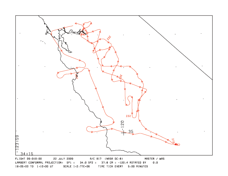
MASTER: HyspIRI Airborne Campaign, California and Nevada, Summer 2016 recent views
National Aeronautics and Space Administration —
This dataset includes Level 1B (L1B) and Level 2 (L2) data products from the MODIS/ASTER Airborne Simulator (MASTER) instrument. The data were collected as part of... -
Federal
CERES MODIS Cloud Retrievals in ISCCP-D2like Format Day Terra FM2 Edition3A NGDA recent views
National Aeronautics and Space Administration —
CER_ISCCP-D2like-Day_Terra-FM2-MODIS_Edition3A is the Clouds and the Earth's Radiant Energy System (CERES) Moderate Resolution Imaging Spectroradiometer (MODIS) Cloud... -
Federal
ABoVE: Soil Active Layer Thaw Depths at CRREL sites near Fairbanks, Alaska, 2014-2018 recent views
National Aeronautics and Space Administration —
This dataset provides soil active layer thaw depth measurements collected along transects at three sites near Fairbanks, Alaska, USA. Measurements were made during... -
Federal
ABoVE: Characterization of Burned and Unburned Spruce Forest Sites, Tanana, AK, 2017 recent views
National Aeronautics and Space Administration —
This dataset provides the results of field observations of soil characteristics and depth to permafrost, survey results for Composite Burn Index (CBI) determination,... -
Federal
Delta-X: AirSWOT L3 Water Surface Elevations, MRD, Louisiana, 2021, Version 2 recent views
National Aeronautics and Space Administration —
This dataset contains water surface elevations at selected point locations generated from the AirSWOT data collected during the Spring and Fall 2021 Delta-X... -
Federal
CERES Monthly Gridded Radiative Fluxes and Clouds Terra FM1 Edition2G recent views
National Aeronautics and Space Administration —
CER_FSW_Terra-FM1-MODIS_Edition2G is the Clouds and the Earth's Radiant Energy System (CERES) Monthly Gridded Radiative Fluxes and Clouds Terra Flight Model (FM1)... -
Federal
Pre-ABoVE: Ground-penetrating Radar Measurements of ALT on the Alaska North Slope recent views
National Aeronautics and Space Administration —
This data set includes estimates of permafrost Active Layer Thickness (ALT; cm), and calculated uncertainties, derived using a ground-penetrating radar (GPR) system... -
Federal
NARSTO SOS99NASH DOE G-1 Air Chemistry Data recent views
National Aeronautics and Space Administration —
NARSTO_SOS99NASH_G-1_AIR_CHEMISTRY_DATA is the North American Research Strategy for Tropospheric Ozone (NARSTO) SOS99 Nashville Department of Energy (DOE) G-1 Air... -
Federal
ABoVE: Burn Severity, Fire Progression, and Field Data, NWT, Canada, 2015-2016 NGDA recent views
National Aeronautics and Space Administration —
This data set provides a fire progression map for year 2015 and measures of burn severity and vegetation community biophysical data collected from areas that were...

Official websites use .gov
A
.gov website belongs to an official government
organization in the United States.
Secure .gov websites use HTTPS
A
lock (
) or https:// means you’ve safely connected to
the .gov website. Share sensitive information only on official,
secure websites.