
-
Federal
Regional Air Quality Data 154 recent views
U.S. Environmental Protection Agency —
This asset provides data on regional air quality, including trace level SO2, nitric acid, ozone, carbon monoxide, and NOy; and particulate sulfate, nitrate, and... -
State
Washington State Air Quality 22 recent views
State of Washington —
The links on this page provide access to the Washington State Department of Ecology's Air Monitoring Network, which tracks various air pollutants at more than six... -
Federal
Aqua/AIRS L2 Standard Physical Retrieval (AIRS+AMSU) V7.0 at GES DISC 15 recent views
National Aeronautics and Space Administration —
The Atmospheric Infrared Sounder (AIRS) is a grating spectrometer (R = 1200) aboard the second Earth Observing System (EOS) polar-orbiting platform, EOS Aqua. The... -
Air Quality History 12 recent views
District of Columbia —
This dataset contains quality assured and DOEE-certified air quality data collected from the District’s five air monitoring network sites. The dataset covers a three-... -
Federal
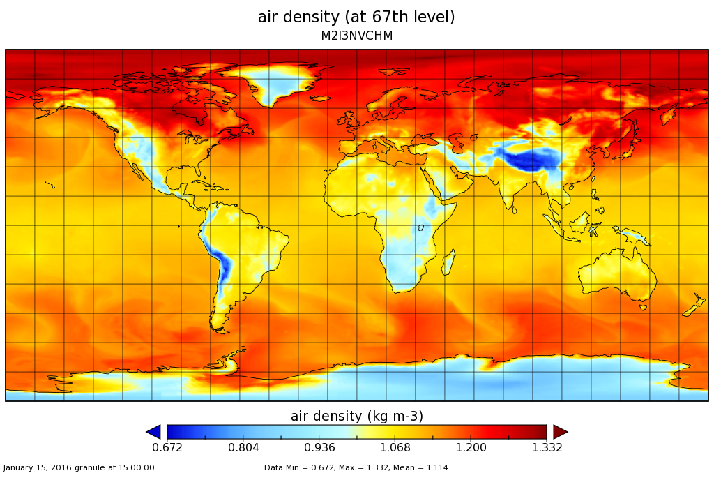
MERRA-2 inst3_3d_chm_Nv: 3d,3-Hourly,Instantaneous,Model-Level,Assimilation,Carbon Monoxide and Ozone Mixing Ratio 0.625 x 0.5 degree V5.12.4 (M2I3NVCHM) at GES DISC 10 recent views
National Aeronautics and Space Administration —
M2I3NVCHM (or inst3_3d_chm_Nv) is an instantaneous 3-dimensional 3-hourly data collection in Modern-Era Retrospective analysis for Research and Applications version 2... -
City
Local Air Quality 10 recent views
Town of Chapel Hill, North Carolina —
This dataset contains air quality data collected using a PurpleAir Dual Laser Air Quality Sensor located at the Chapel Hill Public Library. The sensor measures fine... -
Federal
Global Fire Emissions Database, Version 4.1 (GFEDv4) NGDA
National Aeronautics and Space Administration —
This dataset provides global estimates of monthly burned area, monthly emissions and fractional contributions of different fire types, daily or 3-hourly fields to... -
Federal
AirData AQS REST API
U.S. Environmental Protection Agency —
A REST web service API allowing the retrieval of historical air quality data from EPA. -
Federal
Detroit Exposure and Aerosol Research Study
U.S. Environmental Protection Agency —
The DEARS represents a multipollutant spatial characterization of six neighborhoods and their residents in and around Detroit, Michigan. Personal, residential indoor,... -
County
Allegheny County Air Quality
Allegheny County / City of Pittsburgh / Western PA Regional Data Center —
Air quality data is collected from the Allegheny County Health Department monitors throughout the county. This data must be verified by qualified individuals before... -
Federal
MISR Level 2 Aerosol parameters V002
National Aeronautics and Space Administration —
Multi-angle Imaging SpectroRadiometer (MISR) is an instrument designed to view Earth with cameras pointed in 9 different directions. As the instrument flies overhead,... -
City
Louisville Metro KY - Local Air Quality API
Louisville Metro Government —
API operated by Louisville Metro that returns AQI information from local sensors operated by APCD. Shows the latest hourly data in a JSON feed.The Air Quality Index... -
Federal
Daily and Annual PM2.5, O3, and NO2 Concentrations at ZIP Codes for the Contiguous U.S., 2000-2016, v1.0
National Aeronautics and Space Administration —
The Daily and Annual PM2.5, O3, and NO2 Concentrations at ZIP Codes for the Contiguous U.S., 2000-2016, v1.0 data set contains daily and annual concentration... -
Federal
TES/Aura L2 Ammonia Nadir Special Observation V007
National Aeronautics and Space Administration —
TL2NH3NS_7 is the Tropospheric Emission Spectrometer (TES)/Aura Level 2 Ammonia Nadir Special Observation Version 7 data product. TES was an instrument aboard NASA's... -
Federal
MISR L2 Aerosol Product subset for the SAMUM region V002
National Aeronautics and Space Administration —
This is the Level 2 Aerosol Product.It contains Aerosol optical depth and particle type, with associated atmospheric data for the SAMUM_2006 theme. -
Federal
HAQAST Sentinel-5P TROPOMI Nitrogen Dioxide (NO2) CONUS Monthly Level 3 0.01 x 0.01 Degree Gridded Data V2.4 (HAQ_TROPOMI_NO2_CONUS_M_L3) at GES DISC
National Aeronautics and Space Administration —
This product provides level 3 annual averages of tropospheric Nitrogen dioxide (NO2) vertical column density derived from the level 2 Tropospheric Monitoring... -
Federal
ISLSCP II EDGAR 3 Gridded Greenhouse and Ozone Precursor Gas Emissions
National Aeronautics and Space Administration —
The EDGAR (Emission Database for Global Atmospheric Research) database project is a comprehensive task carried out jointly by the National Institute for Public Health... -
Federal
Sentinel-5P TROPOMI Total Ozone Column 1-Orbit L2 7km x 3.5km V1 (S5P_L2__O3_TOT) at GES DISC
National Aeronautics and Space Administration —
Starting from August 6th in 2019, Sentinel-5P TROPOMI along-track high spatial resolution (~5.5km at nadir) has been implemented. Starting from July 13th in 2020,... -
Federal
Sounder SIPS: Suomi NPP CrIMSS Level 2 CLIMCAPS Normal Spectral Resolution: Atmosphere cloud and surface geophysical state V2 (SNDRSNIML2CCPRETN) at GES DISC
National Aeronautics and Space Administration —
WARNING: To users of the derived product “co_mmr_midtrop” (carbon monoxide mass mixing ratio to dry air [kg/kg] at ~500 hPa). This variable has a significant bias due... -
Federal
MERRA-2 tavg1_2d_aer_Nx: 2d,1-Hourly,Time-averaged,Single-Level,Assimilation,Aerosol Diagnostics 0.625 x 0.5 degree V5.12.4 (M2T1NXAER) at GES DISC
National Aeronautics and Space Administration —
M2T1NXAER (or tavg1_2d_aer_Nx) is an hourly time-averaged 2-dimensional data collection in Modern-Era Retrospective analysis for Research and Applications version 2...

Official websites use .gov
A
.gov website belongs to an official government
organization in the United States.
Secure .gov websites use HTTPS
A
lock (
) or https:// means you’ve safely connected to
the .gov website. Share sensitive information only on official,
secure websites.