
-
Federal
Dynamically Downscaled Hourly Future Weather Data with 12-km Resolution Covering Most of North America
Department of Energy —
This is an hourly future weather dataset for energy modeling applications. The dataset is primarily based on the output of a regional climate model (RCM), i.e., the... -
Federal
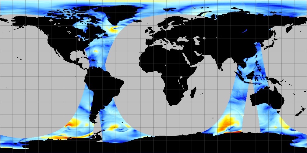
CYGNSS Level 3 MRG Science Data Record Version 3.2
National Aeronautics and Space Administration —
This dataset contains the version 3.2 CYGNSS level 3 science data record merged storm (MRG) wind speed which combines CYGNSS storm-centric gridded (SCG) wind speeds,... -
Federal
SCATSAT-1 ESDR Level 2 Ancillary Ocean Surface Fields Version 1.1
National Aeronautics and Space Administration —
This dataset contains the first science quality release (post-provisional after v1.0) of the MEaSUREs-funded Earth Science Data Record (ESDR) of ancillary data... -
Federal
RapidScat Level 2B Ocean Wind Vectors in 12.5km Slice Composites Version 1.3
National Aeronautics and Space Administration —
This dataset contains the RapidScat Level 2B 12.5km Version 1.3 science-quality ocean surface wind vectors, which are intended as a replacement and continuation of... -
Federal
GHRSST Level 3U Global Subskin Sea Surface Temperature version7.0.1a from the WindSat Polarimetric Radiometer on the Coriolis satellite
National Aeronautics and Space Administration —
The WindSat Polarimetric Radiometer, launched on January 6, 2003 aboard the Department of Defense Coriolis satellite, was designed to measure the ocean surface wind... -
Federal
CYGNSS Level 3 MRG Science Data Record Near Real Time Version 3.2.2
National Aeronautics and Space Administration —
CYGNSS_L3_MRG_NRT_V3.2.2This dataset contains the Near Real Time (NRT) version of the 3.2.2 CYGNSS Level 3 Merged (MRG) Science Data Record Wind Speed which combines... -
Federal
COWVR STP-H8 Surface Wind Vector and Column-Integrated Atmospheric Water Measurements Version 10.0
National Aeronautics and Space Administration —
This dataset includes satellite-based observations of geolocated surface wind vectors, precipitable water vapor, and integrated cloud liquid water, as well as the... -
Federal
UNH TDP - Concurrent Measurements of Inflow, Power Performance, and Loads for a Grid-Synchronized Vertical Axis Cross-Flow Turbine Operating in a Tidal Estuary
Department of Energy —
This data was collected between October 12 and December 15 of 2021 at the University of New Hampshire (UNH) and Atlantic Marine Energy Center (AMEC) turbine... -
Federal
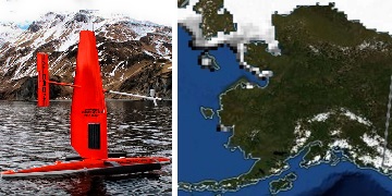
Saildrone 2021 Arctic field campaign for the Multi-Sensor Improved SST (MISST) project
National Aeronautics and Space Administration —
The Saildrone Arctic 2021 dataset presents a unique collection of high-quality, near real-time, multivariate surface ocean, and atmospheric observations obtained... -
Federal
SASSIE Arctic Field Campaign Jet Surface Salinity Profiler Data Fall 2022 Version 1
National Aeronautics and Space Administration —
The Salinity and Stratification at the Sea Ice Edge (SASSIE) project is a NASA experiment that aims to understand how salinity anomalies in the upper ocean generated... -
Federal
RapidScat Level 2B Ocean Wind Vectors in 12.5km Slice Composites Version 1.1
National Aeronautics and Space Administration —
This dataset contains the RapidScat Level 2B 12.5km Version 1.1 science-quality ocean surface wind vectors. The Level 2B wind vectors are binned on a 12.5 km Wind... -
Federal
SPURS-1 research vessel Thermosalinograph series data for N. Atlantic cruises
National Aeronautics and Space Administration —
The SPURS (Salinity Processes in the Upper Ocean Regional Study) project is an oceanographic process study and associated field program that aim to elucidate key... -
Federal
CYGNSS Level 2 Science Data Record Version 3.2
National Aeronautics and Space Administration —
This dataset contains the version 3.2 CYGNSS level 2 science data record which provides the time-tagged and geolocated average wind speed (m/s) and mean square slope... -
Federal
CYGNSS Level 3 MRG Science Data Record Version 3.2.2
National Aeronautics and Space Administration —
This dataset contains the version 3.2.2 CYGNSS level 3 science data record merged storm (MRG) wind speed which combines CYGNSS storm-centric gridded (SCG) wind... -
Federal
CYGNSS Level 3 Science Data Record Version 3.2
National Aeronautics and Space Administration —
This dataset contains the version 3.2 CYGNSS level 3 science data record which provides the average wind speed and mean square slope (MSS) on a 0.2x0.2 degree... -
Federal
CYGNSS Level 3 Science Data Record Version 3.1
National Aeronautics and Space Administration —
This dataset contains the Version 3.1 CYGNSS Level 3 Science Data Record which provides the average wind speed and mean square slope (MSS) on a 0.2x0.2 degree... -
Federal
Burned and Unburned Field Site Data, Noatak, Seward, and North Slope, AK, 2016-2018
National Aeronautics and Space Administration —
This dataset includes field measurements from unburned and burned 10 m x 10 m and 1 m x 1 m plots in the Noatak, Seward, and North Slope regions of the Alaskan tundra... -
Federal
CYGNSS Level 2 Science Data Record Version 3.1
National Aeronautics and Space Administration —
This dataset contains the Version 3.1 CYGNSS Level 2 Science Data Record which provides the time-tagged and geolocated average wind speed (m/s) and mean square slope... -
Federal
SEASAT SCATTEROMETER DEALIASED OCEAN WIND VECTORS (Wentz et al.)
National Aeronautics and Space Administration —
Contains Seasat-A Scatterometer (SASS) wind vector measurements for the entire Seasat mission, from July 1978 until October 1978. The data are global and presented... -
Federal
MetOp-B ASCAT ESDR Level 2 Ancillary Ocean Surface Fields Version 1.1
National Aeronautics and Space Administration —
This dataset contains model output interpolated in space and time to observations from the MetOp-B ASCAT (ASCAT-B) instrument (a satellite-based scatterometer),...

Official websites use .gov
A
.gov website belongs to an official government
organization in the United States.
Secure .gov websites use HTTPS
A
lock (
) or https:// means you’ve safely connected to
the .gov website. Share sensitive information only on official,
secure websites.