

CYGNSS Level 3 Science Data Record Version 3.1
Access & Use Information
Public: This dataset is intended for public access and use.
License: No license information was provided. If this work was prepared by an officer or employee of the United States government as part of that person's official duties it is considered a U.S. Government Work.
Downloads & Resources
-
Data Information (Unknown Format)BIN
-
Data Information (Unknown Format)BIN
-
Data Information (Unknown Format)BIN
-
Data Information (Unknown Format)BIN
-
Data Information (Unknown Format)BIN
-
Data Information (PDF)PDF
148-0319_ATBD_L3_Gridded_Wind_Speed_R2.pdf
-
Data Information (XLSX)EXCEL
148-0351-4_Level_3_netCDF_Data_Dictionary.xlsx
-
Data Information (PDF)PDF
CYGNSS_Handbook_April2016.pdf
-
Data Information (HTML)HTML
-
Data Information (HTML)HTML
-
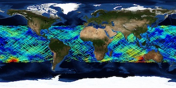
Data Information (JPEG)JPEG
CYGNSS_L3_V3.1.jpg
-
Landing PageLanding Page
Dates
| Metadata Created Date | April 11, 2025 |
|---|---|
| Metadata Updated Date | August 29, 2025 |
Metadata Source
- Data.json Data.json Metadata
Harvested from NASA Data.json
Additional Metadata
| Resource Type | Dataset |
|---|---|
| Metadata Created Date | April 11, 2025 |
| Metadata Updated Date | August 29, 2025 |
| Publisher | NASA/JPL/PODAAC;NASA/ESSP/UMICH/CYGNSS |
| Maintainer | |
| Identifier | 10.5067/CYGNS-L3X31 |
| Data Last Modified | 2025-08-27 |
| Category | Earth Science |
| Public Access Level | public |
| Bureau Code | 026:00 |
| Metadata Context | https://project-open-data.cio.gov/v1.1/schema/catalog.jsonld |
| Schema Version | https://project-open-data.cio.gov/v1.1/schema |
| Catalog Describedby | https://project-open-data.cio.gov/v1.1/schema/catalog.json |
| Harvest Object Id | 2ea74359-0789-4220-ad23-a5a44032eb4c |
| Harvest Source Id | 58f92550-7a01-4f00-b1b2-8dc953bd598f |
| Harvest Source Title | NASA Data.json |
| Homepage URL | https://podaac.jpl.nasa.gov/CitingPODAAC |
| Old Spatial | "CARTESIAN",{"NorthBoundingCoordinate":40.0,"WestBoundingCoordinate":-180.0,"EastBoundingCoordinate":180.0,"SouthBoundingCoordinate":-40.0} |
| Program Code | 026:000 |
| Source Datajson Identifier | True |
| Source Hash | adaaa04e55d5ecaf810ac3853ceb04f6277d7b15f492f0381afb899fbc24919f |
| Source Schema Version | 1.1 |
| Spatial | |
| Temporal | 2018-08-01/2018-08-01 |
Didn't find what you're looking for? Suggest a dataset here.