

27 datasets found for ""Tree Density""
-
Federal
Pacific Island Network Focal Terrestrial Plant Communities Monitoring Dataset 2010-2022
Department of the Interior —
The Pacific Island Network Inventory and Monitoring (PACN I&M) Program collected data of the status of plant communities of the parks in the PACN. The coastal... -
Federal
Post-fire Recovery of Soil Organic Layer Carbon in Canadian Boreal Forests, 2015-2018
National Aeronautics and Space Administration —
This dataset provides site moisture, soil organic layer thickness, soil organic carbon, nonvascular plant functional group, stand dominance, ecozone, time-after-fire,... -
Federal
Data from: Emerald ash borer biocontrol in ash saplings: the potential for early stage recovery of North American Ash trees
Department of Agriculture —
Our study on saplings was conducted in six forested sites in three southern Michigan counties: Ingham Co. (three sites), Gratiot Co. (two sites), and Shiawassee Co.... -
Federal
Long-term Experimental Forest Growth and Drought Data
Department of the Interior —
These data were compiled in order to represent long-term (multi-decadal) forest growth across eight different experimental forests in the United States, each with... -
Federal
ABoVE: Characterization of Carbon Dynamics in Burned Forest Plots, NWT, Canada, 2014
National Aeronautics and Space Administration —
This dataset provides field data from boreal forests in the Northwest Territories (NWT), Canada, that were burned by wildfires in 2014. During fieldwork in 2015, 211... -
Federal
Terrestrial Condition Assessment (TCA) Grassland Encroachment
Department of Agriculture —
Direct Download (Raster Data Gateway)Objective: An indicator that identifies where tree density has exceeded the levels presumed to be present in pre-Euro-American... -
Federal
Site characterization and regeneration attributes of managed and unmanaged ponderosa pine sites in the southwestern United States
Department of the Interior —
These data consist of environmental covariates, measured plot-level and tree characteristics for seven coniferous tree species across the southwestern United States.... -
Federal
ABoVE: Photochemical Reflectance and Tree Growth, Brooks Range, Alaska, 2018-2019
National Aeronautics and Space Administration —
This dataset provides simultaneous in-situ measurements of the photochemical reflectance index (PRI) and radial tree growth of selected white spruce trees (Picea... -
State
Tree Habitat - Spears and Didion Ranches [ds321]
State of California —
These data are the summary statistics calculated for trees and snags from the three 0.05-ha circular plot habitat samples taken in 2005 each at the 15 sample points... -
State
Aspen Delineation - Klamath National Forest [ds370]
State of California —
The database represents polygons of aspen stands in the Klamath National Forest, Siskiyou County, California. The Klamath National Forest Region 5 Vegetation aspen... -
Federal
NPS Alaska FFI Fire Effects Monitoring Data
Department of the Interior —
NPS Alaska FFI Fire Effects Monitoring Data (2004–2024) Fire effects and fuels monitoring data were collected across National Park Service units in Alaska between... -
Federal
Pinyon-juniper basal area, climate and demographics data from National Forest Inventory plots and projected under future density and climate conditions
Department of the Interior —
These data were compiled to help understand how climate change may impact dryland pinyon-juniper ecosystems in coming decades, and how resource management might be... -
State
Aspen Characteristics - Klamath National Forest [ds369]
State of California —
The database represents point locations and associated stand assessment data collected with known aspen stands in the Klamath National Forest, Siskiyou County,... -
Federal
SNF Forest Understory Cover Data (Table)
National Aeronautics and Space Administration —
The purpose of the SNF study was to improve our understanding of the relationship between remotely sensed observations and important biophysical parameters in the... -
Federal
SNF Forest Understory Cover Data
National Aeronautics and Space Administration —
The purpose of the SNF study was to improve our understanding of the relationship between remotely sensed observations and important biophysical parameters in the... -
Federal
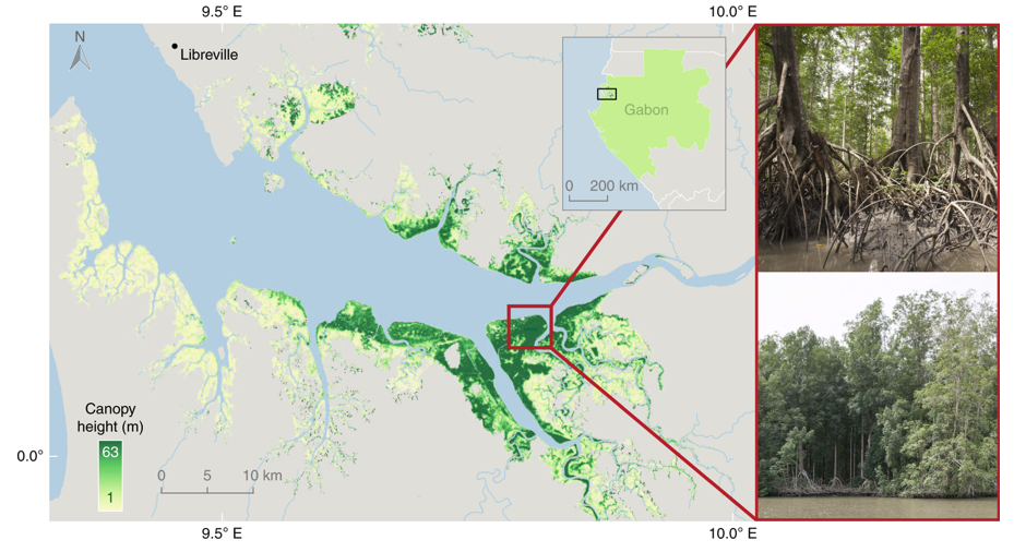
Global Mangrove Distribution, Aboveground Biomass, and Canopy Height
National Aeronautics and Space Administration —
This dataset characterizes the global distribution, biomass, and canopy height of mangrove-forested wetlands based on remotely sensed and in situ field measurement... -
Federal
Vegetation Monitoring at Channel Islands National Park (CHIS) by the Mediterranean Coast Network (MEDN): 1984-2025 — Data Package
Department of the Interior —
Channel Islands National Park, and later in collaboration with the Mediterranean Coast Network (MEDN) have been monitoring vegetation at Channel Islands National Park... -
Federal
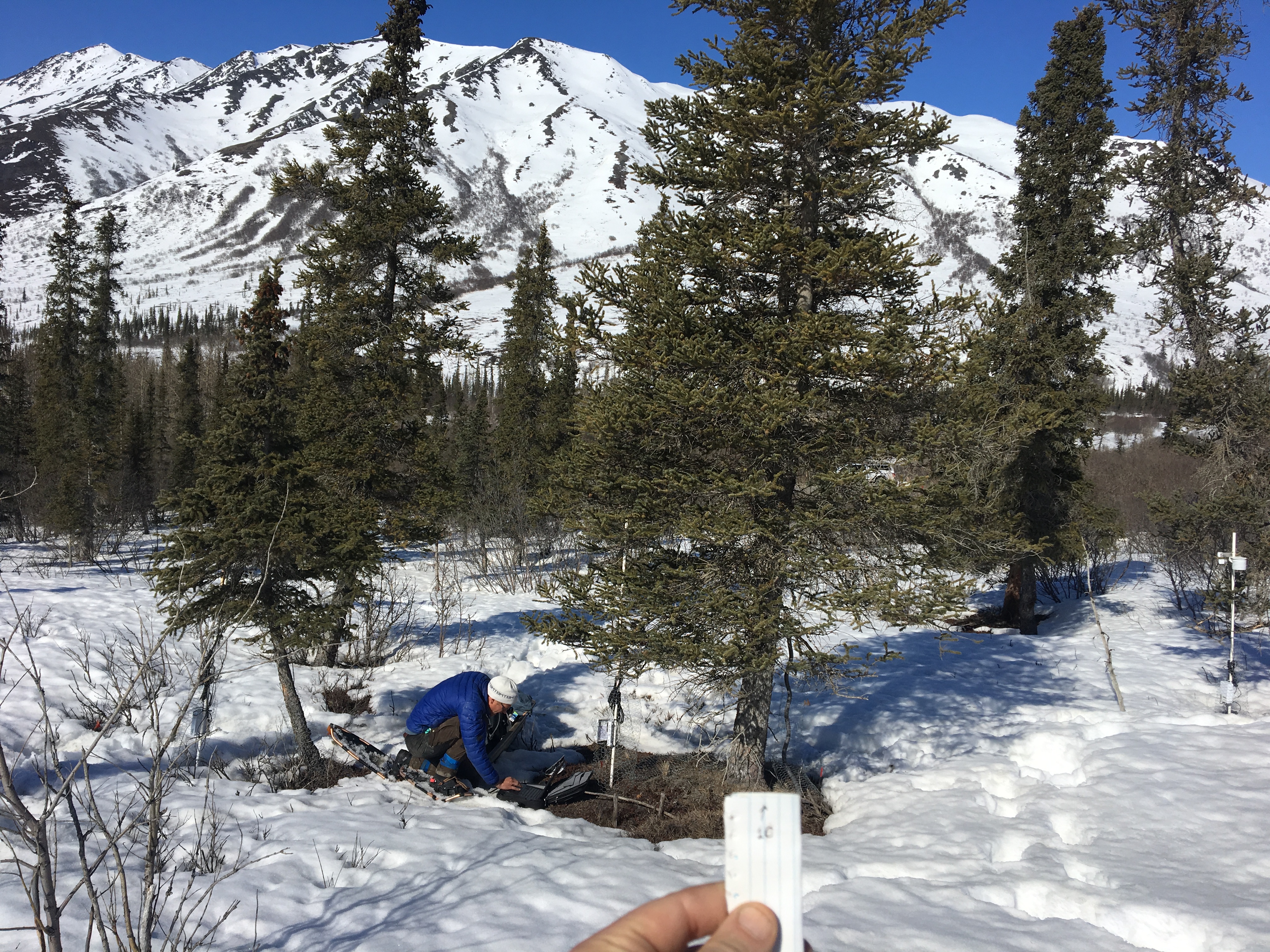
SnowEx20 Grand Mesa Reference GIS Data Sets V001
National Aeronautics and Space Administration —
This data set contains geolocation information of the infrastructure locations for the SnowEx20 Intensive Observation Period (IOP) and Time Series (TS) campaigns.... -
Federal
ABoVE: Synthesis of Burned and Unburned Forest Site Data, AK and Canada, 1983-2016
National Aeronautics and Space Administration —
This dataset is a synthesis of field plot characterization data, derived above-ground and below-ground combusted carbon, and acquired Fire Weather Index (FWI) System... -
Federal
Hawaii Volcanoes National Park Forest Composition and Hawaii Elepaio Breeding Behavior 1993-1994 and 2015-2019
Department of the Interior —
This data release contains the tabular data and metadata to record changes in forest composition (tree species relative abundance, tree density, tree height, and tree...
27 datasets found for ""Tree Density""