
-
Federal
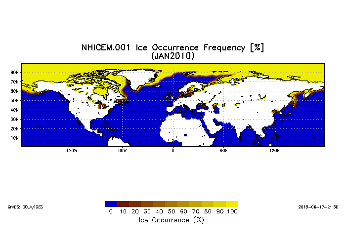
Northern Hemisphere Ice Cover Monthly Statistics at 1 Degree Resolution V001 (NHICEM) at GES DISC
National Aeronautics and Space Administration —
This product is monthly Ice Cover Statistics. The dataset was prepared by Dr. Peter Romanov at Cooperative Institute for Climate Studies(CICS) of the University of... -
Federal
TRACER-AQ JSC G-V Aircraft Remotely Sensed High Spectral Resolution Lidar-2 (HSRL-2) Data
National Aeronautics and Space Administration —
TRACERAQ_AircraftRemoteSensing_GV_HSRL2_Data is the remotely sensed High Spectral Resolution Lidar-2 (HSRL-2) data collected onboard the Johnson Space Center (JSC)... -
Federal
Sulfates, Clouds and Radiation Brazil (SCAR-B) AERONET (AErosol RObotic NETwork) Data
National Aeronautics and Space Administration —
SCAR_B_AERONET data are Smoke, Clouds and Radiation Brazil (SCARB) Aerosol Robotic Network (AERONET) data for aerosol characterization.Smoke/Sulfates, Clouds and... -
Federal
AirMSPI verison 6 terrain-projected georegistered radiance product acquired during the SPEX-PR flight campaign
National Aeronautics and Space Administration —
AirMSPI_SPEX-PR_Terrain-projected_Georegistered_Radiance_Data is an AirMSPI terrain-projected georegistered radiance product acquired during the SPEX engineering... -
Federal
AirMSPI version 6 terrain-projected georegistered radiance product acquired during the CalWater-2 flight campaign Jan-Feb 2015
National Aeronautics and Space Administration —
AirMSPI_CalWater-2_Terrain-projected_Georegistered_Radiance_Data are AirMSPI terrain-projected georegistered radiance product acquired during the Precipitation,... -
Federal
ASTER Global Emissivity Dataset, 1 kilometer, HDF5 V003
National Aeronautics and Space Administration —
The Terra Advanced Spaceborne Thermal Emission and Reflection Radiometer (ASTER) Global Emissivity Dataset (GED) land surface temperature and emissivity (LST&E)... -
Federal
Chiniak, Alaska 8/15 arc-second Coastal Digital Elevation Model
National Oceanic and Atmospheric Administration, Department of Commerce —
NOAA's National Centers for Environmental Information is building high-resolution digital elevation models (DEMs) to support individual coastal States as part of the... -
Federal
Sediment Grab Data from September 2001 in Wells, Maine (wellssedgrabs)
National Oceanic and Atmospheric Administration, Department of Commerce —
In fall 2001, researchers from the Wells National Estuarine Research Reserve, Virginia Institute of Marine Science, and the NOAA Office for Coastal Management... -
Federal
Coastal Massachusetts Submerged Aquatic Beds 1994-1996 Geoform
National Oceanic and Atmospheric Administration, Department of Commerce —
The Coastal Change Analysis Program (C-CAP) at NOAA Office for Coastal Management partnered with The Massachusetts Department of Environmental Protection Wetlands... -
Federal
Benthic Habitat Mapping - Indian River Lagoon, Florida Submerged Aquatic Vegetation (SAV) Data 1996 Geodatabase
National Oceanic and Atmospheric Administration, Department of Commerce —
The NOAA Office for Coastal Management's Coastal Change Analysis Program, in cooperation with the St. Johns River and South Florida Water Management Districts, used... -
Federal
East Florida 2020 ESI RESOURCE MANAGEMENT Polygons, Points
National Oceanic and Atmospheric Administration, Department of Commerce —
This data set contains sensitive biological resource data for seagrass, coral reef, hard-bottom communities, and deep-sea coral for East Florida. Vector polygons in... -
Federal
Benthic Habitats of Florida Bay, FL 1991-1995 Biotic
National Oceanic and Atmospheric Administration, Department of Commerce —
In the winter of 1991/92 the National Oceanic and Atmospheric Administration's Office for Coastal Management's Coastal Change Analysis Program (C-CAP) and the State... -
Federal
Benthic Habitats of Florida Bay, FL 1991-1995 Geoform
National Oceanic and Atmospheric Administration, Department of Commerce —
In the winter of 1991/92 the National Oceanic and Atmospheric Administration's Office for Coastal Management's Coastal Change Analysis Program (C-CAP) and the State... -
Federal
cmomy: A python package to calculate and manipulate Central (co)moments.
Department of Commerce —
cmomy is a python package to calculate central moments and co-moments in a numerical stable and direct way. Behind the scenes, cmomy makes use of Numba to rapidly... -
Federal
Genome In A Bottle - v2.0 Genome Stratifications (Deprecated)
Department of Commerce —
These stratification BED files from the Global Alliance for Genomics and Health (GA4GH) Benchmarking Team and the Genome in a Bottle Consortium are intended as a... -
Federal
SRM 3949 Folate Vitamers in Frozen Human Serum
Department of Commerce —
Standard Reference Material 3949 Folate Vitamers in Frozen Human Serum -
Federal
Supplementary data for "Distributions of fitness effects for amino acid changes from high-throughout mutagenesis experiments" (McCandlish and Stoltzfus, 2018)
Department of Commerce —
McCandlish and Stoltzfus gathered data from deep mutational scanning experiments on 12 proteins, comprising 56641 distinct amino acid replacement mutations. By... -
Federal
Unpublished Digital Post-Hurricane Sandy (2015) Geomorphological-GIS Map of the Staten Island Unit, Gateway National Recreation Area, New York (NPS, GRD, GRI, GATE, STIS digital map) adapted from a Rutgers University Institute of Marine and Coastal Sciences unpublished digital data by Psuty, N.P., Schmelz, W., Greenberg, J. and Spahn A. (2015)
Department of the Interior —
The Unpublished Digital Post-Hurricane Sandy Geomorphological-GIS Map of the Staten Island Unit, Gateway National Recreation Area, New York is composed of GIS data...

Official websites use .gov
A
.gov website belongs to an official government
organization in the United States.
Secure .gov websites use HTTPS
A
lock (
) or https:// means you’ve safely connected to
the .gov website. Share sensitive information only on official,
secure websites.