
-
Federal
AERONET-SDA Retrievals
National Aeronautics and Space Administration —
The SDA dataset uses the spectral behavior of AOD to partition between fine and coarse modes, without a size-cutoff radius of the type used by the Dubovik and King... -
Federal
The Acidity of Atmospheric Particles and Clouds
U.S. Environmental Protection Agency —
Dataset contains supplementary information (model inputs and/or outputs and literature values) for Section 4.1 (idealized acidity calculations), Section 4.2 (box... -
Federal
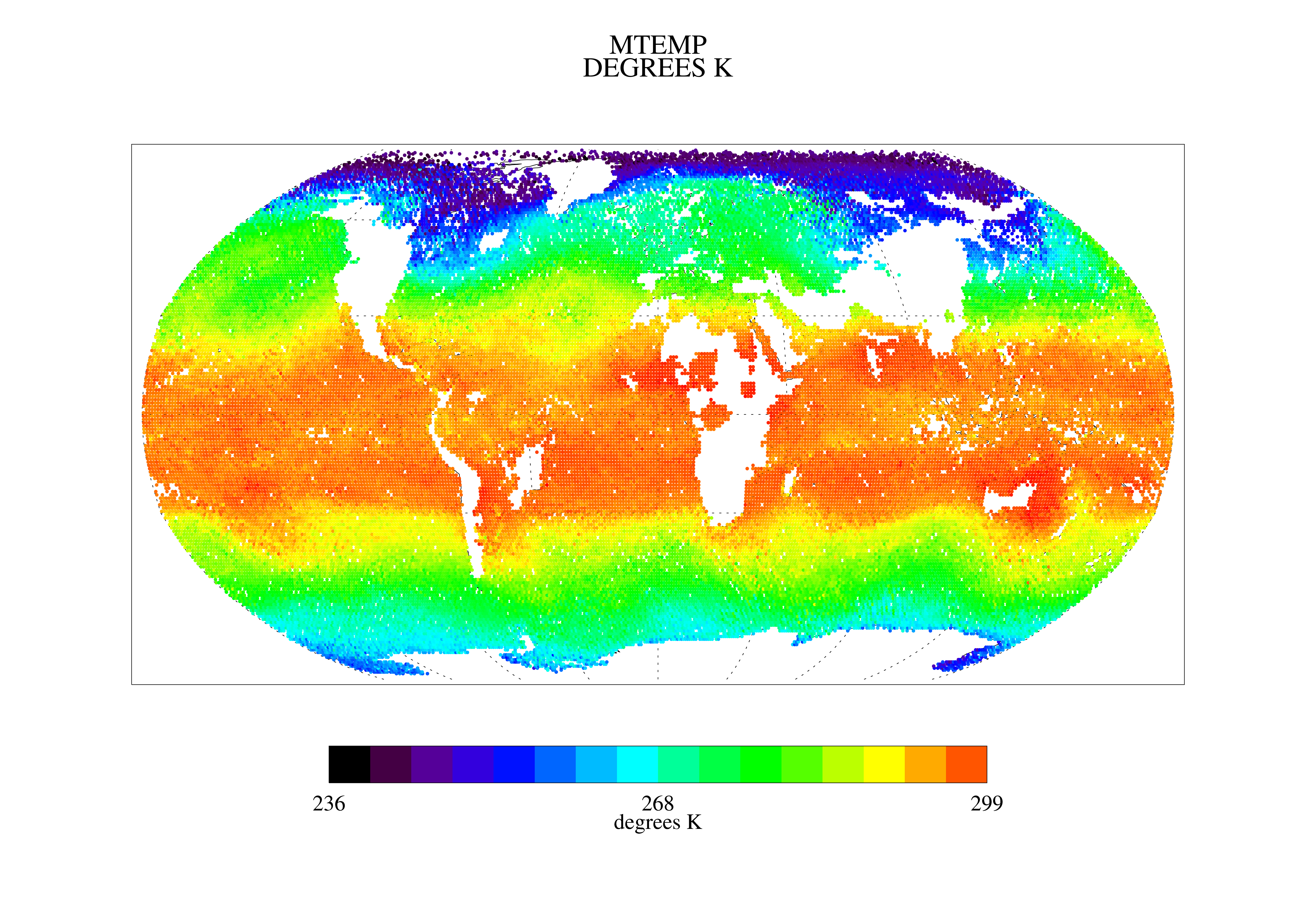
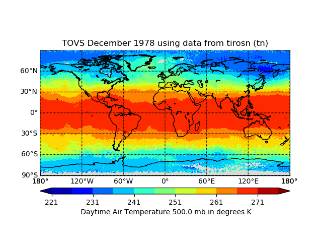
TOVS LMD 5 DAY GRIDS from NOAA-10 V01 (TOVSB5NG) at GES DISC
National Aeronautics and Space Administration —
Level 3 parameters from HIRS/2 and MSU radiances using the Improved Initialization Inversion (3I) classification retrieval scheme by the Laboratoire de Meteorologie... -
Federal
Hurricane Satellite (HURSAT) from Advanced Very High Resolution Radiometer (AVHRR)
National Oceanic and Atmospheric Administration, Department of Commerce —
Huricane Satellite (HURSAT)-Advanced Very High Resolution Radiometer (AVHRR) is used to extend the HURSAT data set such that appling the Objective Dvorak technique... -
Federal
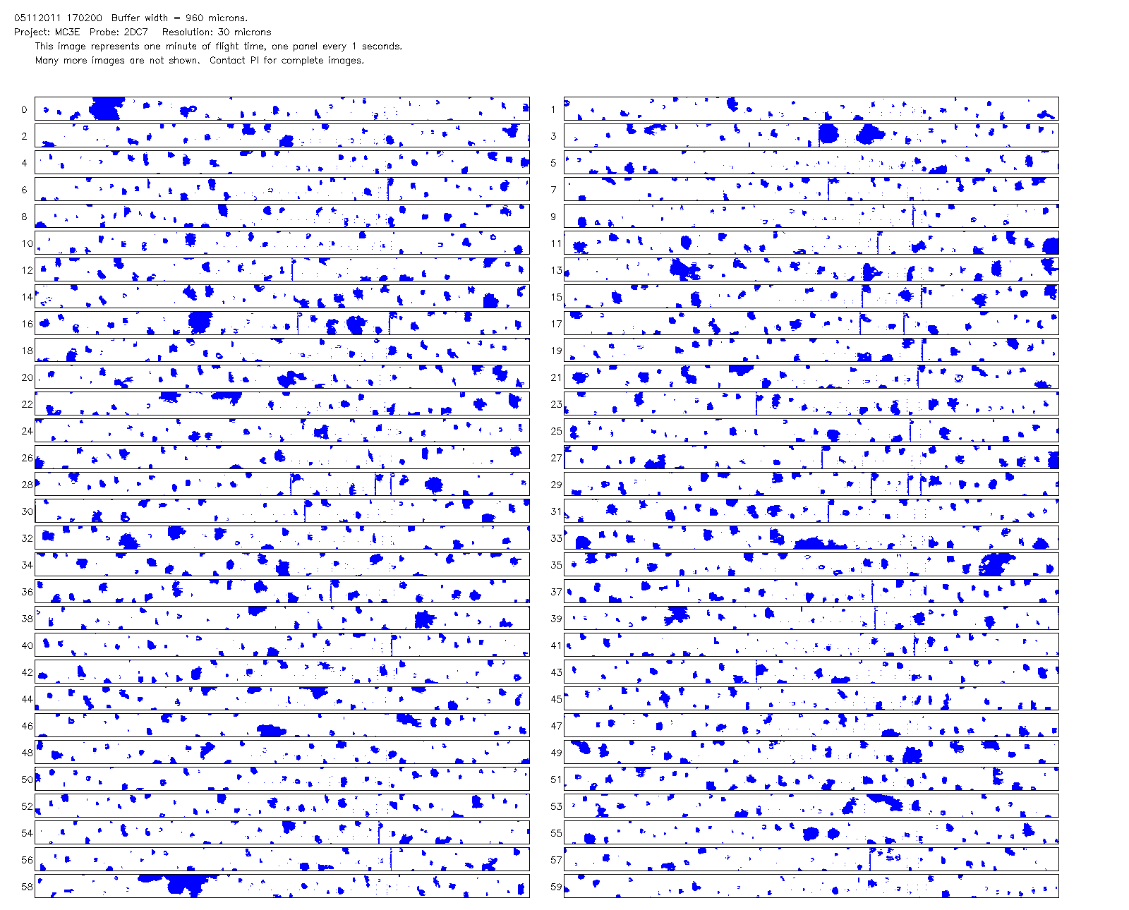
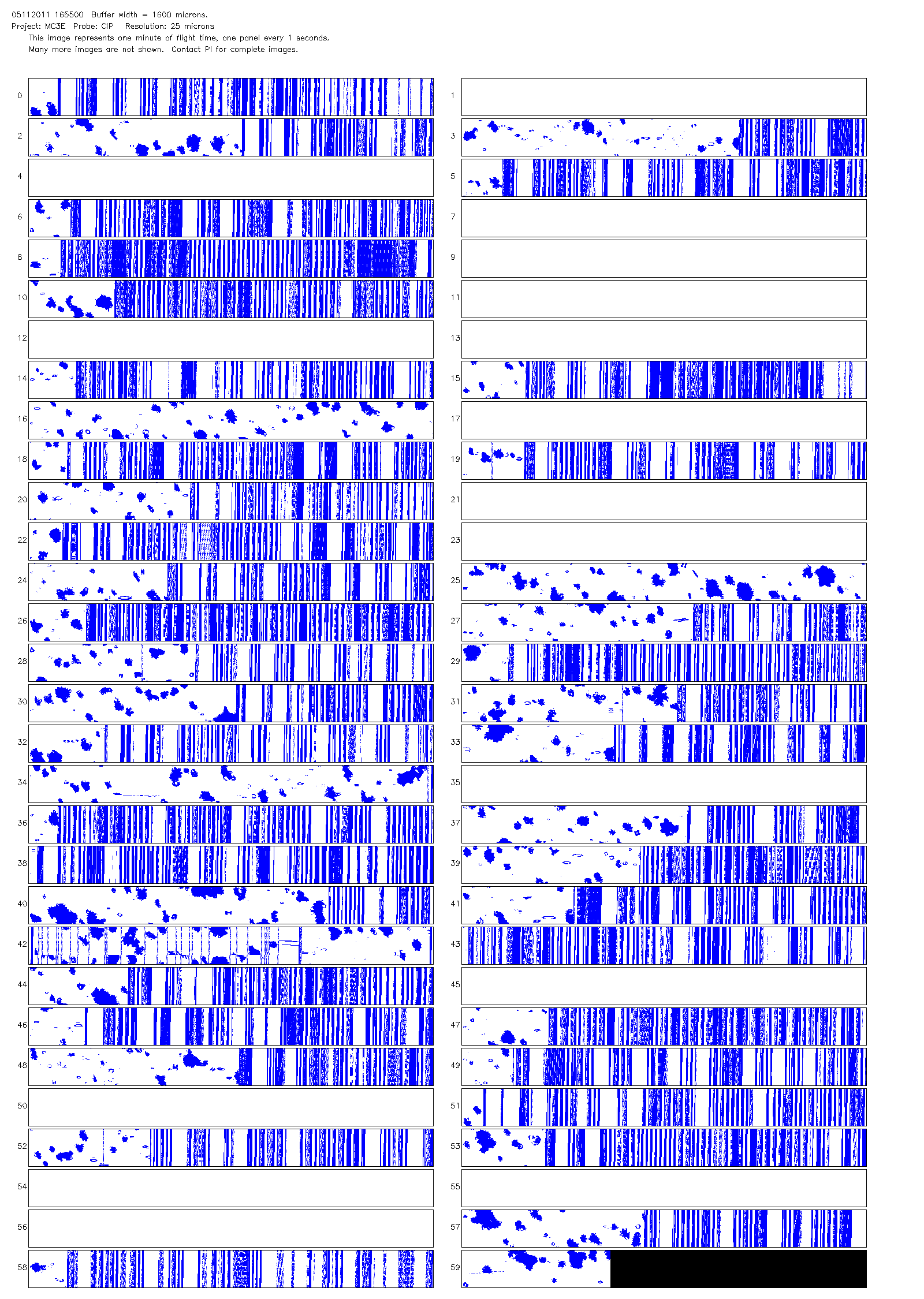
GPM GROUND VALIDATION NCAR CLOUD MICROPHYSICS PARTICLE PROBES MC3E V1
National Aeronautics and Space Administration —
The GPM Ground Validation NCAR Cloud Microphysics Particle Probes MC3E dataset was collected during the Midlatitude Continental Convective Clouds Experiment (MC3E),... -
Federal
TRACER-AQ JSC G-V Aircraft Remotely Sensed High Spectral Resolution Lidar-2 (HSRL-2) Data
National Aeronautics and Space Administration —
TRACERAQ_AircraftRemoteSensing_GV_HSRL2_Data is the remotely sensed High Spectral Resolution Lidar-2 (HSRL-2) data collected onboard the Johnson Space Center (JSC)... -
Federal
Moderate Resolution Imaging Spectroradiometer (MODIS) - Aqua NGDA
National Aeronautics and Space Administration —
This dataset represents multiple products archived at the multiple archive centers for the MODIS (Moderate Resolution Imaging Spectroradiometer) instrument aboard the... -
Federal
Bolivia Synoptic and Summary of the Day Digital Image Records
National Oceanic and Atmospheric Administration, Department of Commerce —
This dataset consists of images of records containing meteorological surface observations in both synoptic and monthly formats for over 20 stations in the country of... -
Federal
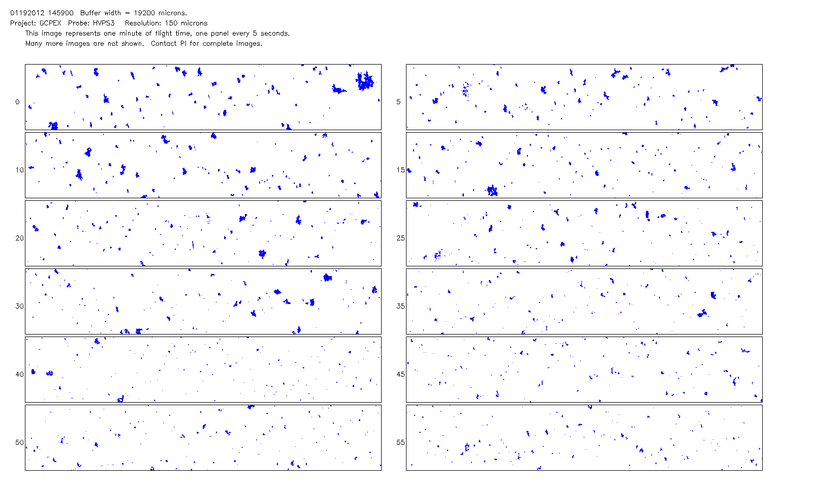
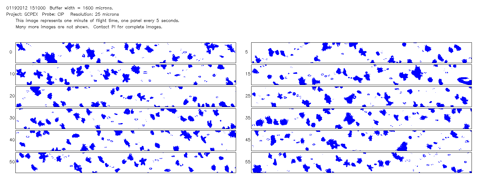
GPM GROUND VALIDATION NCAR CLOUD MICROPHYSICS PARTICLE PROBES GCPEX V1
National Aeronautics and Space Administration —
The GPM Ground Validation NCAR Cloud Microphysics Particle Probes GCPEx data was collected during the GPM Cold-season Precipitation Experiment (GCPEx), which occurred... -
Federal
Sentinel-5P TROPOMI SNPP VIIRS cloud product band 6 (NIR detector) 1-Orbit L2 5.5km x 3.5km V1 (S5P_L2__NP_BD6_HiR) at GES DISC
National Aeronautics and Space Administration —
Starting from August 6th in 2019, Sentinel-5P TROPOMI along-track high spatial resolution (~5.5km at nadir) has been implemented. For data before August 6th of 2019,... -
Federal
FLASHFlux Daily Gridded Single Satellite TOA and Surfaces/Clouds data in HDF Version 4A
National Aeronautics and Space Administration —
FLASH_TISA_Terra-Aqua_Version4a is the Fast Longwave And SHortwave Fluxes (FLASHFlux) Daily Gridded Single Satellite Top-of-Atmosphere (TOA) and Surfaces/Clouds data... -
Federal
TES/Aura L2 Methane Nadir Special Observation V007
National Aeronautics and Space Administration —
TL2CH4NS_7 is the Tropospheric Emission Spectrometer (TES)/Aura Level 2 Methane Nadir Special Observation Version 7 data product. TES was an instrument aboard NASA's... -
Federal
Sounder SIPS: AQUA AIRS IR MW Level 3 CLIMCAPS : Specific Quality Control Gridded Daily V2 at GES DISC
National Aeronautics and Space Administration —
WARNING: Users of the derived product “co_mmr_midtrop” (carbon monoxide mass mixing ratio to dry air [kg/kg] at ~500 hPa). This variable has a significant bias due to... -
Federal
SSMI(S) Hydrological Products
National Oceanic and Atmospheric Administration, Department of Commerce —
The Special Sensor Microwave/Imager (SSM/I) and Special Sensor Microwave Imager-Sounder (SSMIS) have been making measurements of earth-emitted microwave radiation for... -
Federal
Paraguay Synoptic Digital Image Records
National Oceanic and Atmospheric Administration, Department of Commerce —
This dataset consists of images of records containing meteorological surface observations in synoptic format for various stations in the country of Paraguay. It has a... -
Federal
SatCORPS CERES GEO Edition 4 GOES-13 Southern Hemisphere Version 1.0
National Aeronautics and Space Administration —
CER_GEO_Ed4_GOE13_SH_V01 is the Satellite Cloud and Radiation Property retrieval System (SatCORPS) Clouds and the Earth's Radiant Energy System (CERES) Geostationary... -
Federal
TOVS GLA MONTHLY GRIDS from TIROS-N 02 (TOVSAMTN) at GES DISC
National Aeronautics and Space Administration —
This dataset (TOVSAMTN) contains the TIROS Operational Vertical Sounder (TOVS) level 3 geophysical parameters derived using data from TIROS-N and the physical... -
Federal
NCEP-GTS Marine Observations in BUFR format
National Oceanic and Atmospheric Administration, Department of Commerce —
The Global Telecommunications System (GTS) is a major component of transmitting global meteorological data, consisting of both in situ and satellite observations.... -
Federal
CERES and GEO-Enhanced TOA, Within-Atmosphere and Surface Fluxes, Clouds and Aerosols 3-Hourly Terra-Aqua Edition4A NGDA
National Aeronautics and Space Administration —
CER_SYN1deg-3Hour_Terra-Aqua-MODIS_Edition4A is the Clouds and the Earth's Radiant Energy System (CERES) and geostationary (GEO)-Enhanced Top of Atmosphere (TOA),... -
Federal
Coral bleaching data from BleachWatch in the Florida Keys National Marine Sanctuary from 2023-06-01 to 2023-11-02 (NCEI Accession 0289530)
National Oceanic and Atmospheric Administration, Department of Commerce —
As the occurrence and severity of coral bleaching has increased in the Florida Keys National Marine Sanctuary (FKNMS) since the 1980s, The U.S. National Oceanic and...

Official websites use .gov
A
.gov website belongs to an official government
organization in the United States.
Secure .gov websites use HTTPS
A
lock (
) or https:// means you’ve safely connected to
the .gov website. Share sensitive information only on official,
secure websites.