
-
Federal
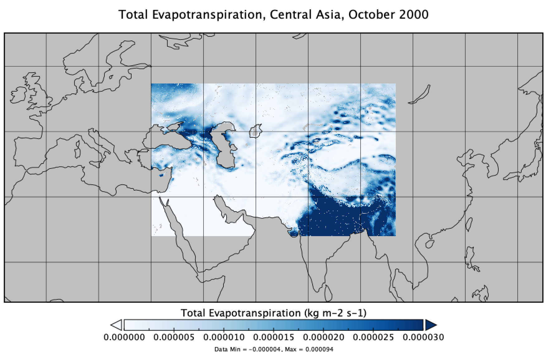
FLDAS Noah Land Surface Model L4 Central Asia Daily 0.01 x 0.01 degree V001 (FLDAS_NOAH001_G_CA_D) at GES DISC
National Aeronautics and Space Administration —
This dataset contains a series of land surface parameters simulated from the Noah 3.6.1 model in the Famine Early Warning Systems Network (FEWS NET) Land Data... -
Federal
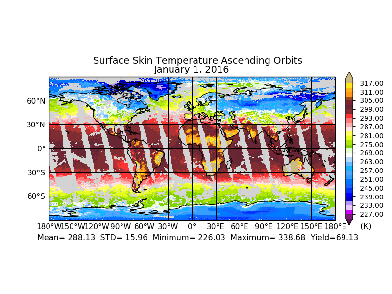
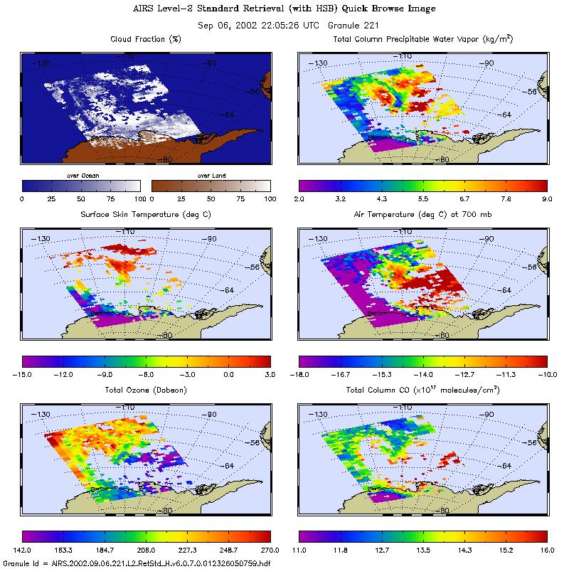
Aqua/AIRS L3 Daily Standard Physical Retrieval (AIRS-only) 1 degree x 1 degree V7.0 at GES DISC
National Aeronautics and Space Administration —
The Atmospheric Infrared Sounder (AIRS) is a grating spectrometer (R = 1200) aboard the second Earth Observing System (EOS) polar-orbiting platform, EOS Aqua. The... -
Federal
Sounder SIPS: JPSS-1 ATMS Level 2 RAMSES2 Standard: Atmosphere, precipitation and surface geophysical state V3 (SNDRJ1ML2RMS) at GES DISC
National Aeronautics and Space Administration —
This level 2 product is generated by the RAMSES (Retrieval Algorithm for Microwave Sounders in Earth Science II algorithm.The RAMSES II algorithm is a microwave only... -
Federal
Sounder SIPS: Suomi NPP ATMS Level 2 RAMSES2 Standard: Atmosphere, precipitation and surface geophysical state, V3 (SNDRSNML2RMS ) at GES DISC
National Aeronautics and Space Administration —
This level 2 product is generated by the RAMSES (Retrieval Algorithm for Microwave Sounders in Earth Science) II algorithm.The RAMSES II algorithm is a microwave only... -
Federal
Aqua/AIRS L3 Daily Standard Physical Retrieval (AIRS+AMSU) 1 degree x 1 degree V7.0 at GES DISC
National Aeronautics and Space Administration —
The Atmospheric Infrared Sounder (AIRS) is a grating spectrometer (R = 1200) aboard the second Earth Observing System (EOS) polar-orbiting platform, EOS Aqua. In... -
Federal
MACPEX WB-57 Aircraft In-situ Meteorology and Navigational Data
National Aeronautics and Space Administration —
MACPEX_MetNav_AircraftInSitu_WB57_Data is the in-situ meteorology and navigational data collection during the Mid-latitude Airborne Cirrus Properties Experiment... -
Federal
HURRICANE AND SEVERE STORM SENTINEL (HS3) GLOBAL HAWK HIGH ALTITUDE MMIC SOUNDING RADIOMETER (HAMSR) V1
National Aeronautics and Space Administration —
The Hurricane and Severe Storm Sentinel (HS3) Global Hawk High Altitude MMIC Sounding Radiometer (HAMSR) dataset includes measurements gathered by the HAMSR... -
Federal
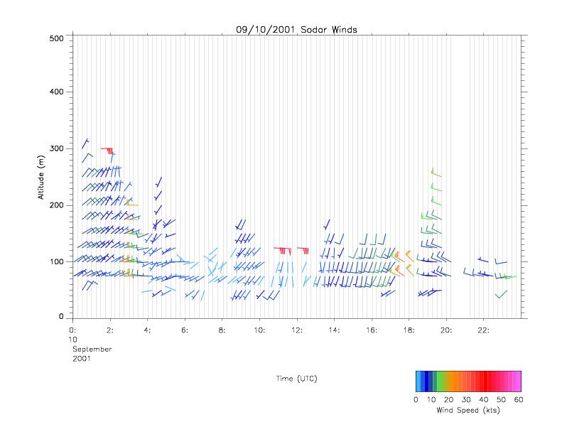
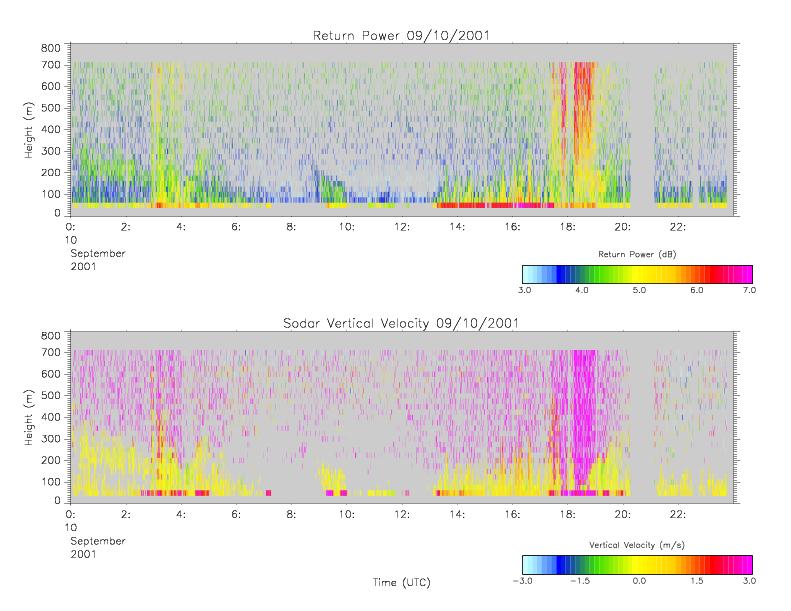
CAMEX-4 MIPS SODAR V1
National Aeronautics and Space Administration —
The University of Alabama in Huntsville (UAH) Mobile Integrated Profiling System (MIPS) is a mobile atmospheric profiling system. It includes a 915 MHz Doppler... -
Federal
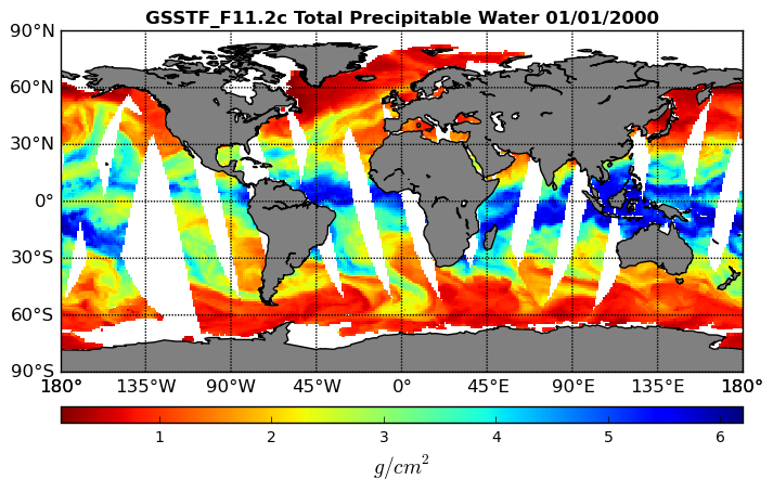
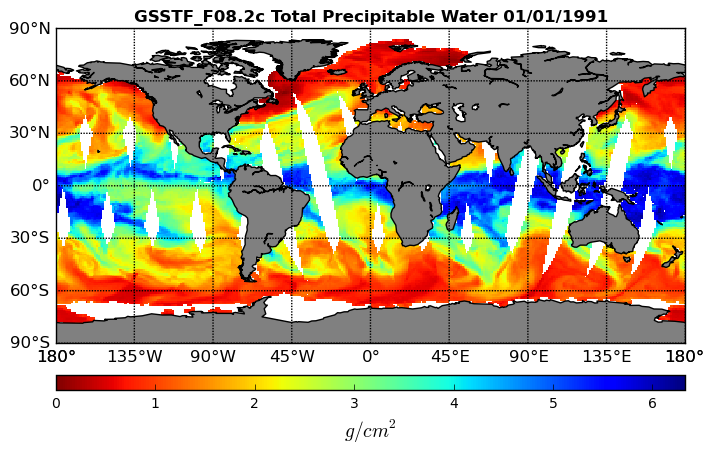
Goddard Satellite-Based Surface Turbulent Fluxes, 1x1 deg Daily Grid, Satellite F11 V2c (GSSTF_F11) at GES DISC
National Aeronautics and Space Administration —
These data are part of the Goddard Satellite-based Surface Turbulent Fluxes Version-2c (GSSTF 2c) Dataset recently produced through a MEaSURES funded project led by... -
Federal
First ISCCP Regional Experiment (FIRE) Cirrus 1 TIROS Operational Vertical Sounder (TOVS) Data
National Aeronautics and Space Administration —
Temperature soundings from the TOVS sensor on NOAA-9 and -10 satellites. Soundings were made for each pixel over the cirrus IFO network. Sounding information contains... -
Federal
AIRS/Aqua L2 Standard Physical Retrieval (AIRS+AMSU+HSB) V006 (AIRH2RET) at GES DISC
National Aeronautics and Space Administration —
The Atmospheric Infrared Sounder (AIRS) is a grating spectrometer (R = 1200) aboard the second Earth Observing System (EOS) polar-orbiting platform, EOS Aqua. In... -
Federal
MOPITT Derived CO (Near and Thermal Infrared Radiances) V009
National Aeronautics and Space Administration —
MOP02J_9 is the Measurements Of Pollution In The Troposphere (MOPITT) Derived Carbon Monoxide (CO) (Near and Thermal Infrared Radiances) version 9 product. It... -
Federal
GEOS-5 FP-IT 3D Time-Averaged Single-Level Diagnostics Geo-Colocated to OMI/Aura VIS 1-Orbit L2 Swath 13x24km V4 (OMVFPSLV) at GES DISC
National Aeronautics and Space Administration —
The GEOS-5 FP-IT 3D Time-Averaged Single-Level Diagnostics Geo-Colocated to OMI/Aura VIS 1-Orbit L2 Swath 13x24km (OMVFPSLV) provides selected parameters from GEOS-5... -
Federal
VIRGAS WB-57 Aircraft In-Situ Meteorology and Navigation Data
National Aeronautics and Space Administration —
VIRGAS_MetNav_AircraftInSitu_Data are the meteorology and navigational data collected during the Volcano-plume Investigation Readiness and Gas-phase and Aerosol... -
Federal
GPM GROUND VALIDATION WYOMING KING AIR CLOUD MICROPHYSICS LPVEX V1
National Aeronautics and Space Administration —
The GPM Ground Validation Wyoming King Air Cloud Microphysics LPVEx dataset includes, in addition to aircraft parameters, many scientific parameters, such as static... -
Federal
FIREX-AQ NOAA-CHEM Twin Otter In Situ Meteorological and Navigational Data
National Aeronautics and Space Administration —
FIREXAQ_MetNav_AircraftInSitu_N48_Data are in situ meteorological and navigational data collected onboard the NOAA-CHEM Twin Otter during FIREX-AQ. This product... -
Federal
SAGE III/ISS L2 Solar Event Species Profiles (HDF5) V052
National Aeronautics and Space Administration —
g3bssp_52 is the Stratospheric Aerosol and Gas Experiment III (SAGE III) on the International Space Station (ISS) (SAGE III/ISS) Level 2 Solar Event Species Profiles... -
Federal
GLDAS Noah Land Surface Model L4 3 hourly 1.0 x 1.0 degree V2.1 (GLDAS_NOAH10_3H) at GES DISC
National Aeronautics and Space Administration —
NASA Global Land Data Assimilation System Version 2 (GLDAS-2) has three components: GLDAS-2.0, GLDAS-2.1, and GLDAS-2.2. GLDAS-2.0 is forced entirely with the... -
Federal
Goddard Satellite-Based Surface Turbulent Fluxes, 1x1 deg Daily Grid, Satellite F08 V2c (GSSTF_F08) at GES DISC
National Aeronautics and Space Administration —
These data are part of the Goddard Satellite-based Surface Turbulent Fluxes Version-2c (GSSTF 2c) Dataset recently produced through a MEaSURES funded project led by... -
Federal
CERES and GEO-Enhanced TOA, Within-Atmosphere and Surface Fluxes, Clouds and Aerosols 1-Hourly Terra-NOAA20 Edition4A NGDA
National Aeronautics and Space Administration —
CER_SYN1deg-1Hour_Terra-NOAA20-MODIS_Edition4A is the Clouds and the Earth's Radiant Energy System (CERES) and geostationary (GEO) Top-of-Atmosphere (TOA) Within-...

Official websites use .gov
A
.gov website belongs to an official government
organization in the United States.
Secure .gov websites use HTTPS
A
lock (
) or https:// means you’ve safely connected to
the .gov website. Share sensitive information only on official,
secure websites.