
-
Federal
West Africa Coastal Vulnerability Mapping: Subset of High and Low Resolution Altimeter Corrected Elevations 2 (ACE2)
National Aeronautics and Space Administration —
The West Africa Coastal Vulnerability Mapping: Subset of High and Low Resolution Altimeter Corrected Elevations 2 (ACE2) data set consists of extracts from the 3 arc-... -
Federal
West Africa Coastal Vulnerability Mapping: Mangrove Forests Distribution, 2000 Polygon
National Aeronautics and Space Administration —
The West Africa Coastal Vulnerability Mapping: Mangrove Forests Distribution, 2000 Polygon data set was derived from the 30m resolution NASA Socioeconomic Data and... -
Federal
Global Reservoir and Dam Database, Version 1 (GRanDv1): Reservoirs, Revision 01
National Aeronautics and Space Administration —
Global Reservoir and Dam Database, Version 1, Revision 01 (v1.01) contains 6,862 records of reservoirs and their associated dams with a cumulative storage capacity of... -
Federal
Compendium of Environmental Sustainability Indicator Collections: The Wellbeing of Nations
National Aeronautics and Space Administration —
The Wellbeing of Nations portion of the Compendium of Environmental Sustainability Indicator Collections contains a subset of 123 variables assembled from the... -
Federal
Global Earthquake Proportional Economic Loss Risk Deciles
National Aeronautics and Space Administration —
The Global Earthquake Proportional Economic Loss Risk Deciles is a 2.5 minute grid of earthquake hazard economic loss as proportions of Gross Domestic Product (GDP)... -
Federal
F00500: NOS Hydrographic Survey , Lake Superior-Duluth/Superior and Two Harbors, 2004-07-19
National Oceanic and Atmospheric Administration, Department of Commerce —
The National Oceanic and Atmospheric Administration (NOAA) has the statutory mandate to collect hydrographic data in support of nautical chart compilation for safe... -
Federal
AIRS/Aqua L1B Near Real Time (NRT) AMSU (A1/A2) geolocated and calibrated brightness temperatures V005 (AIRABRAD_NRT) at GES DISC
National Aeronautics and Space Administration —
The AMSU-A Level 1B Near Real Time (NRT) product (AIRABRAD_NRT_005) differs from the routine product (AIRABRAD_005) in 2 ways to meet the three hour latency... -
Federal
OCO-3 Level 2 CO2 prior based on CO2 monthly flask record, global meteorology, and age of air, Forward Processing V10 (OCO3_L2_CO2Prior) at GES DISC
National Aeronautics and Space Administration —
Version 10 is the current version of the data set. Older versions will no longer be available and are superseded by Version 10. The Orbiting Carbon Observatory -3... -
Federal
Gridded Population of the World, Version 3 (GPWv3): Population Count Grid, Future Estimates
National Aeronautics and Space Administration —
The Gridded Population of the World, Version 3 (GPWv3): Population Count Grid, Future Estimates consists of estimates of human population for the years 2005, 2010,... -
Federal
Georeferenced Population Datasets of Mexico (GEO-MEX): Raster Based GIS Coverage of Mexican Population
National Aeronautics and Space Administration —
The Raster Based GIS Coverage of Mexican Population is a gridded coverage (1 x 1 km) of Mexican population. The data were converted from vector into raster. The... -
Federal
Natural Resource Management Index (NRMI), 2010 Release
National Aeronautics and Space Administration —
The Natural Resource Management Index (NRMI), 2010 Release is a composite index for 157 countries derived from the average of four proximity-to-target indicators for... -
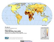
Federal
Poverty Mapping Project: Global Subnational Infant Mortality Rates
National Aeronautics and Space Administration —
The Poverty Mapping Project: Global Subnational Infant Mortality Rates data set consists of estimates of infant mortality rates for the year 2000. The infant... -
Federal
Data from: Genetic mapping and QTL analysis for peanut smut resistance
Department of Agriculture —
This collection contains supplementary information for the manuscript “Genetic mapping and QTL analysis for peanut smut resistance”, which reports the genetic map and... -
Federal
SWOT Level 2 Lake Single-Pass Vector Obs Data Product, Version 2.0
National Aeronautics and Space Administration —
The SWOT Level 2 Lake Single-Pass Vector Obs Data Product from the Surface Water Ocean Topography (SWOT) mission provides water surface elevation, area, storage... -
Federal
Global Drought Total Economic Loss Risk Deciles
National Aeronautics and Space Administration —
The Global Drought Total Economic Loss Risk Deciles is a 2.5 minute grid of global drought total economic loss risks. A process of spatially allocating Gross Domestic... -
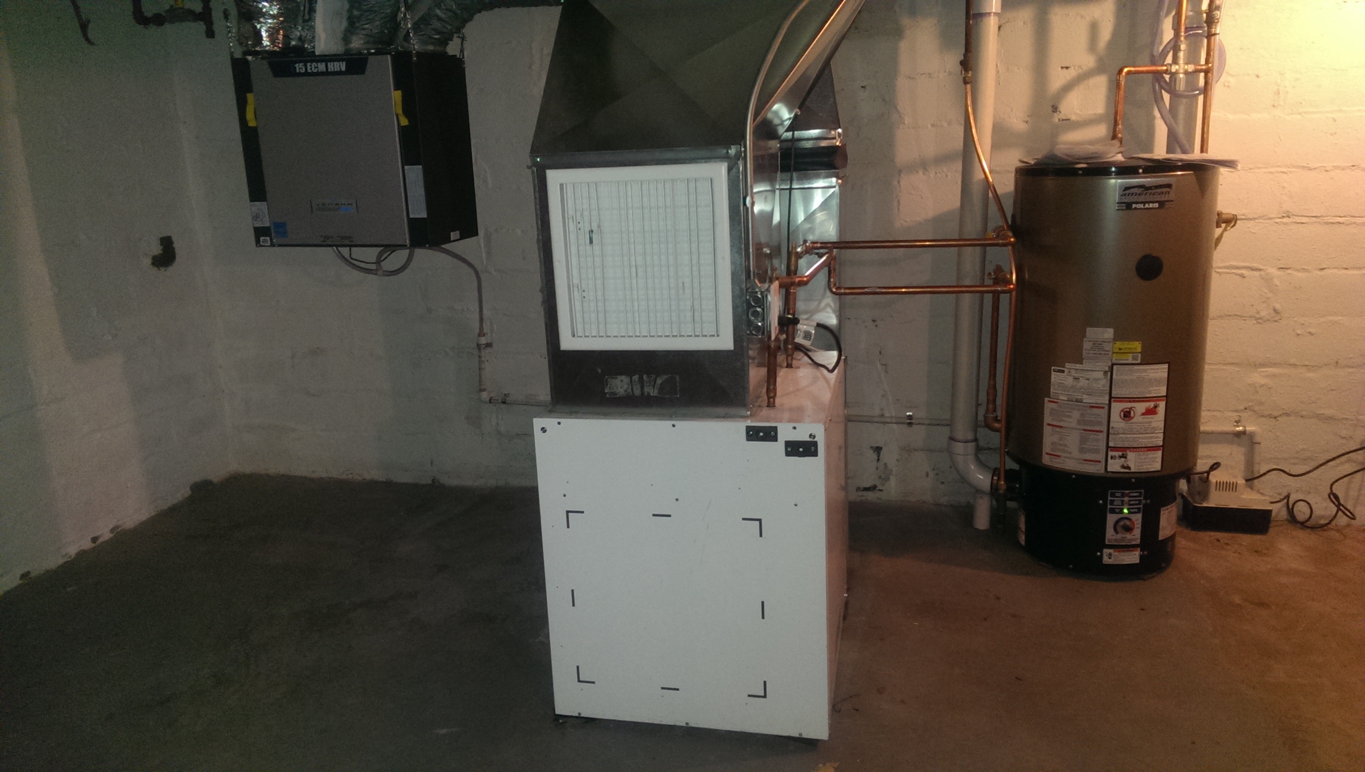
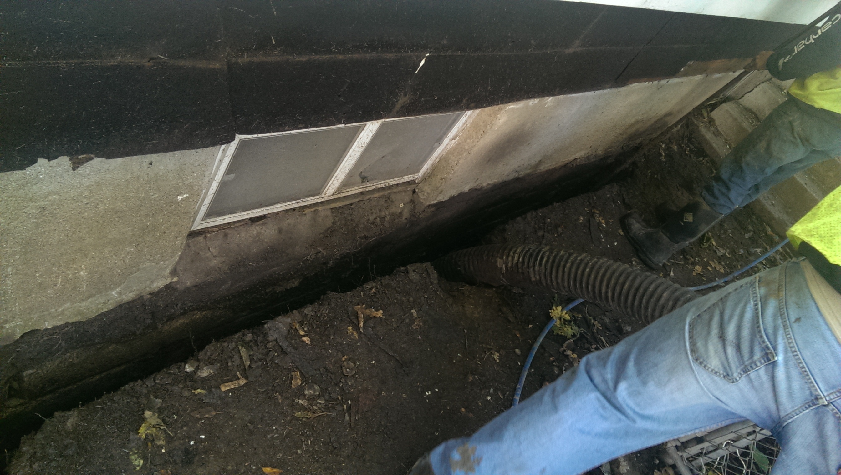
Federal
NorthernSTAR 1.5-Story Demonstration House of Cold Climate Solutions for Affordable Housing
Department of Energy —
This is a NorthernSTAR renovation project for Urban Homeworks incorporating installation of a combination space and water heater, Overcoat insulation retrofit on the... -
Federal
West Africa Coastal Vulnerability Mapping: Commercial Crop Production, 2000
National Aeronautics and Space Administration —
The West Africa Coastal Vulnerability Mapping: Commercial Crop Production, 2000 data set includes 5-minute rasters of crop production in metric tons per grid cell for... -
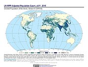
Federal
Gridded Population of the World, Version 4 (GPWv4): Population Count Adjusted to Match 2015 Revision of UN WPP Country Totals, Revision 11
National Aeronautics and Space Administration —
The Gridded Population of the World, Version 4 (GPWv4): Population Count Adjusted to Match 2015 Revision of UN WPP Country Totals, Revision 11 consists of estimates... -
Federal
ASTER L1A Reconstructed Unprocessed Instrument Data V003
National Aeronautics and Space Administration —
The Advanced Spaceborne Thermal Emission and Reflection Radiometer (ASTER) Level 1A (AST_L1A) contains reconstructed, instrument digital numbers (DNs) derived from... -
Federal
H13252: NOS Hydrographic Survey , 2019-09-03
National Oceanic and Atmospheric Administration, Department of Commerce —
The National Oceanic and Atmospheric Administration (NOAA) has the statutory mandate to collect hydrographic data in support of nautical chart compilation for safe...

Official websites use .gov
A
.gov website belongs to an official government
organization in the United States.
Secure .gov websites use HTTPS
A
lock (
) or https:// means you’ve safely connected to
the .gov website. Share sensitive information only on official,
secure websites.