
-
Federal
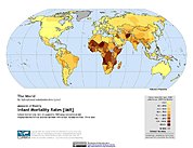
Poverty Mapping Project: Global Subnational Infant Mortality Rates
National Aeronautics and Space Administration —
The Poverty Mapping Project: Global Subnational Infant Mortality Rates data set consists of estimates of infant mortality rates for the year 2000. The infant... -
Federal
Poverty Mapping Project: Small Area Estimates of Poverty and Inequality
National Aeronautics and Space Administration —
The Poverty Mapping Project: Small Area Estimates of Poverty and Inequality data set consists of consumption-based poverty, inequality and related measures for... -
Federal
SWOT Level 2 Water Mask Raster Image 250m Data Product, Version 2.0
National Aeronautics and Space Administration —
The SWOT Level 2 Water Mask Raster Image 250m Data Product from the Surface Water Ocean Topography (SWOT) mission provides global surface water elevation and... -
Federal
Data and code from: AI-based image profiling and detection for the beetle byte quintet using Vision Transformer (ViT) in advanced stored product infestation monitoring
Department of Agriculture —
Managing beetles that infest stored products is crucial for reducing losses in harvest supply chains and improving food security and safety. Successful pest... -
Federal
MetOp-C ASCAT Level 2 Ocean Surface Wind Vectors Optimized for Coastal Ocean
National Aeronautics and Space Administration —
This dataset contains operational near-real-time Level 2 coastal ocean surface wind vector retrievals from the Advanced Scatterometer (ASCAT) on MetOp-C at 12.5 km... -
Federal
Aviation Safety 2009 IVHM Posters
National Aeronautics and Space Administration —
Posters form 2009 Aviation Safety Technical Conference -
Federal
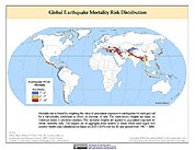
Global Earthquake Mortality Risks and Distribution
National Aeronautics and Space Administration —
The Global Earthquake Mortality Risks and Distribution is a 2.5 minute grid of global earthquake mortality risks. Gridded Population of the World, Version 3 (GPWv3)... -
Federal
MODIS/Terra Vegetation Continuous Fields Yearly L3 Global 250m SIN Grid V061
National Aeronautics and Space Administration —
The MOD44B Version 6.1 Vegetation Continuous Fields (VCF) yearly product is a global representation of surface vegetation cover as gradations of three ground cover... -
Federal
Intelligent Temporal Data Driven World Actuation in Ambient Environments Case Study: Anomaly Recognition and Assistance Provision in Smart Home
National Aeronautics and Space Administration —
Abstract — A possible resident of smart home is an old person or an Alzheimer patient that should be assisted continuously for the rest of his life; however, normally... -
Federal
West Africa Coastal Vulnerability Mapping: Social Vulnerability Indices
National Aeronautics and Space Administration —
The West Africa Coastal Vulnerability Mapping: Social Vulnerability Indices data set includes three indices: Social Vulnerability, Population Exposure, and Poverty... -
Federal
ASTER Global Emissivity Dataset, Monthly, 0.05 deg, HDF5 V041
National Aeronautics and Space Administration —
The Terra Advanced Spaceborne Thermal Emission and Reflection Radiometer (ASTER) Global Emissivity Dataset (GED) is a collection of monthly files (see known issues... -
Federal
Natural Resource Protection and Child Health Indicators, 2023 Release
National Aeronautics and Space Administration —
The Natural Resource Protection and Child Health Indicators, 2023 Release, is produced in support of the U.S. Millennium Challenge Corporation as selection criteria... -
Federal
A Global Database of Gas Fluxes from Soils after Rewetting or Thawing, Version 1.0
National Aeronautics and Space Administration —
This database contains information compiled from published studies on gas flux from soil following rewetting or thawing. The resulting database includes 222 field and... -
Federal
H10616: NOS Hydrographic Survey , Rhode Island Sound Corridor, Rhode Island, 1995-09-29
National Oceanic and Atmospheric Administration, Department of Commerce —
The National Oceanic and Atmospheric Administration (NOAA) has the statutory mandate to collect hydrographic data in support of nautical chart compilation for safe... -
Federal
Compendium of Environmental Sustainability Indicator Collections: Rio to Johannesburg Dashboard of Sustainable Indicators
National Aeronautics and Space Administration —
The Rio to Johannesburg Dashboard of Sustainable Development Indicators portion of the Compendium of Environmental Sustainability Indicator Collections contains 35... -
Federal
Vegetation Index and Phenology (VIP) Vegetation Indices 7Days Global 0.05Deg CMG V004
National Aeronautics and Space Administration —
The NASA Making Earth System Data Records for Use in Research Environments (MEaSUREs) Vegetation Index and Phenology (VIP) global datasets were created using Advanced... -
Federal
CAR ARCTAS BRDF Measurements V2 (CAR_ARCTAS_BRDF) at GES DISC
National Aeronautics and Space Administration —
ARCTAS focuses on advancing understanding of the factors driving current changes in the Arctic region including transport of mid-latitude pollution, boreal forest... -
Federal
SASSIE Arctic Field Campaign Shipboard Castaway CTD Data Fall 2022 Version 1
National Aeronautics and Space Administration —
The Salinity and Stratification at the Sea Ice Edge (SASSIE) project is a NASA experiment that aims to understand how salinity anomalies in the upper ocean generated... -
Federal
SHIFT: Laboratory Foliar Chemical Analysis Results for Field Samples, CA, 2022
National Aeronautics and Space Administration —
This dataset holds laboratory foliar chemical analyses results for field samples collected during the 2022 NASA Surface Biology Geology (SBG) High Frequency Time... -
Federal
PhenoCam Dataset v3.0: Vegetation Phenology from Digital Camera Imagery, 2000-2023
National Aeronautics and Space Administration —
This dataset provides vegetation phenological observations for 738 sites across diverse ecosystems of the world (mostly North America) from 2000 to 2023. The...

Official websites use .gov
A
.gov website belongs to an official government
organization in the United States.
Secure .gov websites use HTTPS
A
lock (
) or https:// means you’ve safely connected to
the .gov website. Share sensitive information only on official,
secure websites.
.jpg)