
-
Federal
UARS Cryogenic Limb Array Etalon Spectrometer (CLAES) Level 3AL V009 (UARCL3AL) at GES DISC
National Aeronautics and Space Administration —
The Cryogenic Limb Array Etalon Spectrometer (CLAES) Level 3AL data product consists of daily, 4 degree increment latitude-ordered vertical profiles of temperature... -
Federal
Sentinel-5P TROPOMI Near-Real-Time (NRT) Sulphur Dioxide SO2 1-Orbit L2 5.5km x 3.5km V2 (S5P_L2__SO2____HiR_NRT) at GES DISC
National Aeronautics and Space Administration —
The Sentinel-5P TROPOMI Near Real Time (NRT) Sulphur Dioxide SO2 1-Orbit L2 5.5km x 3.5km V2 (S5P_L2__SO2_HiRNRT) at GES DISC is the near real time version of the... -
Federal
THIR/Nimbus-7 Level 1 Cloud Data for SBUV/TOMS V001 (THIRN7L1BCLT) at GES DISC
National Aeronautics and Space Administration —
THIRN7L1BCLT is the Nimbus-7 Temperature-Humidity Infrared Radiometer (THIR) Level 1 Cloud Data for SBUV/TOMS (BCLT) product and contains total cloud amounts;... -
Federal
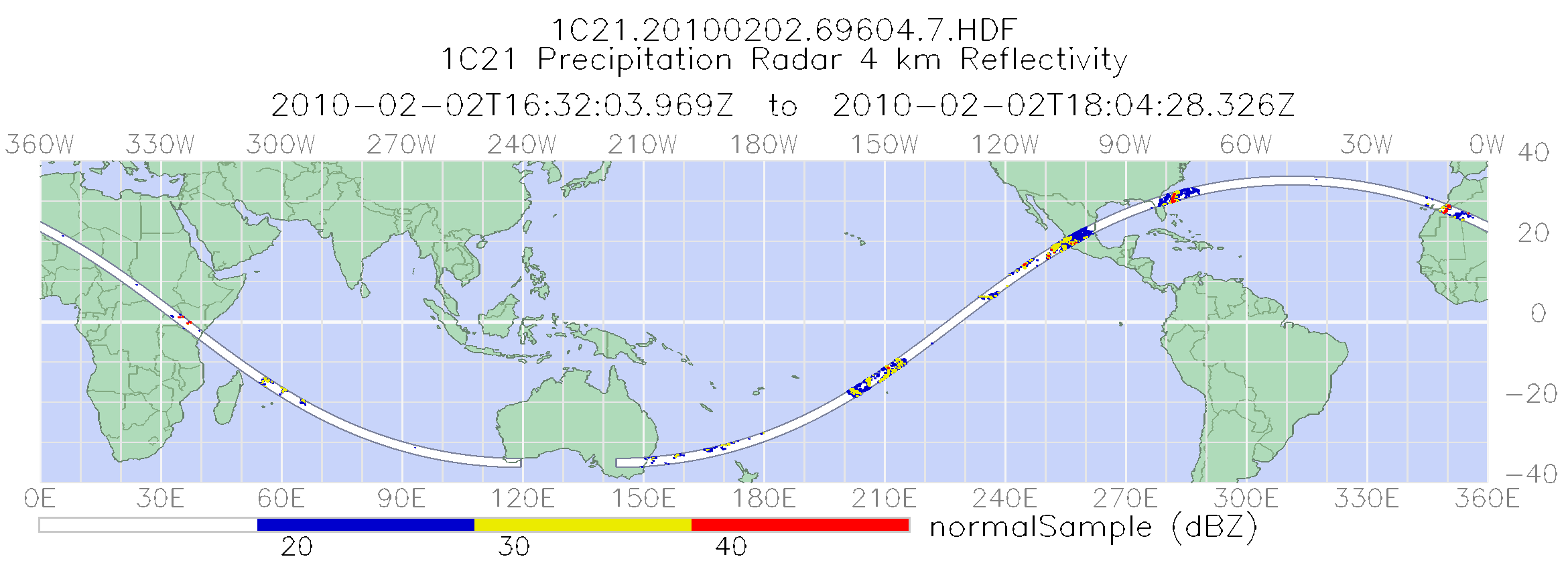
TRMM Precipitation Radar Power and Reflectivity L1C 1.5 hours V7 (TRMM_1C21) at GES DISC
National Aeronautics and Space Administration —
The TRMM Precipitation Radar (PR), the first of its kind in space, is an electronically scanning radar, operating at 13.8 GHz that measures the 3-D rainfall... -
Federal
UARS Solar Ultraviolet Spectral Irradiance Monitor (SUSIM) Level 3BS V022 (UARSU3BS) at GES DISC
National Aeronautics and Space Administration —
The Solar Ultraviolet Spectral Irradiance Monitor (SUSIM) Level 3BS data product consists of daily, 1 nm resolution, solar spectral irradiances and selected solar... -
Federal
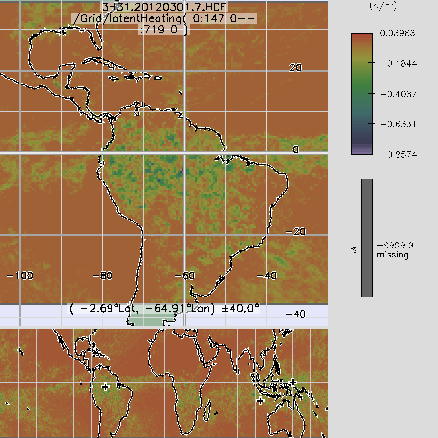
TRMM TMI/PR Combined Convective Stratiform Heating L3 1 month 0.5 degree x 0.5 degree V7 (TRMM_3H31) at GES DISC
National Aeronautics and Space Administration —
3H31, "Monthly Convective Stratiform Heating from Combined", produces 0.5 deg x 0.5 deg monthly apparent heating profiles from surface convective rainfall rate and... -
Federal
OCO-3 Level 2 geolocated XCO2 retrieval results and algorithm diagnostic information, Forward Processing V10 (OCO3_L2_Diagnostic) at GES DISC
National Aeronautics and Space Administration —
Version 10 is the current version of the data set. Older versions will no longer be available and are superseded by Version 10. The Orbiting Carbon Observatory -3... -
Federal
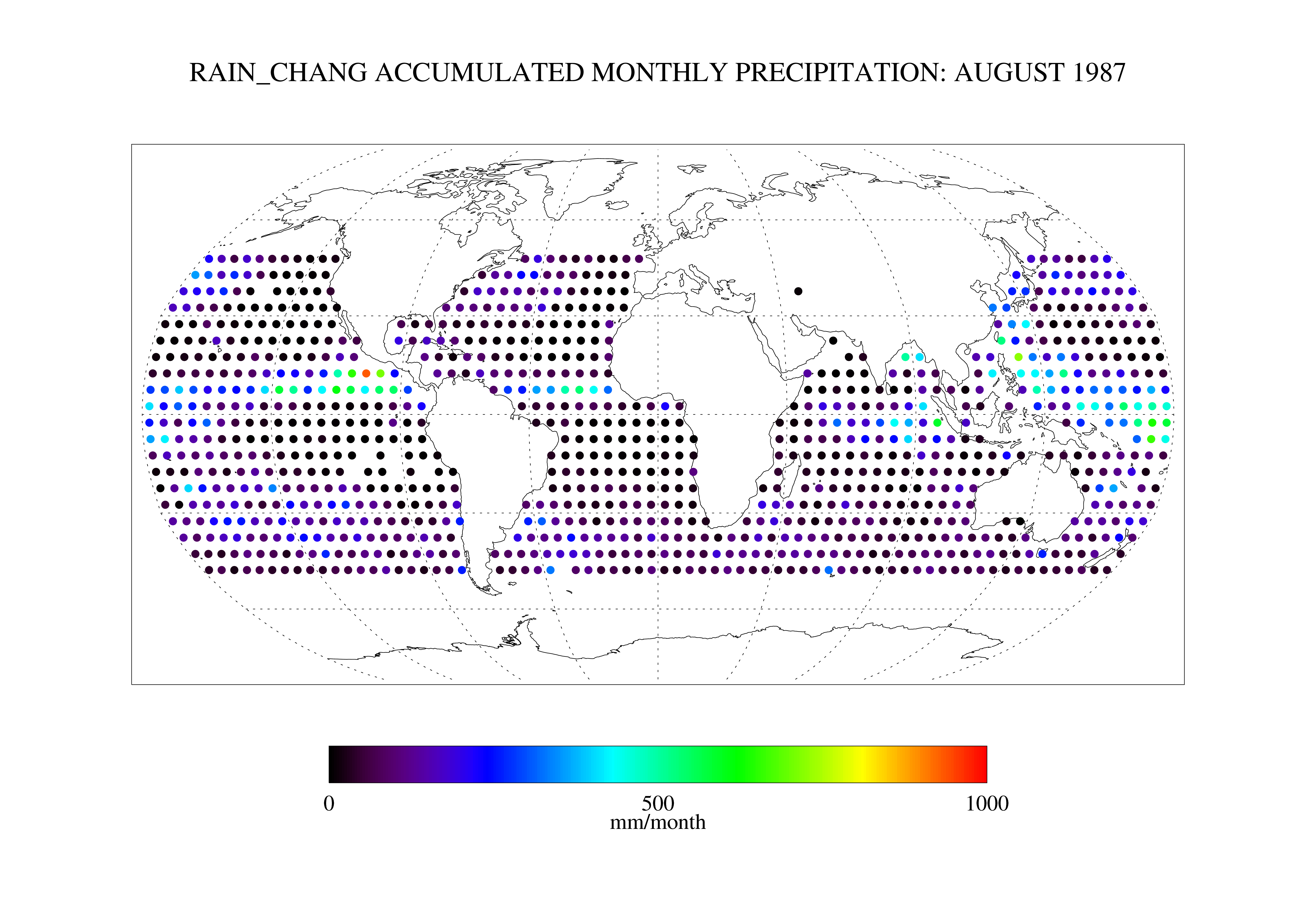
Chang SSM/I Derived Monthly Rain Indices 5 x 5 degree V2.3 (RAIN_CHANG) at GES DISC
National Aeronautics and Space Administration —
These data are transitioned to a state of permanent preservation. They are available upon request. More advanced datasets have been developed since. One recommended... -
Federal
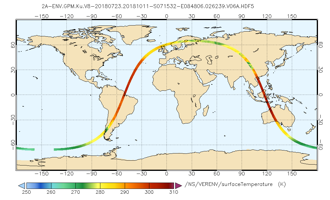
GPM DPR Ku Environment L2A 1.5 hours 5 km V07 (GPM_2AKuENV) at GES DISC
National Aeronautics and Space Administration —
Version 07 is the current version of the data set. Older versions will no longer be available and have been superseded by Version 07. . This is environmental data... -
Federal
OCO-3 Level 2 meteorological parameters interpolated from global assimilation model for each sounding, Forward Processing V10 (OCO3_L2_Met) at GES DISC
National Aeronautics and Space Administration —
Version 10 is the current version of the data set. Older versions will no longer be available and are superseded by Version 10. The Orbiting Carbon Observatory -3... -
Federal
Sentinel-5P TROPOMI Radiance product band 5 (NIR detector) L1B 5.5km x 3.5km V2 (S5P_L1B_RA_BD5_HiR) at GES DISC
National Aeronautics and Space Administration —
Starting from August 6th in 2019, Sentinel-5P TROPOMI along-track high spatial resolution (~5.5km at nadir) has been implemented. For data before August 6th of 2019,... -
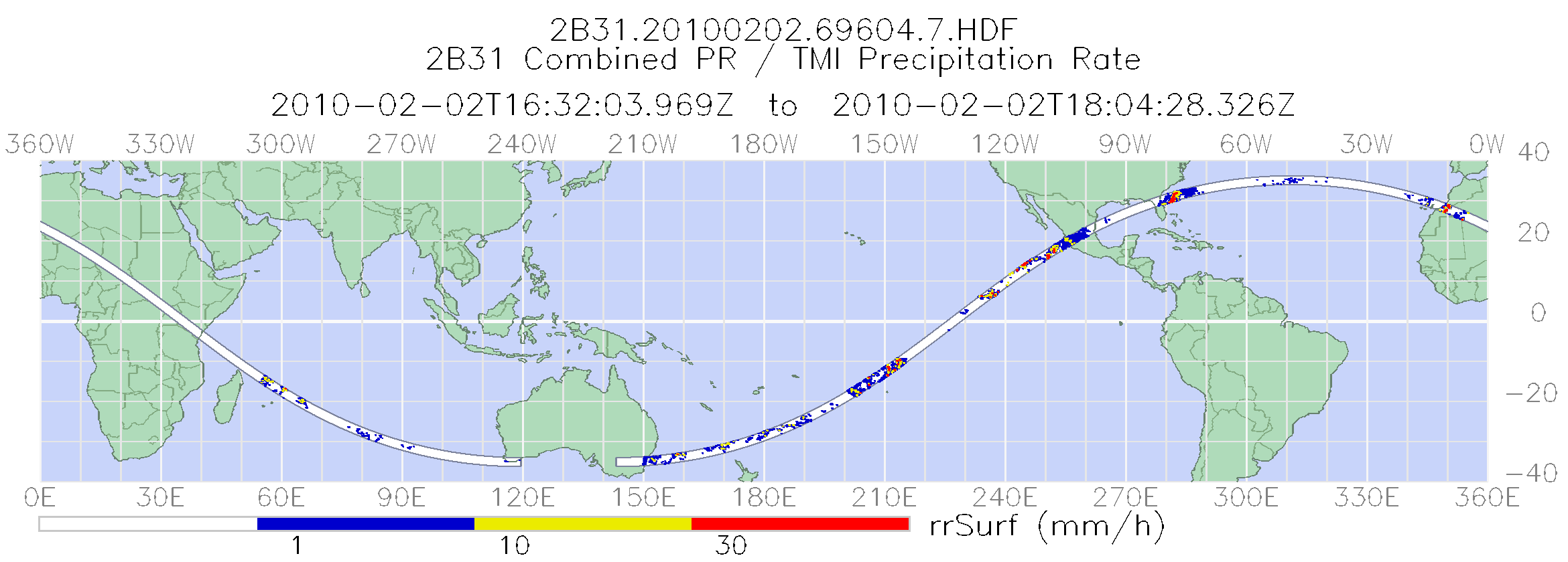
Federal
TRMM Combined Precipitation Radar and Microwave Imager Rainfall Profile L2 1.5 hours V7 (TRMM_2B31) at GES DISC
National Aeronautics and Space Administration —
The TRMM combined algorithm (2B31) combines data from the TMI and PR to produce the best rain estimate for TRMM. This combined rainfall product is derived from... -
Federal
UARS High Resolution Doppler Imager (HRDI) Level 3AT V011 (UARHR3AT) at GES DISC
National Aeronautics and Space Administration —
The High Resolution Doppler Imager (HRDI) Level 3AT data product consists of daily, 65.536 second interval time-ordered vertical profiles of meridional and zonal wind... -
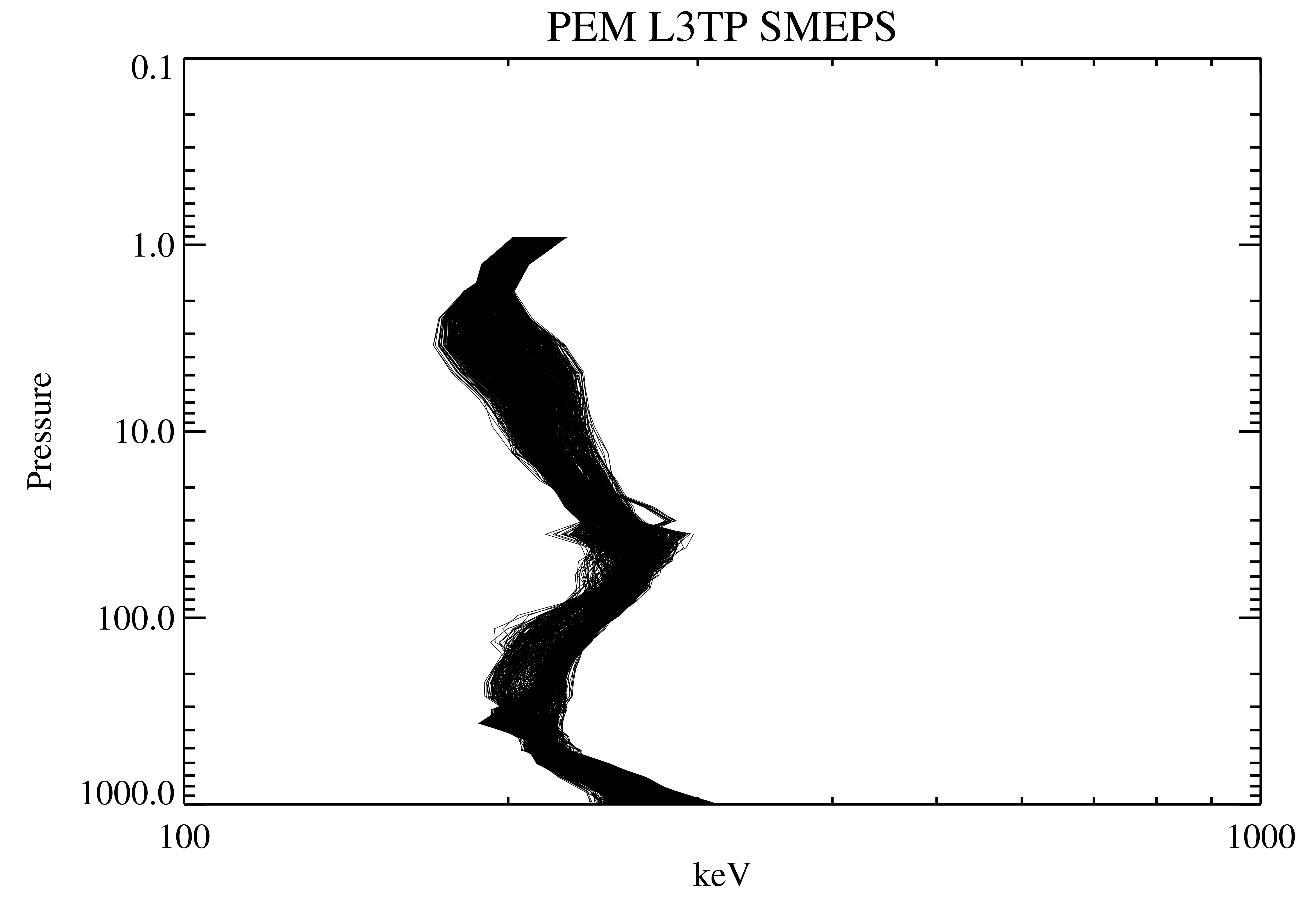
Federal
UARS PEM Level 2 AXIS 1 V001 (UARPE2AXIS1) at GES DISC
National Aeronautics and Space Administration —
The UARS Particle Environment Monitor (PEM) level 2 Atmosphere X-Ray Imaging Spectrometer (AXIS) unit 1 daily product contains the X-ray high-resolution spectral data... -
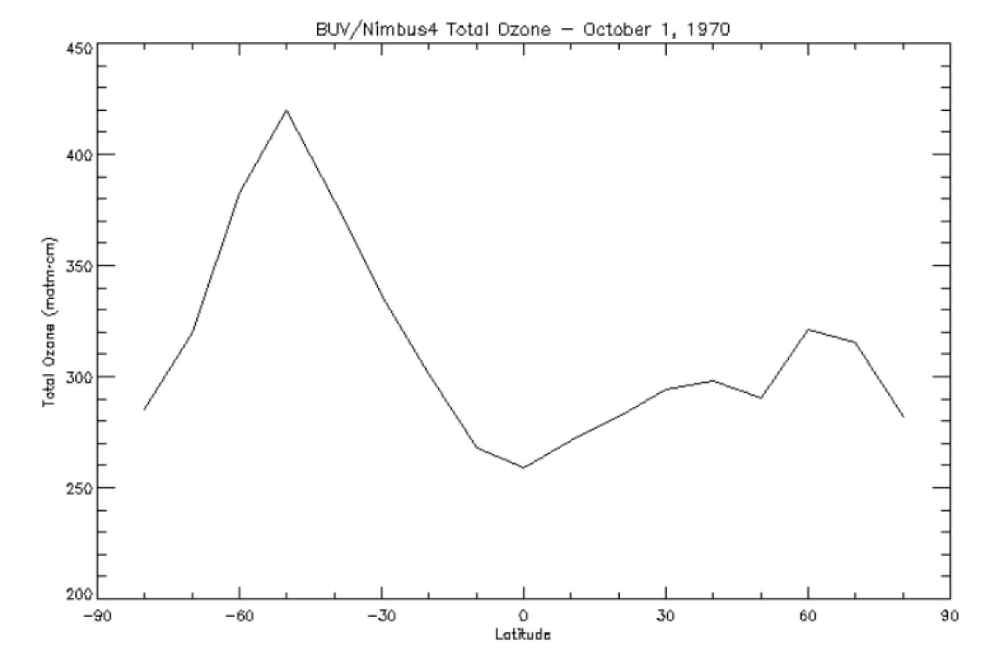
Federal
BUV/Nimbus-4 Level 3 Ozone Zonal Means V005 (BUVN4L3ZMT) at GES DISC
National Aeronautics and Space Administration —
The Nimbus-4 BUV Level 3 Ozone Zonal Means collection or ZMT contains total ozone, reflectivities, and ozone mixing ratios averaged in 10 degree latitude zones... -
Federal
UARS PEM Level 2 HEPS B V001 (UARPE2HEPSB) at GES DISC
National Aeronautics and Space Administration —
The Particle Environment Monitor (PEM) level 2 High-Energy Particle Spectrometer (HEPS) B daily product contains the electron high-resolution spectral data converted... -
Federal
OCO-3 Level 2 spatially ordered geolocated retrievals screened using the IMAP-DOAS Preprocessor (IDP), Forward Processing V10 (OCO3_L2_IMAPDOAS) at GES DISC
National Aeronautics and Space Administration —
Version 10 is the current version of the data set. Older versions will no longer be available and are superseded by Version 10. The Orbiting Carbon Observatory -3... -
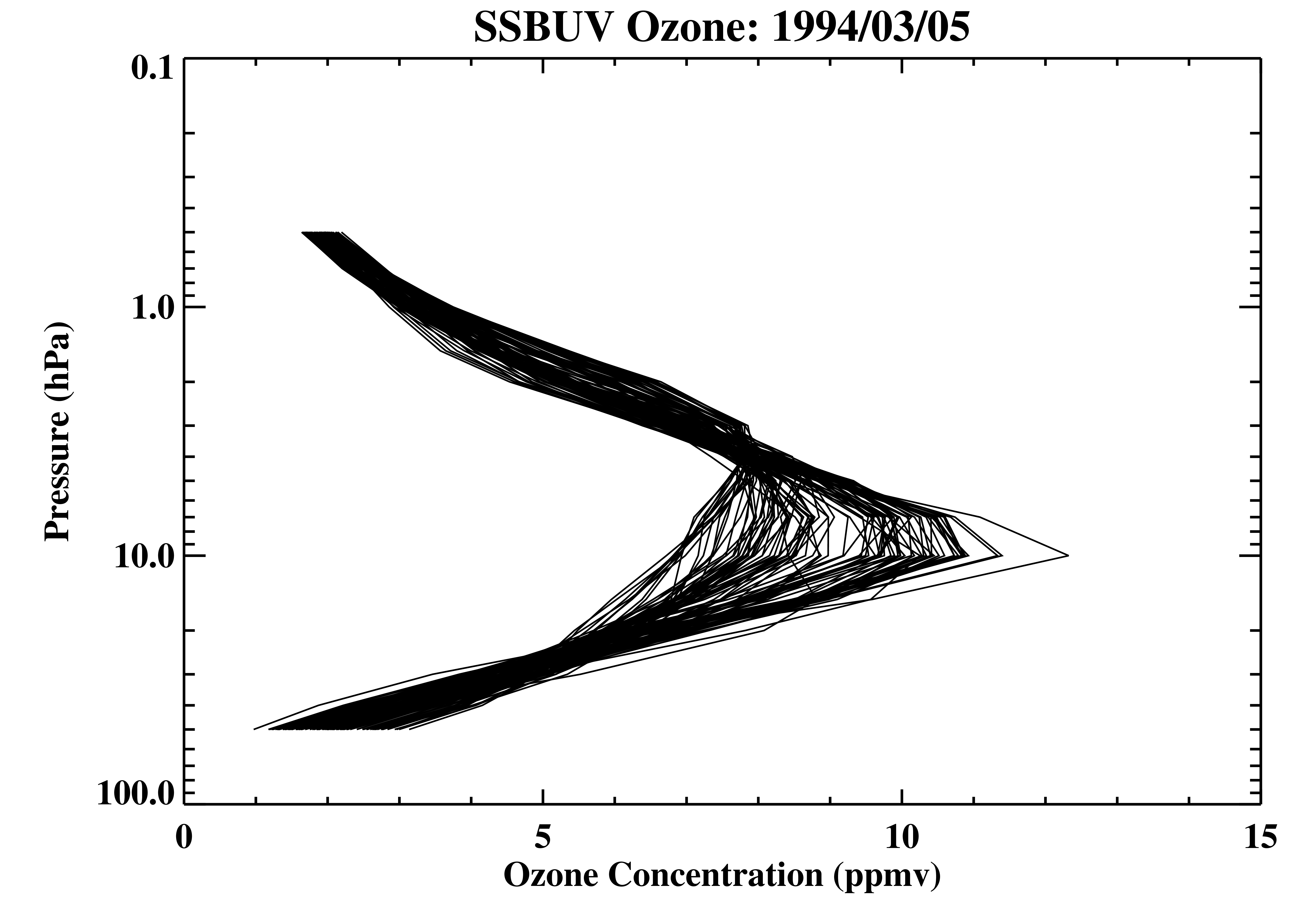
Federal
Shuttle SBUV (SSBUV) Level 2 Ozone Profile and Total Column, Aerosol Index, and UV-Reflectivity V008 (SSBUVO3) at GES DISC
National Aeronautics and Space Administration —
The Shuttle Solar Backscatter Ultraviolet (SSBUV) Level-2 Ozone data are available for eight space shuttle missions flown between 1989 and 1996. SSBUV, a successor to... -
Federal
UARS PEM Level 2 HEPS A V002 (UARPE2HEPSA) at GES DISC
National Aeronautics and Space Administration —
The Particle Environment Monitor (PEM) level 2 High-Energy Particle Spectrometer (HEPS) A daily product contains electron high-resolution spectral data converted to... -
Federal
OCO-3 Level 1B calibrated, geolocated science spectra, Forward Processing V10 (OCO3_L1B_Science) at GES DISC
National Aeronautics and Space Administration —
Version 10 is the current version of the data set. Older versions will no longer be available and are superseded by Version 10. The Orbiting Carbon Observatory -3...

Official websites use .gov
A
.gov website belongs to an official government
organization in the United States.
Secure .gov websites use HTTPS
A
lock (
) or https:// means you’ve safely connected to
the .gov website. Share sensitive information only on official,
secure websites.