
-
Federal
Snowchange Oral History - Work Among the Kolyma River Indigenous Societies in Siberia, Russia, Version 1
National Aeronautics and Space Administration —
This data set includes oral history accounts from Indigenous people participating in the Snowchange project in Siberia, Russia. It provides geographic and... -
Federal
ABoVE: Characterization of Carbon Dynamics in Burned Forest Plots, NWT, Canada, 2014
National Aeronautics and Space Administration —
This dataset provides field data from boreal forests in the Northwest Territories (NWT), Canada, that were burned by wildfires in 2014. During fieldwork in 2015, 211... -
Federal
Global Man-made Impervious Surface (GMIS) Dataset From Landsat
National Aeronautics and Space Administration —
The Global Man-made Impervious Surface (GMIS) Dataset From Landsat consists of global estimates of fractional impervious cover derived from the Global Land Survey... -
Federal
Global Land Cover Characterization Program
National Aeronautics and Space Administration —
The Global Land Cover Characterization Project was established to meet science data requirements identified by the International Geosphere and Biosphere Programme... -
Federal
LBA-ECO LC-14 Modeled Deforestation Scenarios, Amazon Basin: 2002-2050
National Aeronautics and Space Administration —
This data set provides the results of the two modeled scenarios for future patterns of deforestation across the Amazon Basin from 2002 to 2050. This larger defined... -
Federal
ABoVE: Post-Fire and Unburned Vegetation Community and Field Data, NWT, Canada, 2019
National Aeronautics and Space Administration —
This dataset provides vegetation community characteristics, soil moisture, and biophysical data collected in 2019 from 11 study areas, which contained 28 sites that... -
Federal
Land Surface Atmospheric Boundary Interaction Product L3 V1(LANDMET) at GES DISC
National Aeronautics and Space Administration —
This product is a multi-variate data compilation that reconciles the variation scales of these multiple measurements from varies resources, merges and maps them into... -
Federal
LBA-ECO LC-05 Biomass and Soil Properties of Fragmented Forests, Amazonas, Brazil
National Aeronautics and Space Administration —
This data set reports (1) total aboveground dry biomass based on detailed estimates of all live and dead plant material, (2) results from repeated surveys of... -
Federal
National Aggregates of Geospatial Data Collection: Population, Landscape, And Climate Estimates, Version 2 (PLACE II)
National Aeronautics and Space Administration —
The National Aggregates of Geospatial Data Collection: Population, Landscape, And Climate Estimates, Version 2 (PLACE II) data set contains estimates of national-... -
Federal
ABoVE: Subsistence Resource Use Areas of Interior Alaskan Communities, 2011-2017
National Aeronautics and Space Administration —
This dataset provide maps to show the search and harvest areas used by community residents for all subsistence resources combined across Interior Alaska for the years... -
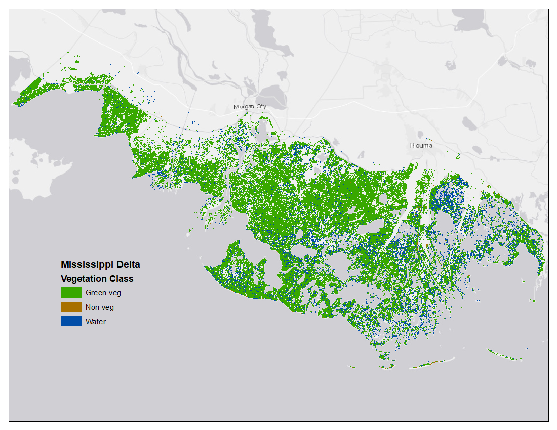
Federal
Vegetation and Open Water High-Resolution Maps for Selected US Tidal Marshes, 2015
National Aeronautics and Space Administration —
This dataset provides maps of tidal marsh green vegetation, non-vegetation, and open water for six estuarine regions of the conterminous United States: Cape Cod, MA;... -
Federal
LBA-ECO ND-30 Fractional Cover of Mixed Land Use Ranches, Para and Rondonia, Brazil
National Aeronautics and Space Administration —
This data set contains images of fractional cover estimates of photosynthetic vegetation (PV) canopy, nonphotosynthetic vegetation (NPV), and exposed soils (S)... -
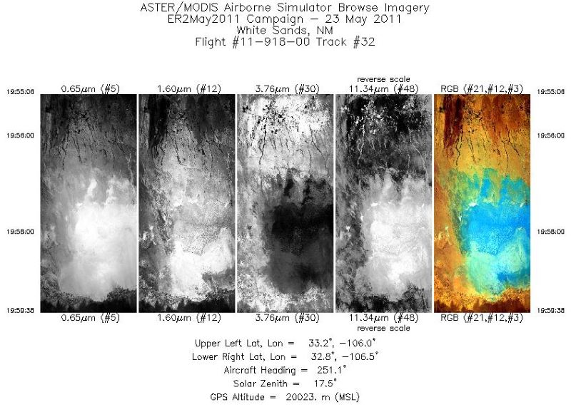
Federal
SAFARI 2000 Pre- and Post-fire Reflectance near Kaoma, Zambia, Dry Season 2000
National Aeronautics and Space Administration —
The main goal of this study was to analyze the possibility of estimating combustion completeness based on fire-induced spectral reflectance changes of surface... -
Federal
LBA-ECO LC-01 Landsat TM Land Use/Land Cover, Northern Ecuadorian Amazon: 1986-1999
National Aeronautics and Space Administration —
This data set contains Landsat TM imagery for the years 1986, 1989, 1996, and 1999, that have been classified into four land use/land cover (LULC) classes: Forest,... -
Federal
LBA-ECO LC-01 Topographic Data for Intensive Study Areas, Northern Ecuadorian Amazon
National Aeronautics and Space Administration —
This data set contains topographic/geomorphological data associated with the four Intensive Study Areas (ISAs) in the Northern Ecuadorian Amazon (northern Oriente)... -
Federal
Aboveground Biomass, Landcover, and Degradation, Kalimantan Forests, Indonesia, 2014
National Aeronautics and Space Administration —
This dataset provides estimates of aboveground biomass, percent canopy cover, mean canopy height, landcover, and forest degradation index products for forests in... -
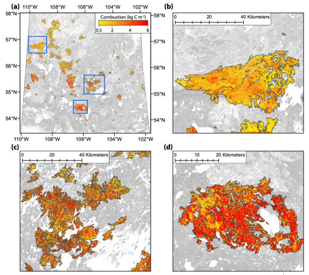
Federal
ABoVE: Spatial Estimates of Carbon Combustion from Wildfires across SK, Canada, 2015
National Aeronautics and Space Administration —
This dataset provides spatial estimates of carbon combustion from all 2015 wildfire burned areas across Saskatchewan, Canada, on a 30-m grid. Carbon combustion (kg... -
Federal
ABoVE: Burn Severity of Soil Organic Matter, Northwest Territories, Canada, 2014-2015
National Aeronautics and Space Administration —
This dataset provides maps at 30-m resolution of landscape surface burn severity (surface litter and soil organic layers) from the 2014-2015 fires in the Northwest...

Official websites use .gov
A
.gov website belongs to an official government
organization in the United States.
Secure .gov websites use HTTPS
A
lock (
) or https:// means you’ve safely connected to
the .gov website. Share sensitive information only on official,
secure websites.