
-
City
Population Under 5
City of Ferndale, Michigan —
These Demographic Data are U.S. Census American Community Survey Data, from the 2014 5-year set. Data Driven Detroit calculated densities (Per Sq Mile) by dividing... -
Federal
Global Land Cover Mapping and Estimation Yearly 30 m V001
National Aeronautics and Space Administration —
NASA's Making Earth System Data Records for Use in Research Environments (MEaSUREs)... -
County
Pittsburgh SNAP Census Data
Allegheny County / City of Pittsburgh / Western PA Regional Data Center —
City of Pittsburgh SNAP census data 2010. -
State
State Responsibility Areas
State of California —
CAL FIRE has a legal responsibility to provide fire protection on all State Responsibility Area (SRA) lands, which are defined based on land ownership, population... -
State
MCNA - Population Points with T/D Standards
State of California —
Updated 10/6/2022: In the Time/Distance analysis process, points that were found to have been included initially, but with no significant or year-round population... -
Federal
Last of the Wild Project, Version 2, 2005 (LWP-2): Global Human Footprint Dataset (Geographic)
National Aeronautics and Space Administration —
The Global Human Footprint Dataset of the Last of the Wild Project, Version 2, 2005 (LWP-2) is the Human Influence Index (HII) normalized by biome and realm. The HII... -
Federal
2021 Miller Woods, IN Natural Color, Color Infrared and Hyperspectral Imagery
National Oceanic and Atmospheric Administration, Department of Commerce —
Wild rice (Zizania palustris and Zizania aquatica), also known as manoomin, plays an integral role in the wetland ecosystems of the Great Lakes and is central to the... -
Federal
Data from: Construction of a High-Density American Cranberry (Vaccinium macrocarpon Ait.) Composite Map Using Genotyping-by-Sequencing for Multi-pedigree Linkage Mapping
Department of Agriculture —
The American cranberry (Vaccinium macrocarpon Ait.) is a recently domesticated, economically important, fruit crop with limited molecular resources. New genetic... -
Federal
Gridded Population of the World, Version 4 (GPWv4): Population Density Adjusted to Match 2015 Revision UN WPP Country Totals, Revision 11
National Aeronautics and Space Administration —
The Gridded Population of the World, Version 4 (GPWv4): Population Density Adjusted to Match 2015 Revision of UN WPP Country Totals, Revision 11 consists of estimates... -
State
Wildland Urban Interface
State of California —
The current dataset is appropriate for displaying the overall pattern of WUI development at the county level, and comparing counties in terms of development patterns.... -
Federal
Last of the Wild Project, Version 2, 2005 (LWP-2): Global Human Influence Index (HII) Dataset (IGHP)
National Aeronautics and Space Administration —
The Global Human Influence Index Dataset of the Last of the Wild Project, Version 2, 2005 (LWP-2) is a global dataset of 1-kilometer grid cells, created from nine... -
Federal
Global 15 x 15 Minute Grids of the Downscaled Population Based on the SRES B2 Scenario, 1990 and 2025
National Aeronautics and Space Administration —
The Global 15x15 Minute Grids of the Downscaled Population Based on the Special Report on Emissions Scenarios (SRES) B2 Scenario, 1990 and 2025, are geospatial... -
Federal
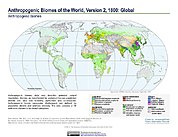
Anthropogenic Biomes of the World, Version 2: 1700
National Aeronautics and Space Administration —
The Anthropogenic Biomes of the World, Version 2: 1700 data set describes anthropogenic transformations within the terrestrial biosphere caused by sustained direct... -
Federal
GLIMPSE II Catalog
National Aeronautics and Space Administration —
The Galactic Legacy Infrared Mid-Plane Survey Extraordinaire (GLIMPSEII) imaged longitudes ±10◦ of the central region of the Galaxy. The latitude coverage is ±1◦ from... -
Federal
Archive of Census Related Products (ACRP): 1990 Census Block Statistics
National Aeronautics and Space Administration —
The 1990 Census Block Statistics portion of the Archive of Census Related Products (ACRP) contains population and housing data from the U.S. Census Bureau's 1990... -
Federal
Gridded Population of the World, Version 3 (GPWv3): Land and Geographic Unit Area Grids
National Aeronautics and Space Administration —
The Gridded Population of the World, Version 3 (GPWv3): Land and Geographic Unit Area Grids measure land areas in square kilometers and the mean Unit size... -
Federal
Anthropogenic Biomes of the World, Version 2: 1800
National Aeronautics and Space Administration —
The Anthropogenic Biomes of the World, Version 2: 1800 data set describes anthropogenic transformations within the terrestrial biosphere caused by sustained direct... -
Federal
Gridded Population of the World, Version 4 (GPWv4): Basic Demographic Characteristics, Revision 11
National Aeronautics and Space Administration —
The Gridded Population of the World, Version 4 (GPWv4): Basic Demographic Characteristics, Revision 11 consists of estimates of human population by age and sex as... -
Federal
Gridded Population of the World, Version 3 (GPWv3): Population Density Grid
National Aeronautics and Space Administration —
The Gridded Population of the World, Version 3 (GPWv3): Population Density Grid consists of estimates of human population for the years 1990, 1995, and 2000 by 2.5...

Official websites use .gov
A
.gov website belongs to an official government
organization in the United States.
Secure .gov websites use HTTPS
A
lock (
) or https:// means you’ve safely connected to
the .gov website. Share sensitive information only on official,
secure websites.