
-
Federal
NACP: MODIS Daily Land Incident 4-km PAR Images For North America, 2003-2005 NGDA
National Aeronautics and Space Administration —
This data set contains daily Moderate Resolution Imaging Spectroradiometer (MODIS) land incident photosynthetically active radiation (PAR) images over North America... -
Federal
BOREAS/SRC AMS Suite A Surface Meteorological and Radiation Data: 1994
National Aeronautics and Space Administration —
Contains the data collected in 1994 by the AMS suite A instrument set operated by SRC and provided to BORIS. -
Federal
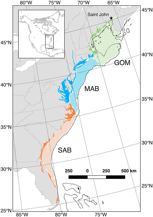
Mean Annual Fluxes of Carbon in Coastal Ecosystems of Eastern North America
National Aeronautics and Space Administration —
This dataset contains best estimates and uncertainties for mean annual fluxes of inorganic, organic, and total (organic + inorganic) carbon in tidal wetlands,... -
Federal
LBA-ECO CD-02 Oxygen Isotopes of Plant Tissue Water and Atmospheric Water Vapor
National Aeronautics and Space Administration —
This data set reports the oxygen isotope signatures of water extracted from plant tissue (xylem from the stems and leaf tissue) and of atmospheric water vapor from... -
Federal
LBA-ECO CD-07 GOES-8 L3 Gridded Surface Radiation and Rain Rate for Amazonia: 1999
National Aeronautics and Space Administration —
The LBA-Ecology CD-07 team collected and processed GOES-8 imager data over the LBA region to characterize the incoming radiation and precipitation rates at regional... -
Federal
LBA-ECO CD-02 Carbon and Oxygen Isotopes in Atmospheric CO2 in the Amazon: 1999-2004
National Aeronautics and Space Administration —
This data set reports carbon and oxygen stable isotope ratios of atmospheric carbon dioxide (CO2) collected at several forest and pasture sites and in the free... -
Federal
LBA-ECO CD-04 Meteorological and Flux Data, km 83 Tower Site, Tapajos National Forest
National Aeronautics and Space Administration —
Tower flux measurements of carbon dioxide,water vapor, heat, and meteorological variables were obtained at the Tapajos National Forest, km 83 site, Santarem, Para,... -
Federal
ABoVE: Ignitions, Burned Area, and Emissions of Fires in AK, YT, and NWT, 2001-2018 NGDA
National Aeronautics and Space Administration —
This dataset provides estimates of daily burned area, carbon emissions, and uncertainty, and daily fire ignition locations for boreal fires in Alaska, U.S., and in... -
Federal
LBA-ECO LC-07 Water Quality, CO2, Chlorophyll, Lago Curuai, Para, Brazil: 2003-2004
National Aeronautics and Space Administration —
This data set reports (1) concentrations of total, organic, and inorganic suspended solids; dissolved inorganic, and organic carbon; chlorophyll-a and (2)... -
Federal
BOREAS HYD-03 Subcanopy Meteorological Data
National Aeronautics and Space Administration —
This table contains the sub-canopy meteorological data collected by HYD-3. -
Federal
CARVE: Alaskan Fire Emissions Database (AKFED), 2001-2013 NGDA
National Aeronautics and Space Administration —
This data set provides estimates of annual carbon emissions (kg carbon per square meter) from boreal fires at 450-m resolution for the state of Alaska between 2001... -
Federal
ABoVE: TVPRM Simulated Net Ecosystem Exchange, Alaskan North Slope, 2008-2017 NGDA
National Aeronautics and Space Administration —
This dataset includes hourly net ecosystem exchange (NEE) simulated by the Tundra Vegetation Photosynthesis and Respiration Model (TVPRM) at 30 km horizontal... -
Federal
ISLSCP II Continuous Fields of Vegetation Cover, 1992-1993 NGDA
National Aeronautics and Space Administration —
The objective of this study was to derive continuous fields of vegetation cover from multi-temporal Advanced Very High Resolution Radiometer (AVHRR) data using all... -
Federal
LBA-ECO TG-07 Long-Term Soil Gas Flux and Root Mortality, Tapajos National Forest
National Aeronautics and Space Administration —
This data set reports measurements of trace gas fluxes of methane (CH4), nitric oxide (N2O), nitrous oxide (NO), carbon dioxide (CO2) from soils at a study site in... -
Federal
SAFARI 2000 Pre- and Post-fire Reflectance near Kaoma, Zambia, Dry Season 2000
National Aeronautics and Space Administration —
The main goal of this study was to analyze the possibility of estimating combustion completeness based on fire-induced spectral reflectance changes of surface... -
Federal
Net Carbon Dioxide and Water Fluxes of Global Terrestrial Ecosystems, 1969-1998
National Aeronautics and Space Administration —
The variability of net surface carbon assimilation (Asmax), net ecosystem surface respiration (Rsmax), and net surface evapotranspiration (Etsmax) among and within... -
Federal
SAFARI 2000 Meteorological Tower Measurements, Kruger National Park, 2000-2002
National Aeronautics and Space Administration —
An eddy covariance system mounted on a tower near the Skukuza Camp in Kruger National Park, South Africa, has been operating continuously since early 2000.... -
Federal
ISLSCP II IGBP DISCover and SiB Land Cover, 1992-1993 NGDA
National Aeronautics and Space Administration —
This data set describes the geographic distributions of 17 classes of land cover based on the International Geosphere-Biosphere DISCover land cover legend (Loveland... -
Federal
A Concise Experiment Plan for the Arctic-Boreal Vulnerability Experiment
National Aeronautics and Space Administration —
This document presents the Concise Experiment Plan for NASA's Arctic-Boreal Vulnerability Experiment (ABoVE) to serve as a guide to the Program as it identifies the... -
Federal
SAFARI 2000 BVOC Measurements at Skukuza and Maun Flux Towers, Wet Season 2001
National Aeronautics and Space Administration —
Biogenic volatile organic compound (BVOC) emissions were measured in a Colophospermum mopane woodland near Maun, Botswana, and in a Combretum-Acacia savanna in Kruger...

Official websites use .gov
A
.gov website belongs to an official government
organization in the United States.
Secure .gov websites use HTTPS
A
lock (
) or https:// means you’ve safely connected to
the .gov website. Share sensitive information only on official,
secure websites.