
-
Federal
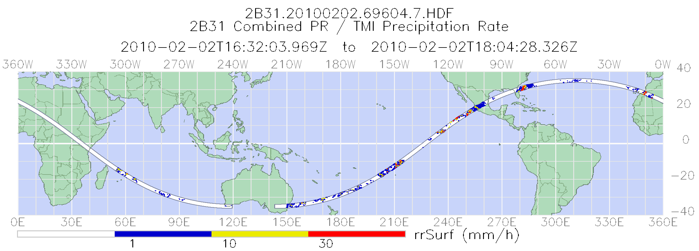
TRMM Combined Precipitation Radar and Microwave Imager Rainfall Profile L2 1.5 hours V7 (TRMM_2B31) at GES DISC
National Aeronautics and Space Administration —
The TRMM combined algorithm (2B31) combines data from the TMI and PR to produce the best rain estimate for TRMM. This combined rainfall product is derived from... -
Federal
AMSR-E/Aqua Daily L3 Global Ascending/Descending .25x.25 deg Ocean Grids V002
National Aeronautics and Space Administration —
The Level-3 daily product (AE_DyOcn), weekly product (AE_WkOcn), and monthly product (AE_MoOcn) include SST, near-surface wind speed, columnar water vapor, and... -
Federal
AMSR-E/AMSR2 Unified L3 Global Daily Ascending/Descending .25x.25 deg Ocean Grids V001
National Aeronautics and Space Administration —
The AMSR-E/AMSR2 Unified L3 Global Daily Ascending/Descending .25 x .25 deg Ocean Grids data set (AU_DyOcn) reports daily estimates of water vapor, cloud liquid water... -
Federal
TES/Aura L2 Carbon Monoxide Nadir Special Observation V007
National Aeronautics and Space Administration —
TL2CONS_7 is the Tropospheric Emission Spectrometer (TES)/Aura Level 2 Carbon Monoxide Nadir Special Observation Version 7 data product. TES was an instrument aboard... -
Federal
ER-2 X-Band Doppler Radar (EXRAD) IMPACTS V1
National Aeronautics and Space Administration —
The ER-2 X-band Radar (EXRAD) IMPACTS dataset consists of radar reflectivity and Doppler velocity estimates collected by the EXRAD onboard the NASA ER-2 high-altitude... -
Federal
TES/Aura L2 Ozone Nadir Special Observation V007
National Aeronautics and Space Administration —
TL2O3NS_7 is the Tropospheric Emission Spectrometer (TES)/Aura Level 2 Ozone Nadir Special Observation Version 7 data product. TES was an instrument aboard NASA's... -
Federal
National Solar Radiation Database (NSRDB) Station Data Output for 1991 to 2010
National Oceanic and Atmospheric Administration, Department of Commerce —
The National Solar Radiation Database (NSRDB) was produced by the National Renewable Energy Laboratory under the U.S. Department of Energy's Office of Energy... -
Federal
AERONET Level 2.0 AOD
National Aeronautics and Space Administration —
The aerosol optical depth processing includes the spectral de-convolution algorithm (SDA) described in O'Neill et al. (2003). This algorithm yields fine (sub-micron)... -
Federal
NOAA Climate Data Record (CDR) of Visible and Near Infrared Reflectance from AVHRR, Version 1.0
National Oceanic and Atmospheric Administration, Department of Commerce —
The AVHRR visible gains and offsets convert GAC pixel level counts to radiances and are provided for each visible band encompassing TIROS-N, NOAA-6 through NOAA-19... -
Federal
TRMM TMI/PR Combined Precipitation L3 1 month 0.5 degree x 0.5 degree V7 (TRMM_3B31) at GES DISC
National Aeronautics and Space Administration —
This is a combined rainfall product. 3B31 uses the high quality retrievals done for the narrow swath in 2B31 to calibrate the wide swath retrievals generated in 2A12.... -
Federal
AMSR-E/Aqua L2B Global Swath Surface Precipitation GSFC Profiling Algorithm V003
National Aeronautics and Space Administration —
The AMSR-E/Aqua Level-2B precipitation product includes instantaneous surface precipitation rate and type over ice-free/snow-free land and ocean between 89.24 degrees... -
Federal
TES/Aura L2 Water Vapor Nadir Special Observation V007
National Aeronautics and Space Administration —
TL2H2ONS_7 is the Tropospheric Emission Spectrometer (TES)/Aura Level 2 Water Vapor Nadir Special Observation Version 7 data product. It consists of information for... -
Federal
SatCORPS CERES GEO Edition 4 Meteosat-10 Northern Hemisphere Version 1.0
National Aeronautics and Space Administration —
CER_GEO_Ed4_MET10_NH_V01 is the Satellite Cloud and Radiation Property retrieval System (SatCORPS) Clouds and the Earth's Radiant Energy System (CERES) Geostationary... -
Federal
Sentinel-5P TROPOMI SNPP VIIRS cloud product band 3 (UVIS detector) 1-Orbit L2 7km x 3.5km V1 (S5P_L2__NP_BD3) at GES DISC
National Aeronautics and Space Administration —
Starting from August 6th in 2019, Sentinel-5P TROPOMI along-track high spatial resolution (~5.5km at nadir) has been implemented. For data after August 6th of 2019,... -
Federal
OMI/Aura and MODIS/Aqua Merged Cloud Product 1-Orbit L2 Swath 13x24 km V003 (OMMYDCLD) at GES DISC NGDA
National Aeronautics and Space Administration —
The OMI/Aura and MODIS/Aqua Merged Cloud Product 1-Orbit L2 Swath 13x24 km (OMMYDCLD) is a Level-2 orbital product that combines cloud parameters retrieved by the... -
Federal
GPM GROUND VALIDATION DUAL-FREQUENCY DUAL-POLARIZED DOPPLER RADAR (D3R) GCPEX V1
National Aeronautics and Space Administration —
The GPM Ground Validation Dual-frequency Dual-polarized Doppler Radar (D3R) GCPEx and IFloodS data sets contain radar reflectivity and doppler velocity measurements.... -
Federal
NOAA Climate Data Records (CDR) of AMSU-A/B and MHS Hydrological Properties, Version 1
National Oceanic and Atmospheric Administration, Department of Commerce —
The NOAA Hydrological Properties for Applications Thematic Climate Data Record (TCDR) consist of Advanced Microwave Sounding Unit-A (AMSU-A), Advanced Microwave... -
Federal
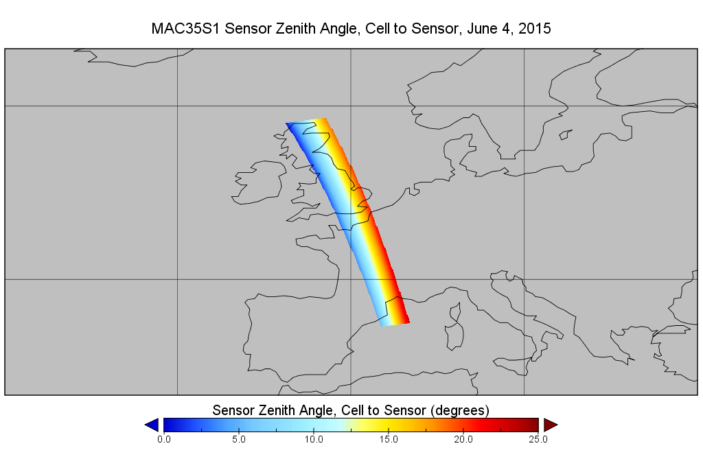
MODIS/Aqua Cld Mask Spect. Test Results 5-Min L2 Swath Subset along MLS V002 (MAM35S0) at GES DISC NGDA
National Aeronautics and Space Administration —
This is the MODIS/Aqua subset along MLS field of view track. The goal of the subset is to select and return MODIS data that are within +-100 km across the MLS track.... -
Federal
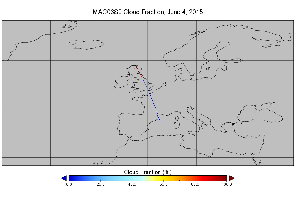
MODIS/Aqua Clouds 1km and 5km 5-Min L2 Narrow Swath Subset along CloudSat V002 (MAC06S0) at GES DISC NGDA
National Aeronautics and Space Administration —
This is the narrow-swath MODIS/Aqua subset along CloudSat field of view track. The goal of the narrow-swath subset is to select and return MODIS data that are within... -
Federal
ATLAS/ICESat-2 L3B Monthly Gridded Atmosphere V005
National Aeronautics and Space Administration —
This data set contains a gridded summary of monthly global cloud fraction, total column optical depth over the oceans, polar cloud fraction, blowing snow frequency,...

Official websites use .gov
A
.gov website belongs to an official government
organization in the United States.
Secure .gov websites use HTTPS
A
lock (
) or https:// means you’ve safely connected to
the .gov website. Share sensitive information only on official,
secure websites.