

193 datasets found
-
City
Parking Meters
City of Somerville —
ESRI point feature class representing City of Somerville, Massachusetts street parking meters. -
City
Bloomington 2-Mile Fringe
City of Bloomington —
This map data layer represents the former 2 Mile Fringe for the City of Bloomington, Indiana. This area was establish by an inter-local agreement between the City of... -
Federal
Great Basin NV Play Fairway Analysis - Carson Sink
Department of Energy —
All datasets and products specific to the Carson Sink Basin. Includes a packed ArcMap (.mpk), individually zipped shapefiles, and a file geodatabase for the Carson... -
City
Sanitation Route Areas
City of Bloomington —
This map data layer represents the daily sanitation pick up route areas for the City of Bloomington. Curbside collection of trash, recycle and yard waste is provided... -
Federal
HHS COVID-19 Small Area Estimations Survey - Updated Bivalent Vaccine Audience - Wave 24
U.S. Department of Health & Human Services —
The goal of the Monthly Outcome Survey (MOS) Small Area Estimations (SAE) is to generate estimates of the proportions of adults, by county and month, who were in the... -
Federal
Gazetteer of Planetary Nomenclature: Moon: 1:1 million-scale maps of the Moon
National Aeronautics and Space Administration —
The purpose of the lunar maps is to provide an up-to-date and comprehensive depiction on lunar nomenclature approved by the International Astronomical Union (IAU). -
City
Paid Meter Parking
City of Bloomington —
This layer represents the parking meter area where on street parking meters are in use in downtown Bloomington, Indiana that are enforced by the Parking Services... -
State
Hudson River Estuary Program's Index of Hudson River Benthic Mapping Reports at NYS Library: 2000 - 2016
State of New York —
A listing of reports of the benthic habitats of the Hudson River produced by NYS DEC along with other NYS agencies, other governmental entities, and non-governmental... -
City
Bloomington City & Street Map Gallery
City of Bloomington —
Collection of static general Bloomington and city street maps of various sizes. -
City
Intersections
City of Bloomington —
This map data layer represents intersection points within the roadway network for the City of Bloomington, Indiana. It includes source data from the City of... -
Federal
HHS COVID-19 Small Area Estimations Survey - Primary Vaccine Series - Wave 19
U.S. Department of Health & Human Services —
The goal of the Monthly Outcome Survey (MOS) Small Area Estimations (SAE) is to generate estimates of the proportions of adults, by county and month, who were in the... -
County
Historical - Forest Preserve-Cook County Forest Preserve Trails
Cook County of Illinois —
KML file of trails within the Forest Preserve District of Cook County. To view or use these files, special GIS software such as Google Earth is required -
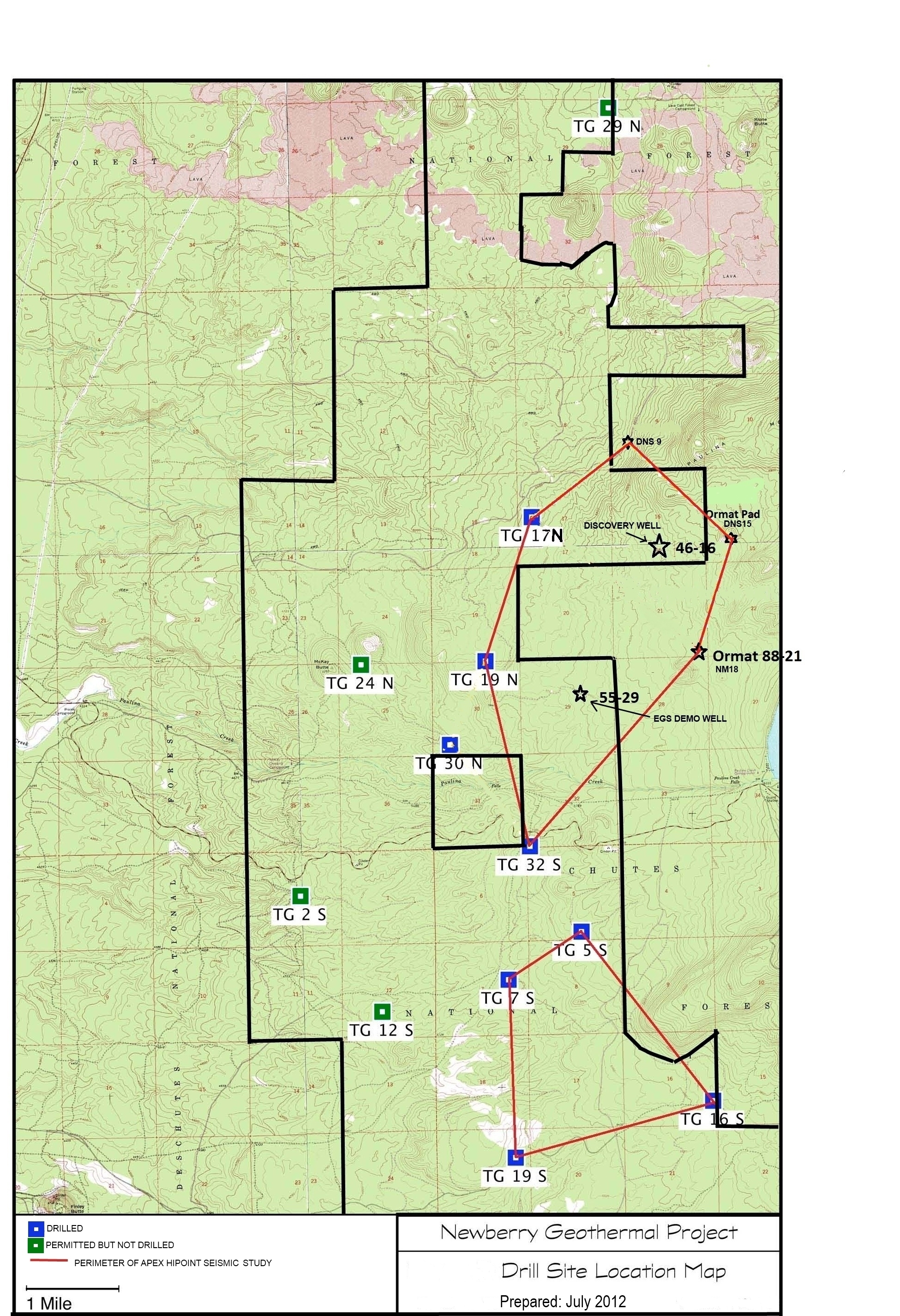
Federal
Map of Validation of Innovative Exploration Technologies for Newberry Volcano
Department of Energy —
A map showing location of wells permitted, drilled and seismic test, as part of validation of innovative exploration technologies done for the Newberry Volcano...
193 datasets found