
-
Federal
TIGER/Line Shapefile, 2019, nation, U.S., Current Metropolitan Statistical Area/Micropolitan Statistical Area (CBSA) National
U.S. Census Bureau, Department of Commerce —
The TIGER/Line shapefiles and related database files (.dbf) are an extract of selected geographic and cartographic information from the U.S. Census Bureau's Master... -
Federal
Location Affordability Index v.3
Department of Housing and Urban Development —
The Location Affordability Index (LAI) helps to better understand the combined cost of housing and transportation. First launched by the U.S. Department of Housing... -
Federal
Intermodal Passenger Connectivity Database (IPCD) NGDA
Federal Geographic Data Committee —
The Intermodal Passenger Connectivity Database (IPCD) dataset was compiled on August 10, 2021 and was updated October 19, 2022 from the Bureau of Transportation... -
Federal
TIGER/Line Shapefile, 2018, nation, U.S., Current Metropolitan Division National
U.S. Census Bureau, Department of Commerce —
The TIGER/Line shapefiles and related database files (.dbf) are an extract of selected geographic and cartographic information from the U.S. Census Bureau's Master... -
Federal
TIGER/Line Shapefile, 2018, nation, U.S., Current NECTA Division National
U.S. Census Bureau, Department of Commerce —
The TIGER/Line shapefiles and related database files (.dbf) are an extract of selected geographic and cartographic information from the U.S. Census Bureau's Master... -
Federal
TIGER/Line Shapefile, 2015, nation, U.S., Current NECTA Division National
U.S. Census Bureau, Department of Commerce —
The TIGER/Line shapefiles and related database files (.dbf) are an extract of selected geographic and cartographic information from the U.S. Census Bureau's Master... -
Federal
Transit Benefit Program Data -
Department of Transportation —
This data set contains information about any US government agency participating in the transit benefits program, funding agreements, individual participating Federal... -
Federal
Location Affordability Index v 2.0
Department of Housing and Urban Development —
The Location Affordability Index (LAI) helps to better understand the combined cost of housing and transportation. First launched by the U.S. Department of Housing... -
Federal
TIGER/Line Shapefile, 2017, nation, U.S., Current NECTA Division National
U.S. Census Bureau, Department of Commerce —
The TIGER/Line shapefiles and related database files (.dbf) are an extract of selected geographic and cartographic information from the U.S. Census Bureau's Master... -
Federal
2016 Cartographic Boundary File, Current Metropolitan/Micropolitan Statistical Area for United States, 1:5,000,000
U.S. Census Bureau, Department of Commerce —
The 2016 cartographic boundary shapefiles are simplified representations of selected geographic areas from the U.S. Census Bureau's Master Address File /... -
Federal
TIGER/Line Shapefile, 2019, nation, U.S., Current NECTA Division National
U.S. Census Bureau, Department of Commerce —
The TIGER/Line shapefiles and related database files (.dbf) are an extract of selected geographic and cartographic information from the U.S. Census Bureau's Master... -
Federal
Collection Series Information for the 2019 Cartographic Boundary File KML, Current Metropolitan/Micropolitan Statistical Area for United States
U.S. Census Bureau, Department of Commerce —
The 2019 cartographic boundary KMLs are simplified representations of selected geographic areas from the U.S. Census Bureau's Master Address File / Topologically... -
Federal
TIGER/Line Shapefile, 2016, nation, U.S., Current Metropolitan Division National
U.S. Census Bureau, Department of Commerce —
The TIGER/Line shapefiles and related database files (.dbf) are an extract of selected geographic and cartographic information from the U.S. Census Bureau's Master... -
Federal
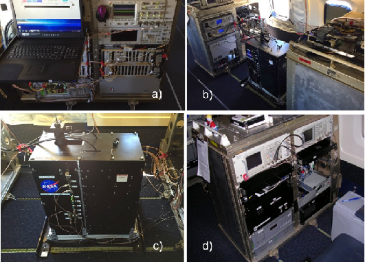
ASCENDS: Airborne CO2 LAS Retrieval, Indianapolis, IN, USA, 2014
National Aeronautics and Space Administration —
This dataset provides in situ airborne measurements of atmospheric carbon dioxide (CO2) over Indianapolis, Indiana (IN) on September 3, 2014 during the morning... -
Federal
Collection Series Information for the 2019 Cartographic Boundary File Shapefile, Current Metropolitan/Micropolitan Statistical Area for United States
U.S. Census Bureau, Department of Commerce —
The 2019 cartographic boundary shapefiles are simplified representations of selected geographic areas from the U.S. Census Bureau's Master Address File /... -
Federal
2015 Cartographic Boundary File, Metropolitan Statistical Area/Micropolitan Statistical Area for United States, 1:5,000,000
U.S. Census Bureau, Department of Commerce —
The 2015 cartographic boundary shapefiles are simplified representations of selected geographic areas from the U.S. Census Bureau's Master Address File /... -
Federal
TIGER/Line Shapefile, 2019, nation, U.S., Current Metropolitan Division National
U.S. Census Bureau, Department of Commerce —
The TIGER/Line shapefiles and related database files (.dbf) are an extract of selected geographic and cartographic information from the U.S. Census Bureau's Master... -
Federal
2015 Cartographic Boundary File, Metropolitan Statistical Area/Micropolitan Statistical Area for United States, 1:20,000,000
U.S. Census Bureau, Department of Commerce —
The 2015 cartographic boundary shapefiles are simplified representations of selected geographic areas from the U.S. Census Bureau's Master Address File /... -
Federal
TIGER/Line Shapefile, 2017, nation, U.S., Current Metropolitan Division National
U.S. Census Bureau, Department of Commerce —
The TIGER/Line shapefiles and related database files (.dbf) are an extract of selected geographic and cartographic information from the U.S. Census Bureau's Master... -
Federal
TIGER/Line Shapefile, 2016, nation, U.S., Current NECTA Division National
U.S. Census Bureau, Department of Commerce —
The TIGER/Line shapefiles and related database files (.dbf) are an extract of selected geographic and cartographic information from the U.S. Census Bureau's Master...

Official websites use .gov
A
.gov website belongs to an official government
organization in the United States.
Secure .gov websites use HTTPS
A
lock (
) or https:// means you’ve safely connected to
the .gov website. Share sensitive information only on official,
secure websites.