
-
Federal
LBA-ECO ND-11 Pre-harvest Forest Tree and Liana Biomass, NW Mato Grosso, Brazil: 2003
National Aeronautics and Space Administration —
The purpose of this study was to determine if spatially-explicit commercial timber inventories (CTI) could be used in conjunction with satellite imagery to improve... -
Federal
Gamma Ray Data: Peck (FIFE)
National Aeronautics and Space Administration —
Airborne soil moisture measurement is based on the difference between natural terrestrial gamma radiation flux measured for comparatively wet and dry soils. The... -
Federal
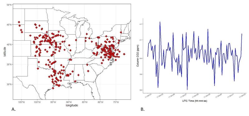
ACT-America: L2 Remotely Sensed Column-avg CO2 by Airborne Lidar, Lite, Eastern USA
National Aeronautics and Space Administration —
This dataset provides a direct subset (i.e., the Lite version) of the Level 2 (L2) remotely sensed column-average carbon dioxide (CO2) concentrations measured during... -
Federal
ISLSCP II Global Gridded Soil Characteristics
National Aeronautics and Space Administration —
This data set provides gridded data for selected soil parameters derived from data and methods developed by the Global Soil Data Task, an international collaborative... -
Federal
LBA-ECO CD-06 Physical, Political, and Hydrologic Maps, Ji-Parana River Basin, Brazil
National Aeronautics and Space Administration —
This data set contains physical, hydrologic, political, demographic, and societal maps for the Ji-Parana River Basin, in the state of Rondonia, Brazil. These data... -
Federal
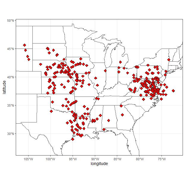
Nitrogen Deposition onto the United States and Western Europe
National Aeronautics and Space Administration —
This data set contains data for wet and dry nitrogen-species deposition for the United States and Western Europe. Deposition data were acquired directly from... -
Federal
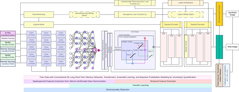
GeoCryoAI: Ensemble Learning and the Permafrost Carbon Feedback in Alaska, 1963-2022
National Aeronautics and Space Administration —
This dataset provides model code, input data, sample results, and documentation for an artificial intelligence-driven model, GeoCryoAI. GeoCryoAI is a hybridized... -
Federal
ACT-America: L2 Remotely Sensed Column-average CO2 by Airborne Lidar, Eastern USA
National Aeronautics and Space Administration —
This dataset provides Level 2 (L2) remotely sensed column-average carbon dioxide (CO2) concentrations measured during airborne campaigns in Summer 2016, Winter 2017,... -
Federal
LBA-ECO ND-01 Streamwater and Watershed Characteristics, Rondonia, Brazil: 1998-1999
National Aeronautics and Space Administration —
This data set provides the results of (1) synoptic streamwater sampling and analyses from numerous sites across Rondonia and (2) corresponding watershed... -
Federal
ACT-America: L2 Weighting Functions for Airborne Lidar Column-avg CO2, Eastern USA
National Aeronautics and Space Administration —
This dataset provides vertical weighting function coefficients of the Level 2 (L2) remotely sensed column-average carbon dioxide (CO2) concentrations measured during... -
Federal
BOREAS TE-08 Aspen Bark Chemistry Data
National Aeronautics and Space Administration —
The BOREAS TE-08 team collected pigment density data from aspen bark and leaves from four sites within the BOREAS SSA from 24-May-1994 to 16-Jun-1994 (IFC-1),... -
Federal
NACP MCI: CO2 Flux from Inversion Modeling, Upper Midwest Region, USA, 2007
National Aeronautics and Space Administration —
This data set provides estimates of Net Ecosystem Exchange (NEE) flux for the U.S. Upper Midwest at 0.5-degree resolution for the year 2007. Estimates were produced... -
Federal
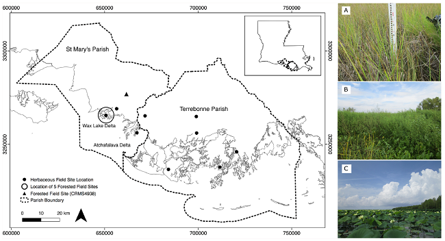
Pre-Delta-X: Vegetation Species, Structure, Aboveground Biomass, MRD, LA, USA, 2015
National Aeronautics and Space Administration —
This dataset provides vegetation species, height, stem density and diameter, and species aboveground biomass (AGB) measurements collected at herbaceous and forested... -
Federal
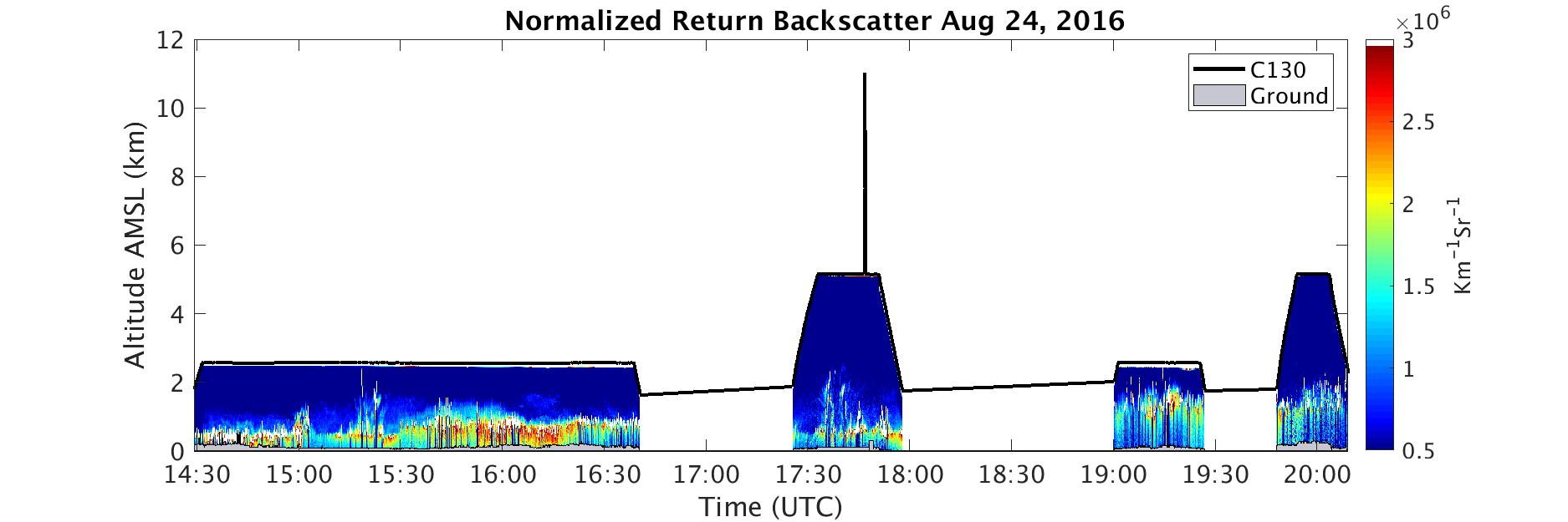
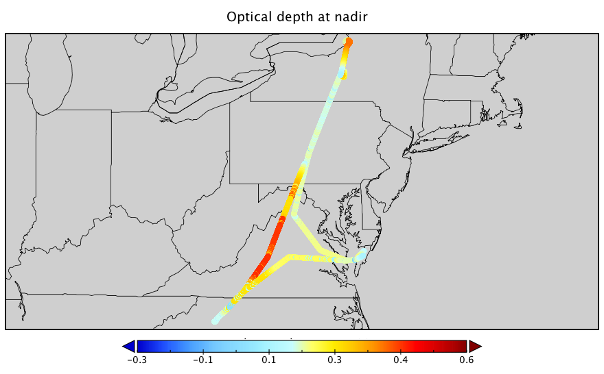
ACT-America: L1 DAOD Measurements by Airborne CO2 Lidar, Eastern USA
National Aeronautics and Space Administration —
This dataset provides Level 1 (L1) remotely sensed differential absorption optical depth (DAOD) measurements made through the Multi-Functional Fiber Laser Lidar... -
Federal
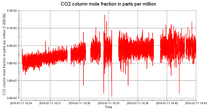
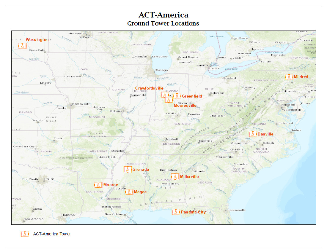
ACT-America: L2 In Situ CO2, CO, and CH4 Concentrations from Towers, Eastern USA
National Aeronautics and Space Administration —
This dataset provides atmospheric carbon dioxide (CO2), carbon monoxide (CO), and methane (CH4) concentrations as measured on a network of instrumented communications... -
Federal
ACT-America: L1 Raw, Uncalibrated In-Situ CO2, CO, and CH4 Mole Fractions from Towers
National Aeronautics and Space Administration —
This dataset provides Level 1 (L1) in situ atmospheric carbon dioxide (CO2), carbon monoxide (CO), and methane (CH4) concentrations as measured on a network of...

Official websites use .gov
A
.gov website belongs to an official government
organization in the United States.
Secure .gov websites use HTTPS
A
lock (
) or https:// means you’ve safely connected to
the .gov website. Share sensitive information only on official,
secure websites.