

ACT-America: L2 In Situ CO2, CO, and CH4 Concentrations from Towers, Eastern USA
Access & Use Information
Public: This dataset is intended for public access and use.
License: No license information was provided. If this work was prepared by an officer or employee of the United States government as part of that person's official duties it is considered a U.S. Government Work.
Downloads & Resources
-
Data Information (Unknown Format)BIN
-
Data Information (HTML)HTML
-
Data Information (Unknown Format)BIN
-
Data Information (ZIP)ZIP
ACTAMERICA-PICARRO_Ground_1568.zip
-
Data Information (PNG)PNG
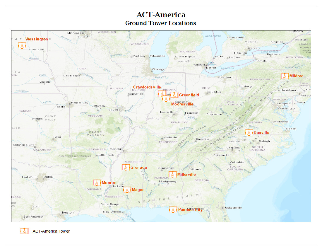
ACTAMERICA-PICARRO_Ground_Fig1.png
-
Data Information (Unknown Format)BIN
-
Data Information (PDF)PDF
ACTAMERICA-PICARRO_Ground.pdf
-
Landing PageLanding Page
Dates
| Metadata Created Date | April 11, 2025 |
|---|---|
| Metadata Updated Date | September 19, 2025 |
Metadata Source
- Data.json Data.json Metadata
Harvested from NASA Data.json
Additional Metadata
| Resource Type | Dataset |
|---|---|
| Metadata Created Date | April 11, 2025 |
| Metadata Updated Date | September 19, 2025 |
| Publisher | ORNL_DAAC |
| Maintainer | |
| Identifier | 10.3334/ORNLDAAC/1568 |
| Data Last Modified | 2025-09-10 |
| Category | Earth Science |
| Public Access Level | public |
| Bureau Code | 026:00 |
| Metadata Context | https://project-open-data.cio.gov/v1.1/schema/catalog.jsonld |
| Schema Version | https://project-open-data.cio.gov/v1.1/schema |
| Catalog Describedby | https://project-open-data.cio.gov/v1.1/schema/catalog.json |
| Harvest Object Id | a518279d-a3a0-4d0d-a126-e591b5af2209 |
| Harvest Source Id | 58f92550-7a01-4f00-b1b2-8dc953bd598f |
| Harvest Source Title | NASA Data.json |
| Homepage URL | https://search.earthdata.nasa.gov/search?q=ACTAMERICA-PICARRO_Ground_1568&ac=true |
| Old Spatial | {"WestBoundingCoordinate":-98.588,"NorthBoundingCoordinate":44.0502,"EastBoundingCoordinate":-76.4188,"SouthBoundingCoordinate":30.1951},"CARTESIAN" |
| Program Code | 026:000 |
| Source Datajson Identifier | True |
| Source Hash | b586ce5996585629119a8564d9f24265eb7793d30e37396c7e0dc7fff9ba2f63 |
| Source Schema Version | 1.1 |
| Spatial | |
| Temporal | 2015-01-01/2015-01-01 |
Didn't find what you're looking for? Suggest a dataset here.