
-
Federal
EMIT L2B Estimated Mineral Identification and Band Depth and Uncertainty 60 m V001
National Aeronautics and Space Administration —
The Earth Surface Mineral Dust Source Investigation (EMIT) instrument measures surface mineralogy, targeting the Earth’s arid dust source regions. EMIT is installed... -
Federal
Real System Failures
National Aeronautics and Space Administration —
This resource area contains descriptions of actual electronic systems failure scenarios with an emphasis on the diversity of failure modes and effects that can befall... -
Federal
Polar Radiant Energy in the Far InfraRed Experiment (PREFIRE) Spectral Flux from PREFIRE Satellite 2 COG R01
National Aeronautics and Space Administration —
Polar Radiant Energy in the Far InfraRed Experiment (PREFIRE) Spectral Flux from PREFIRE Satellite 2 COG (PREFIRE_SAT2_2B-FLX_COG) is derived from data collected by... -
Federal
GPM GROUND VALIDATION ENVIRONMENT CANADA (EC) MANUAL PRECIPITATION MEASUREMENTS GCPEX V1
National Aeronautics and Space Administration —
The GPM Ground Validation Environment Canada (EC) Manual Precipitation Measurements GCPEx dataset was collected during the GPM Cold-season Precipitation Experiment... -
Federal
Reflectance Reference Targets (OTTER)
National Aeronautics and Space Administration —
Spectral reflectance measurements of flat field targets as reference points representative of psuedo-invariant targets as measured by the Spectron SE590... -
Federal
BOREAS TE-18 Landsat TM Physical Classification Image of the SSA
National Aeronautics and Space Administration —
The objective of this classification is to provide the BOREAS investigators with a data product that characterizes the land cover of the SSA. A Landsat-5 TM image... -
Federal
Sentinel-1 Interferograms - Unwrapped Phase (BETA)
National Aeronautics and Space Administration —
Sentinel-1 SLC interferometric products generated by JPL using ISCE v2.0.0, delivered by ASF -
Federal
CALIPSO Lidar Level 2 Blowing Snow - Antarctica, V1-01
National Aeronautics and Space Administration —
CAL_LID_L2_BlowingSnow_Antarctica-Standard-V1-01 is the Cloud-Aerosol Lidar and Infrared Pathfinder Satellite Observations (CALIPSO) Lidar Level 2 Blowing Snow -... -
Federal
HIRENASD Beam FEM
National Aeronautics and Space Administration —
This contains attempts to create BEAM FEM model. I have started a Blog to discuss this... please put your comments there and I will attempt to keep everything... -
Federal
LBA-ECO LC-03 Hypsography, Rivers, Roads, and DEM, Four Areas across Brazilian Amazon
National Aeronautics and Space Administration —
This data set provides four related spatial data products for four study areas across the Brazilian Amazon: Manaus, Amazonas; Tapajos National Forest, Para Western... -
Federal
LBA-ECO ND-02 Agricultural and Secondary Forest Soil Trace Gas Flux, Para: 2001-2004
National Aeronautics and Space Administration —
Fires set for slash-and-burn agriculture contribute to the current unsustainable accumulation of atmospheric greenhouse gases, and they also deplete the soil of... -
Federal
TROPESS Chemical Reanalysis Surface OH 2-Hourly 2-dimensional Product V1 (TRPSCROH2H2D) at GES DISC
National Aeronautics and Space Administration —
The TROPESS Chemical Reanalysis OH 2-Hourly 2-dimensional Product contains surface concentrations of the hydroxyl radical. The data are part of the Tropospheric... -
Federal
Soil Reflectance Data (FIFE)
National Aeronautics and Space Administration —
Soil reflectance properties are an important factor in determining landscape reflectance characteristics. No soil reflectance data were collected as part of the FIFE... -
Federal
ABoVE: Angular-corrected MODIS MAIAC Reflectance across Alaska and Canada, 2000-2017
National Aeronautics and Space Administration —
This dataset provides angular corrections of MODIS Multi-Angle Implementation of Atmospheric Correction algorithm (MAIAC) surface reflectances across the ABoVE domain... -
Federal
BOREAS TGB-12 Soil Carbon and Flux Data of NSA-MSA in Raster Format
National Aeronautics and Space Administration —
The BOREAS TGB-12 team made measurements of soil carbon inventories, carbon concentration in soil gases, and rates of soil respiration at several sites. This data set... -
Federal
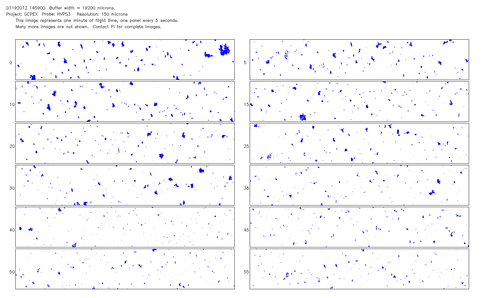
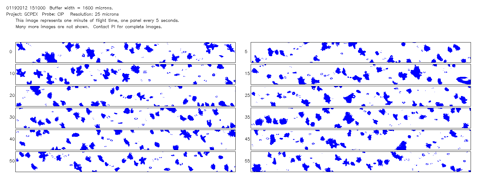
GPM GROUND VALIDATION NCAR CLOUD MICROPHYSICS PARTICLE PROBES GCPEX V1
National Aeronautics and Space Administration —
The GPM Ground Validation NCAR Cloud Microphysics Particle Probes GCPEx data was collected during the GPM Cold-season Precipitation Experiment (GCPEx), which occurred... -
Federal
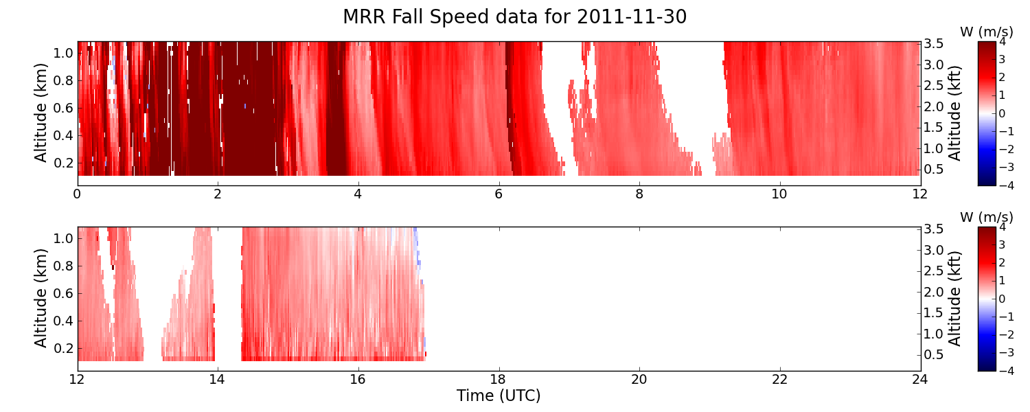
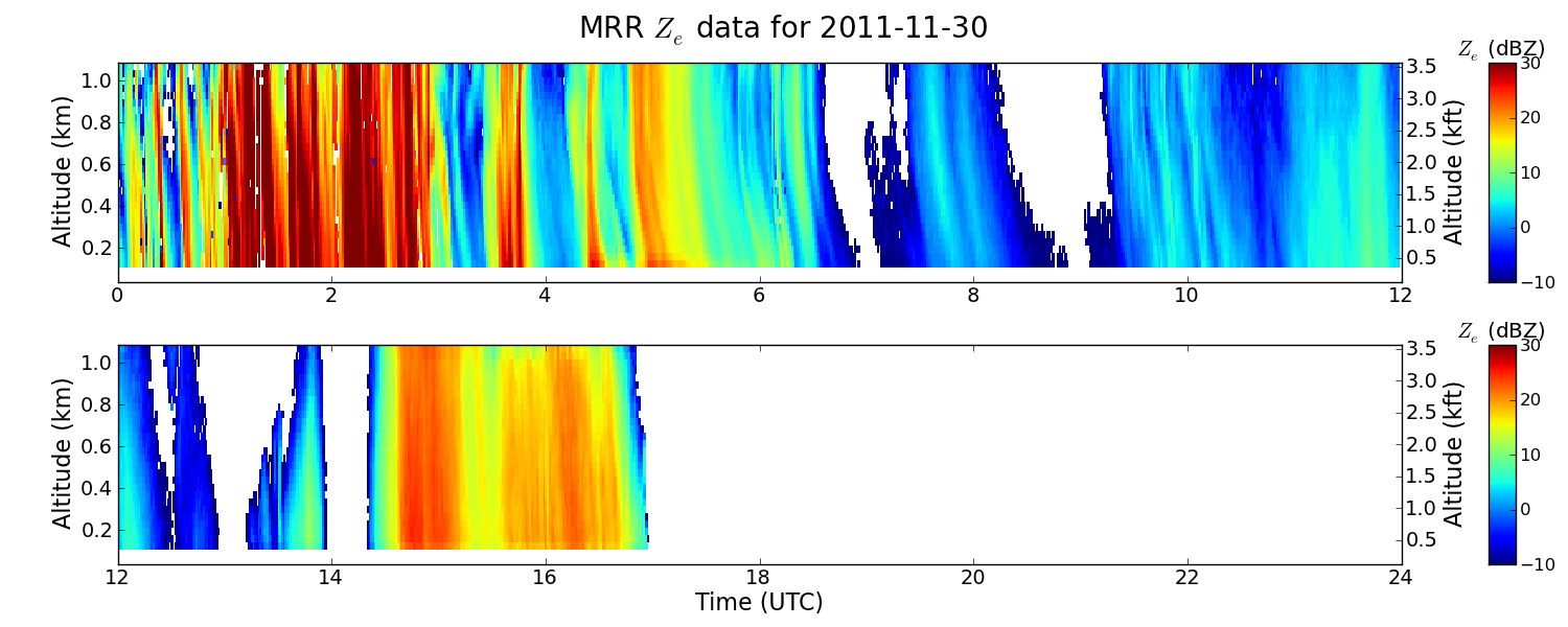
GPM GROUND VALIDATION NASA MICRO RAIN RADAR (MRR) GCPEX V2
National Aeronautics and Space Administration —
The GPM Ground Validation NASA Micro Rain Radar (MRR) GCPEx dataset was collected by a Micro Rain Radar (MRR), which is a vertically pointing Doppler radar which... -
Federal
LBA-ECO CD-06 Carbon Cycling in Rivers in Amazonas and Acre, Brazil: 2005-2006
National Aeronautics and Space Administration —
This data set provides measured and calculated variables describing the carbon pools in river waters, CO2 respired from the water and total amount of CO2 evaded,... -
Federal
NACP Aboveground Biomass and Carbon Baseline Data, V.2 (NBCD 2000), U.S.A., 2000
National Aeronautics and Space Administration —
The NBCD 2000 (National Biomass and Carbon Dataset for the Year 2000) data set provides a high-resolution (30 m) map of year-2000 baseline estimates of basal area-... -
Federal
BOREAS TE-07 Sap Flow Data
National Aeronautics and Space Administration —
The BOREAS TE-07 team collected data sets in support of its efforts to characterize and interpret information on the sap flow of boreal vegetation. The heat pulse...

Official websites use .gov
A
.gov website belongs to an official government
organization in the United States.
Secure .gov websites use HTTPS
A
lock (
) or https:// means you’ve safely connected to
the .gov website. Share sensitive information only on official,
secure websites.