
-
Federal
TROPICS05 L1B Orbital Geolocated Native-Resolution Brightness Temperatures V0.2
National Aeronautics and Space Administration —
The "Time-Resolved Observations of Precipitation structure and storm Intensity with a Constellation of Smallsats" (TROPICS) mission has a goal of providing nearly... -
Federal
TROPICS06 L2B Neural-network Atmospheric Vertical Temperature & Moisture Profiles V1.0
National Aeronautics and Space Administration —
The "Time-Resolved Observations of Precipitation structure and storm Intensity with a Constellation of Smallsats" (TROPICS) mission has a goal of providing nearly... -
Federal
VIIRS/NPP Day/Night Band 6-Min L1B Swath 750m NRT
National Aeronautics and Space Administration —
The VIIRS/NPP Day/Night Band 6-Min L1B Swath SDR 750m Near Real Time (NRT) product, short-name VNP02DNB_NRT is among the VIIRS Level 1 and Level 2 swath products that... -
Federal
LBA-ECO LC-31 Historical Land-Use in the Amazon: 1940-1995
National Aeronautics and Space Administration —
This data set provides annual spatial patterns of cropland, natural pasture, and planted pasture land uses across Amazonia for the period 1940/1950-1995. Two series... -
Federal
TROPICS05 Pathfinder L2B Instantaneous Surface Rain Rate (ISRR) V0.2
National Aeronautics and Space Administration —
The "Time-Resolved Observations of Precipitation structure and storm Intensity with a Constellation of Smallsats" (TROPICS) mission has a goal of providing nearly... -
Federal
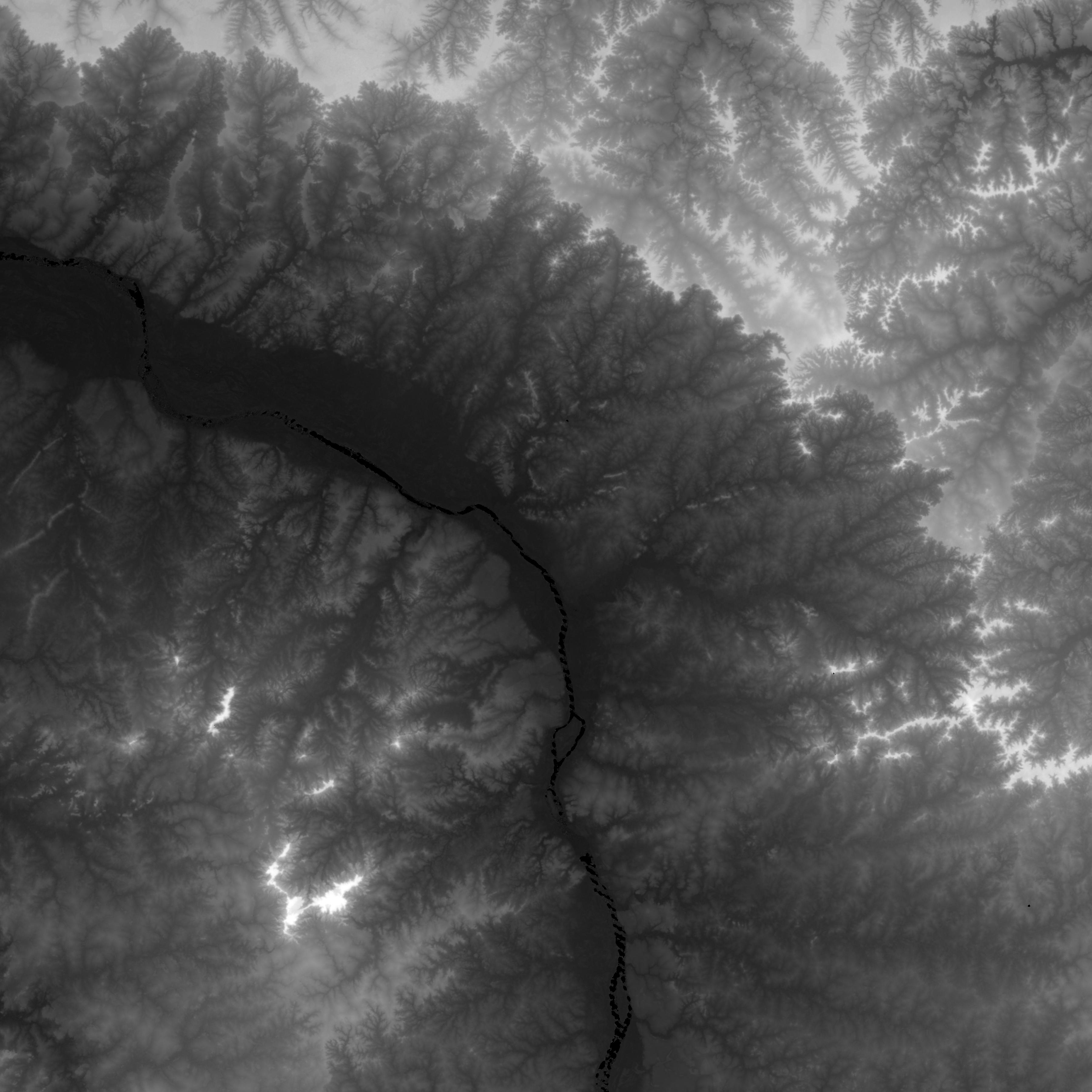
NASADEM SRTM-only Height and Height Precision Mosaic Global 1 arc second V001
National Aeronautics and Space Administration —
The Land Processes Distributed Active Archive Center (LP DAAC) is responsible for the archive and distribution of NASA Making Earth System Data Records for Use in... -
Federal
TROPICS03 L2B Neural-network Atmospheric Vertical Temperature & Moisture Profiles V1.0
National Aeronautics and Space Administration —
The "Time-Resolved Observations of Precipitation structure and storm Intensity with a Constellation of Smallsats" (TROPICS) mission has a goal of providing nearly... -
Federal
TROPICS05 L2B Neural-network Atmospheric Vertical Temperature & Moisture Profiles V0.2
National Aeronautics and Space Administration —
The "Time-Resolved Observations of Precipitation structure and storm Intensity with a Constellation of Smallsats" (TROPICS) mission has a goal of providing nearly... -
Federal
TROPICS06 Pathfinder L2B Instantaneous Surface Rain Rate (ISRR) V1.0
National Aeronautics and Space Administration —
The "Time-Resolved Observations of Precipitation structure and storm Intensity with a Constellation of Smallsats" (TROPICS) mission has a goal of providing nearly... -
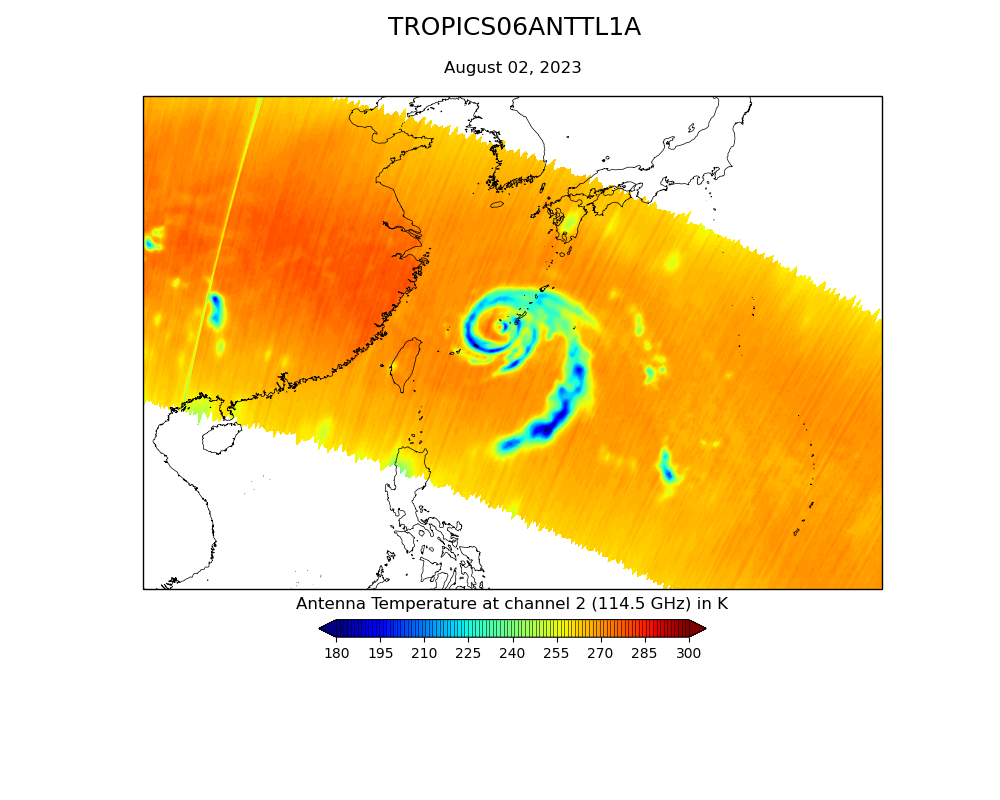
Federal
TROPICS07 L1B Orbital Geolocated Native-Resolution Brightness Temperatures V0.2
National Aeronautics and Space Administration —
The "Time-Resolved Observations of Precipitation structure and storm Intensity with a Constellation of Smallsats" (TROPICS) mission has a goal of providing nearly... -
Federal
TROPICS07 L1A Orbital Geolocated Native-Resolution Antenna Temperatures V0.2
National Aeronautics and Space Administration —
The "Time-Resolved Observations of Precipitation structure and storm Intensity with a Constellation of Smallsats" (TROPICS) mission has a goal of providing nearly... -
Federal
TROPICS01 Pathfinder L2B Atmospheric Vertical Temperature and Moisture Profiles (AVTP, AVMP) V1.0
National Aeronautics and Space Administration —
The "Time-Resolved Observations of Precipitation structure and storm Intensity with a Constellation of Smallsats" (TROPICS) mission has a goal of providing nearly... -
Federal
TROPICS06 L1A Orbital Geolocated Native-Resolution Antenna Temperatures V1.0
National Aeronautics and Space Administration —
The "Time-Resolved Observations of Precipitation structure and storm Intensity with a Constellation of Smallsats" (TROPICS) mission has a goal of providing nearly... -
Federal
TROPICS06 L2B Atmospheric Vertical Temperature and Moisture Profiles (AVTP, AVMP) V1.0
National Aeronautics and Space Administration —
The "Time-Resolved Observations of Precipitation structure and storm Intensity with a Constellation of Smallsats" (TROPICS) mission has a goal of providing nearly... -
Federal
TROPICS01 Pathfinder L2B Instantaneous Surface Rain Rate (ISRR) V1.0
National Aeronautics and Space Administration —
The "Time-Resolved Observations of Precipitation structure and storm Intensity with a Constellation of Smallsats" (TROPICS) mission has a goal of providing nearly... -
Federal
TROPICS01 L2B Neural-network Atmospheric Vertical Temperature & Moisture Profiles V1.0
National Aeronautics and Space Administration —
The "Time-Resolved Observations of Precipitation structure and storm Intensity with a Constellation of Smallsats" (TROPICS) mission has a goal of providing nearly... -
Federal
MEaSUREs Greenland Ice Mapping Project (GIMP) Land Ice and Ocean Classification Mask V001
National Aeronautics and Space Administration —
This data set, part of the NASA Making Earth System Data Records for Use in Research Environments (MEaSUREs) program, provides a complete land ice and ocean... -
Federal
BOREAS Level-3S SPOT Imagery: Scaled At-Sensor Radiance in LGSOWG Format
National Aeronautics and Space Administration —
For BOREAS, the level-3s SPOT data, along with the other remotely sensed images, were collected in order to provide spatially extensive information over the primary... -
Federal
TROPICS06 L1B Orbital Geolocated Native-Resolution Brightness Temperatures V1.0
National Aeronautics and Space Administration —
The "Time-Resolved Observations of Precipitation structure and storm Intensity with a Constellation of Smallsats" (TROPICS) mission has a goal of providing nearly... -
Federal
TROPICS05 L1B Orbital Geolocated Native-Resolution Brightness Temperatures V0.2
National Aeronautics and Space Administration —
The "Time-Resolved Observations of Precipitation structure and storm Intensity with a Constellation of Smallsats" (TROPICS) mission has a goal of providing nearly...

Official websites use .gov
A
.gov website belongs to an official government
organization in the United States.
Secure .gov websites use HTTPS
A
lock (
) or https:// means you’ve safely connected to
the .gov website. Share sensitive information only on official,
secure websites.