

172 datasets found for "Forts"
-
University
National Park Boundaries
Earth Data Analysis Center, University of New Mexico —
National Park Service unit boundaries. -
Small Area Plans
District of Columbia —
This dataset contains areal locations for Major Area Pans as established by the DC Office of Planning. Below are brief descriptions about each area. 1. Benning Road:... -
Federal
Administrative Boundaries Centroids of National Park System Units NGDA
Department of the Interior —
National Park Service unit points. -
Federal
BLM Natl AIM Riparian and Wetland Indicators Hub
Department of the Interior —
This feature class includes monitoring data collected nationally to understand the status, condition, and trend of resources on BLM lands. Data are collected in... -
Historic Landmarks Points
District of Columbia —
This dataset contains Historic Landmarks (by structure) officially designated by the District of Columbia. This is a consolidated collection of structures with... -
Historic Landmark Sites
District of Columbia —
This dataset contains Historic Landmarks (by structure) officially designated by the District of Columbia. This is a consolidated collection of structures with... -
University
Soil Survey Geographic (SSURGO) database for Gila National Forest, New Mexico, Parts of Catron, Grant and Sierra Counties
Earth Data Analysis Center, University of New Mexico —
This data set is a digital soil survey and generally is the most detailed level of soil geographic data developed by the National Cooperative Soil Survey. The... -
Federal
Digital Geologic-GIS Map of Fayette County, Pennsylvania (NPS, GRD, GRI, FONE, FRHI, FACO digital map) adapted from a Pennsylvania Geological Survey Water Resource Report map by McElroy (1988)
Department of the Interior —
The Digital Geologic-GIS Map of Fayette County, Pennsylvania is composed of GIS data layers and GIS tables, and is available in the following GRI-supported GIS data... -
State
Groundwater Restricted Areas
State of Oregon —
The Department’s role is to protect existing water rights by preventing excessive groundwater declines, restoring aquifer stability, and preserving aquifers with... -
Federal
Digital Geologic Map of San Francisco and parts of Oakland, California (NPS, GRD, GRI, GOGA, FOPO, RORI, SAFR, SFOA digital map)
Department of the Interior —
The Digital Geologic Map of San Francisco and parts of Oakland, California is composed of GIS data layers complete with ArcMap 9.3 layer (.LYR) files, two ancillary... -
Federal
Viewsheds from Key Observation Points for Fort Union Trading Post National Historic Site (FOUS)
Department of the Interior —
Visibility viewsheds incorporate influences of distance from observer, object size and limits of human visual acuity to define the degree of visibility as a... -
Federal
TIGER/Line Shapefile, 2021, County, Fort Bend County, TX, All Roads
U.S. Census Bureau, Department of Commerce —
The TIGER/Line shapefiles and related database files (.dbf) are an extract of selected geographic and cartographic information from the U.S. Census Bureau's Master... -
Federal
Digital Geologic-GIS Map of Fort Laramie National Historic Site and Vicinity, Wyoming (NPS, GRD, GRI, FOLA, FOLA digital map) adapted from a U.S. Geological Survey Bulletin map by McGrew (1963)
Department of the Interior —
The Digital Geologic-GIS Map of Fort Laramie National Historic Site and Vicinity, Wyoming is composed of GIS data layers and GIS tables, and is available in the... -
Federal
Digital Geologic-GIS Map of Fort Davis National Historic Site and Vicinity, Texas (NPS, GRD, GRI, FODA, FODA digital map) adapted from a Texas Bureau of Economic Geology, University of Texas at Austin Geologic Atlas of Texas map by Barnes et al. (1994)
Department of the Interior —
The Digital Geologic-GIS Map of Fort Davis National Historic Site and Vicinity, Texas is composed of GIS data layers and GIS tables, and is available in the following... -
Historic Landmarks
District of Columbia —
This dataset contains Historic Landmarks (by structure) officially designated by the District of Columbia. This is a consolidated collection of structures with... -
Federal
Digital Geologic-GIS Map of the Bowie Mountain South Quadrangle, Arizona (NPS, GRD, GRI, FOBO, BWMS digital map) adapted from a U.S. Geological Survey Miscellaneous Investigations Series Map by Drewes (1981)
Department of the Interior —
The Digital Geologic-GIS Map of the Bowie Mountain South Quadrangle, Arizona is composed of GIS data layers and GIS tables, and is available in the following GRI-... -
Federal
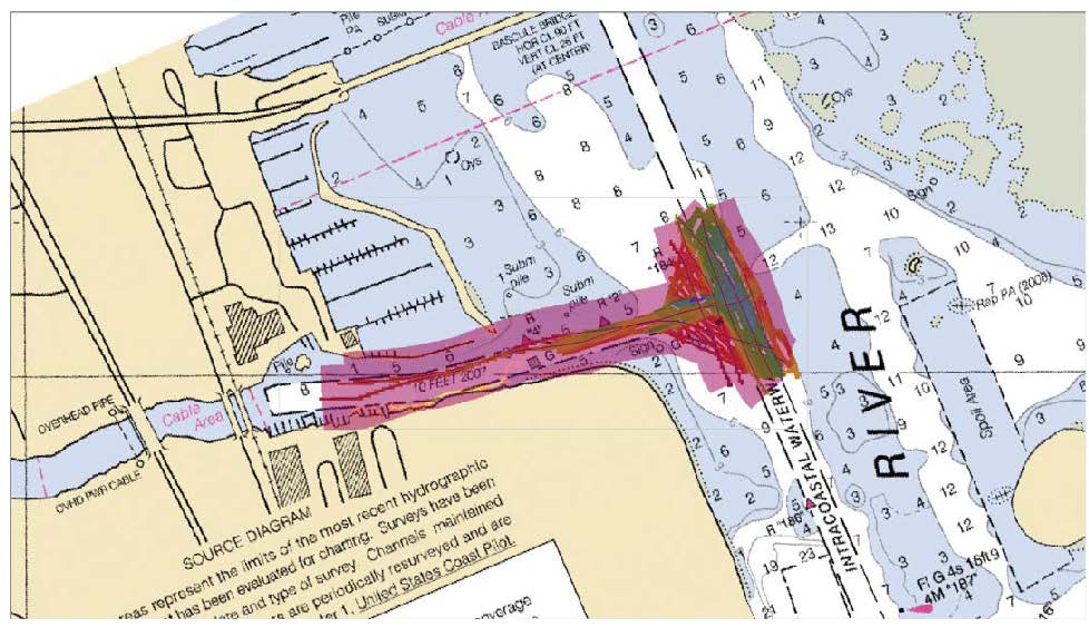
F00634: NOS Hydrographic Survey , 2013-06-04
National Oceanic and Atmospheric Administration, Department of Commerce —
The National Oceanic and Atmospheric Administration (NOAA) has the statutory mandate to collect hydrographic data in support of nautical chart compilation for safe... -
Federal
Geospatial data for the Vegetation Mapping Inventory Project of Fort Union Trading Post National Historic Site
Department of the Interior —
The files linked to this reference are the geospatial data created as part of the completion of the baseline vegetation inventory project for the NPS park unit.... -
Historic Landmark Elements
District of Columbia —
This dataset contains Historic Landmark Elements (by structure) officially designated by the District of Columbia. This is a consolidated collection of structures with... -
Federal
Digital Surficial Geologic-GIS Map of Bent's Old Fort National Historic Site and Vicinity, Colorado (NPS, GRD, GRI, BEOL, BOFS digital map) adapted from a Colorado State University unpublished map by Linn (1999)
Department of the Interior —
The Digital Surficial Geologic-GIS Map of Bent's Old Fort National Historic Site, Colorado is composed of GIS data layers and GIS tables, and is available in the...
172 datasets found for "Forts"