

12 datasets found for "影视视频短剧系统源码搭建教程短剧saas系统小程序h5✅项目合作 二开均可 TG:saolei44✅.oXKpPVXdMJPBKpa"
-
Federal
UARS Improved Stratospheric and Mesospheric Sounder (ISAMS) Level 3AL V010 (UARIS3AL) at GES DISC
National Aeronautics and Space Administration —
The Improved Stratospheric and Mesospheric Sounder (ISAMS) Level 3AL data product consists of daily, 4 degree increment latitude-ordered vertical profiles of... -
Federal
UARS Cryogenic Limb Array Etalon Spectrometer (CLAES) Level 3AL V009 (UARCL3AL) at GES DISC
National Aeronautics and Space Administration —
The Cryogenic Limb Array Etalon Spectrometer (CLAES) Level 3AL data product consists of daily, 4 degree increment latitude-ordered vertical profiles of temperature... -
Federal
UARS Solar Ultraviolet Spectral Irradiance Monitor (SUSIM) Level 3BS V022 (UARSU3BS) at GES DISC
National Aeronautics and Space Administration —
The Solar Ultraviolet Spectral Irradiance Monitor (SUSIM) Level 3BS data product consists of daily, 1 nm resolution, solar spectral irradiances and selected solar... -
Federal
UARS High Resolution Doppler Imager (HRDI) Level 3AT V011 (UARHR3AT) at GES DISC
National Aeronautics and Space Administration —
The High Resolution Doppler Imager (HRDI) Level 3AT data product consists of daily, 65.536 second interval time-ordered vertical profiles of meridional and zonal wind... -
Federal
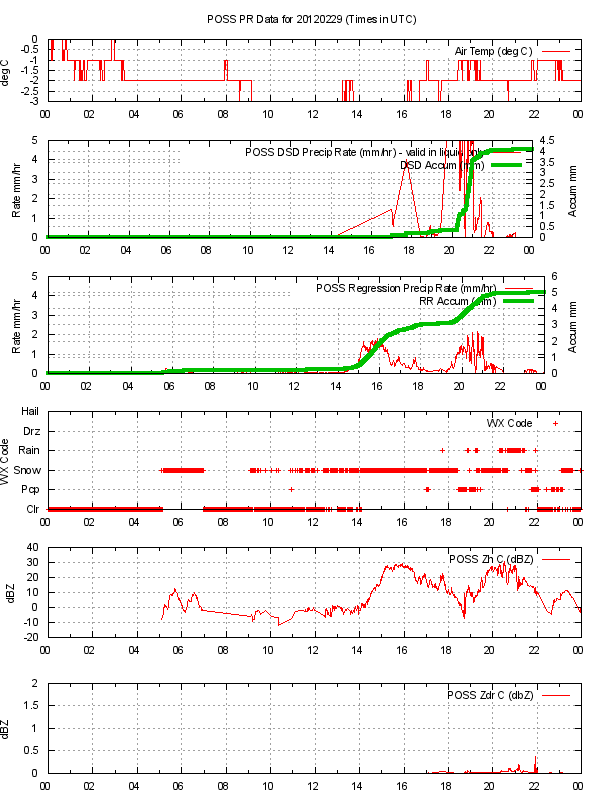
GPM GROUND VALIDATION ENVIRONMENT CANADA (EC) PRECIPITATION OCCURRENCE SENSOR SYSTEM (POSS) GCPEX V1
National Aeronautics and Space Administration —
The GPM Ground Validation Environment Canada (EC) Precipitation Occurrence Sensor System (POSS) GCPEx dataset is comprised of data gathered during the GPM Cold-season... -
Federal
UARS Microwave Limb Sounder (MLS) Level 3AT V005 (UARML3AT) at GES DISC
National Aeronautics and Space Administration —
The Microwave Limb Sounder (MLS) Level 3AT data product consists of daily, 4 degree increment latitude-ordered vertical profiles of temperature, geopotential height,... -
Federal
Data from: Spatial and temporal features of snow water equivalent across a headwater catchment in the Sierra Nevada
Department of Agriculture —
Accompanying dataset for: “Spatial and Temporal Features of Snow Water Equivalent Across a Headwater Catchment in the Sierra Nevada”Abstract:Here, we present the... -
Federal
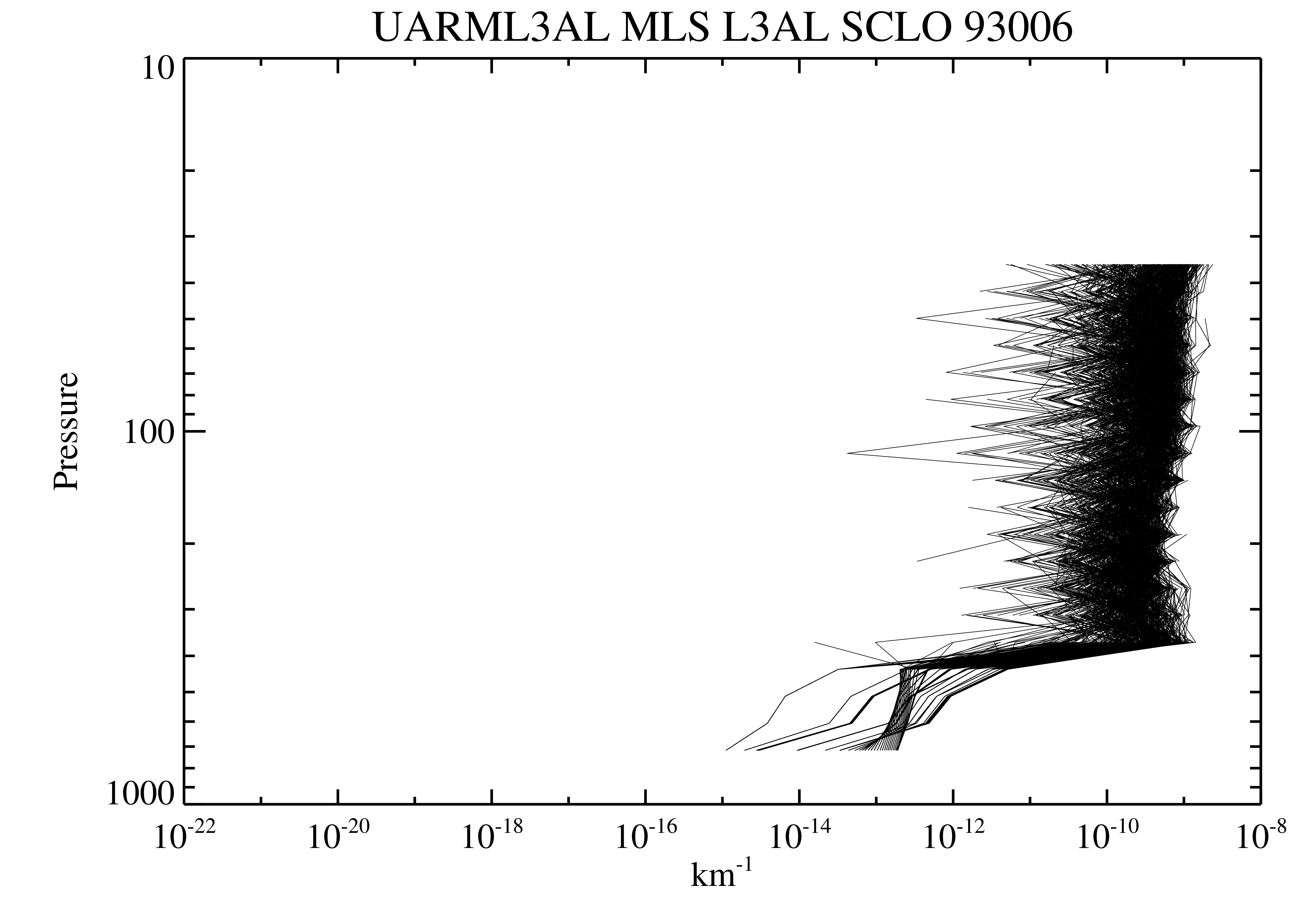
UARS Microwave Limb Sounder (MLS) Level 3AL V005 (UARML3AL) at GES DISC
National Aeronautics and Space Administration —
The Microwave Limb Sounder (MLS) Level 3AL data product consists of daily, 4 degree increment latitude-ordered vertical profiles of temperature, geopotential height,... -
Federal
UARS Cryogenic Limb Array Etalon Spectrometer (CLAES) Level 3AT V009 (UARCL3AT) at GES DISC
National Aeronautics and Space Administration —
The Cryogenic Limb Array Etalon Spectrometer (CLAES) Level 3AT data product consists of daily, 65.536 second interval time-ordered vertical profiles of temperature... -
Federal
UARS High Resolution Doppler Imager (HRDI) Level 3AL V011 (UARHR3AL) at GES DISC
National Aeronautics and Space Administration —
The High Resolution Doppler Imager (HRDI) Level 3AL data product consists of daily, 4 degree increment latitude-ordered vertical profiles of meridional and zonal wind... -
Federal
UARS Improved Stratospheric and Mesospheric Sounder (ISAMS) Level 3AT V010 (UARIS3AT) at GES DISC
National Aeronautics and Space Administration —
The Improved Stratospheric and Mesospheric Sounder (ISAMS) Level 3AT data product consists of daily, 65.536 second interval time-ordered vertical profiles of...
12 datasets found for "影视视频短剧系统源码搭建教程短剧saas系统小程序h5✅项目合作 二开均可 TG:saolei44✅.oXKpPVXdMJPBKpa"